
| Birth | : | 14 Jan 1880 Cherokee, Cherokee County, Iowa, USA |
| Death | : | 21 Oct 1941 Cherokee, Cherokee County, Iowa, USA |
| Burial | : | St Nicolas Churchyard, Great Coates, North East Lincolnshire Unitary Authority, England |
| Coordinate | : | 53.5701890, -0.1391100 |
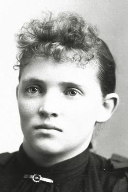
| Description | : | Leland Floyd Cave, son of George and Alice Cave was born January 14, 1880, in Cherokee County, and passed away at his home in Afton Township on Tuesday morning, October 21, 1941, being 61 years, 9 months and 14 days old. Mr. Cave grew to manhood in Afton Township, and apart from one and a half years which he spent homesteading in South Dakota, he spent his entire life in Cherokee and Buena Vista counties, Iowa. On February 23, 1910, he was united in marriage to Opal Menefee of Afton Township. To this union one child... Read More |
frequently asked questions (FAQ):
-
Where is Leland F. Cave's memorial?
Leland F. Cave's memorial is located at: St Nicolas Churchyard, Great Coates, North East Lincolnshire Unitary Authority, England.
-
When did Leland F. Cave death?
Leland F. Cave death on 21 Oct 1941 in Cherokee, Cherokee County, Iowa, USA
-
Where are the coordinates of the Leland F. Cave's memorial?
Latitude: 53.5701890
Longitude: -0.1391100
Family Members:
Parent

Siblings
Flowers:


Nearby Cemetories:
1. St Nicolas Churchyard
Great Coates, North East Lincolnshire Unitary Authority, England
Coordinate: 53.5701890, -0.1391100
2. St Michael's Churchyard
Little Coates, North East Lincolnshire Unitary Authority, England
Coordinate: 53.5631770, -0.1274160
3. St Peter & St Paul
Healing, North East Lincolnshire Unitary Authority, England
Coordinate: 53.5734480, -0.1682390
4. St Georges Churchyard
Bradley, North East Lincolnshire Unitary Authority, England
Coordinate: 53.5429000, -0.1275800
5. St. James Minster and Parish Church
Grimsby, North East Lincolnshire Unitary Authority, England
Coordinate: 53.5639670, -0.0893070
6. St Lawrence Churchyard
Aylesby, North East Lincolnshire Unitary Authority, England
Coordinate: 53.5511600, -0.1858320
7. Laceby Cemetery
Laceby, North East Lincolnshire Unitary Authority, England
Coordinate: 53.5411890, -0.1740470
8. Scartho Road Cemetery
Grimsby, North East Lincolnshire Unitary Authority, England
Coordinate: 53.5464940, -0.0885840
9. Ss Peter & Paul Churchyard
Stallingborough, North East Lincolnshire Unitary Authority, England
Coordinate: 53.5895280, -0.1960590
10. Grimsby Crematorium
Grimsby, North East Lincolnshire Unitary Authority, England
Coordinate: 53.5466260, -0.0776350
11. St. Giles Churchyard
Scartho, North East Lincolnshire Unitary Authority, England
Coordinate: 53.5384200, -0.0888130
12. St Edmunds Churchyard
Riby, West Lindsey District, England
Coordinate: 53.5506410, -0.2134070
13. Holy Trinity & St Mary the Virgin Churchyard
Grimsby, North East Lincolnshire Unitary Authority, England
Coordinate: 53.5569000, -0.0541000
14. All Saints Churchyard
Waltham, North East Lincolnshire Unitary Authority, England
Coordinate: 53.5167000, -0.0986700
15. Cleethorpes Cemetery
Cleethorpes, North East Lincolnshire Unitary Authority, England
Coordinate: 53.5553760, -0.0399990
16. Waltham Cemetery
Waltham, North East Lincolnshire Unitary Authority, England
Coordinate: 53.5155500, -0.0934700
17. St Bartholomew Churchyard
Keelby, West Lindsey District, England
Coordinate: 53.5732400, -0.2420900
18. St Peter's Church
Cleethorpes, North East Lincolnshire Unitary Authority, England
Coordinate: 53.5579756, -0.0307081
19. St Andrew Churchyard
Immingham, North East Lincolnshire Unitary Authority, England
Coordinate: 53.6190600, -0.2248370
20. St Andrew
Beelsby, North East Lincolnshire Unitary Authority, England
Coordinate: 53.5015700, -0.1810580
21. St Helen's Churchyard
Brigsley, North East Lincolnshire Unitary Authority, England
Coordinate: 53.4982361, -0.1099315
22. Holton le Clay Cemetery
Holton le Clay, East Lindsey District, England
Coordinate: 53.5074170, -0.0592630
23. St Peters Churchyard
Holton le Clay, East Lindsey District, England
Coordinate: 53.5060368, -0.0616628
24. St Peters Churchyard
Humberston, North East Lincolnshire Unitary Authority, England
Coordinate: 53.5278300, -0.0238300