
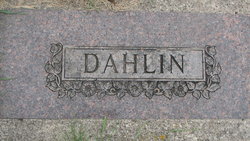
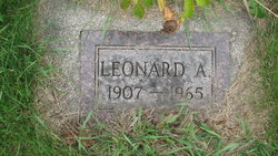
Leonard A. Dahlin
| Birth | : | 23 Dec 1907 Griggs County, North Dakota, USA |
| Death | : | 18 Jun 1965 Griggs County, North Dakota, USA |
| Burial | : | St. Mary's Churchyard, Brome, Mid Suffolk District, England |
| Coordinate | : | 52.3443800, 1.1475990 |
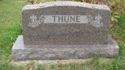
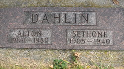
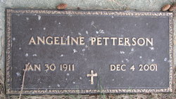
| Description | : | Leonard A. Dahlin, 57, died of a heart attack while working in his granary at his farm on Friday. He made his home in Binford. The funeral was held Monday in Trinity Lutheran Church of Binford, Rev. Albert Tastad and Rev. A. O. Borlaug officiating. He was born at Binford, December 23, 1907. He leaves ten brothers and sisters, Ernest, Olga and Esther Dahlin, all of Fargo; Ruth Dahlin and Mrs. Robert (Florence) Sparke, both Tacoma, Washington; Mrs. A. N. (Mildred) Petersen, Davenport, Iowa; Mrs. Bernard (Angeline) Petterson, Mrs. Nels (Agnes) Thune and Alton, all of Binford; and Leo of... Read More |
frequently asked questions (FAQ):
-
Where is Leonard A. Dahlin's memorial?
Leonard A. Dahlin's memorial is located at: St. Mary's Churchyard, Brome, Mid Suffolk District, England.
-
When did Leonard A. Dahlin death?
Leonard A. Dahlin death on 18 Jun 1965 in Griggs County, North Dakota, USA
-
Where are the coordinates of the Leonard A. Dahlin's memorial?
Latitude: 52.3443800
Longitude: 1.1475990
Family Members:
Parent


Siblings
Flowers:


Nearby Cemetories:
1. St. Mary's Churchyard
Brome, Mid Suffolk District, England
Coordinate: 52.3443800, 1.1475990
2. St. Nicholas Churchyard
Oakley, Mid Suffolk District, England
Coordinate: 52.3518380, 1.1662190
3. All Saints Churchyard
Stuston, Mid Suffolk District, England
Coordinate: 52.3571980, 1.1332590
4. Eye War Memorial
Eye, Mid Suffolk District, England
Coordinate: 52.3213410, 1.1461480
5. Saint Andrew Churchyard
Scole, South Norfolk District, England
Coordinate: 52.3671670, 1.1579150
6. Saint Peter and Saint Paul Churchyard
Eye, Mid Suffolk District, England
Coordinate: 52.3200520, 1.1516450
7. Eye Cemetery
Eye, Mid Suffolk District, England
Coordinate: 52.3188270, 1.1371000
8. St Leonard Churchyard
Billingford, South Norfolk District, England
Coordinate: 52.3666290, 1.1834260
9. St Peter Churchyard
Palgrave, Mid Suffolk District, England
Coordinate: 52.3634190, 1.1059170
10. Saint Peter and St. Paul Churchyard
Hoxne, Mid Suffolk District, England
Coordinate: 52.3522270, 1.2016300
11. Unitarian Chapel Cemetery
Palgrave, Mid Suffolk District, England
Coordinate: 52.3693130, 1.1086820
12. St Andrew's Frenze Church
Scole, South Norfolk District, England
Coordinate: 52.3802000, 1.1361000
13. Saint Mary Churchyard
Diss, South Norfolk District, England
Coordinate: 52.3772370, 1.1097880
14. Diss War Memorial
Diss, South Norfolk District, England
Coordinate: 52.3773380, 1.1088530
15. Saint John The Baptist Churchyard
Denham, Mid Suffolk District, England
Coordinate: 52.3275300, 1.2101200
16. Croft Lane Baptist Church Burial Ground
Diss, South Norfolk District, England
Coordinate: 52.3771070, 1.1025490
17. St Mary's Church Burial Ground - old
Braiseworth, Mid Suffolk District, England
Coordinate: 52.3028860, 1.1277010
18. Braiseworth War Memorial
Braiseworth, Mid Suffolk District, England
Coordinate: 52.3027890, 1.1276970
19. Diss Cemetery
Diss, South Norfolk District, England
Coordinate: 52.3839060, 1.1115880
20. St Mary Churchyard
Thornham Parva, Mid Suffolk District, England
Coordinate: 52.3113910, 1.0926010
21. St Mary the Virgin Churchyard
Mellis, Mid Suffolk District, England
Coordinate: 52.3268950, 1.0725720
22. St. Michael's Churchyard
Occold, Mid Suffolk District, England
Coordinate: 52.2936170, 1.1598150
23. St. Remigius Churchyard
Roydon, South Norfolk District, England
Coordinate: 52.3815610, 1.0784680
24. Saint George Churchyard
Shimpling, South Norfolk District, England
Coordinate: 52.3993000, 1.1680000