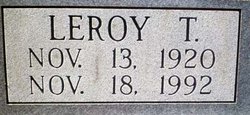
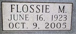
LeRoy Theodore “Ted” White
| Birth | : | 13 Nov 1920 Kansas, USA |
| Death | : | 18 Nov 1992 Strong City, Chase County, Kansas, USA |
| Burial | : | Saint Anthony Cemetery, Strong City, Chase County, USA |
| Coordinate | : | 38.4056015, -96.5547028 |
| Description | : | !OBIT: Wichita Eagle, The (KS) - November 20, 1992 Deceased Name: White, LeRoy "Ted White, LeRoy "Ted," 72, custom farmer, died Wednesday, Nov. 18, 1992. Rosary 7 p.m. today, service 2 p.m. Saturday, both at Brown-Bennett-Alexander Funeral Home, Cottonwood Falls. Survivors: wife, Flossie; sisters, Helen Keener of Cottonwood Falls, Neva Britian of Springfield, Mo. Memorial has been established with St. Anthony's Catholic Chruch, Strong City. Copyright (c) 1992 The Wichita Eagle |
frequently asked questions (FAQ):
-
Where is LeRoy Theodore “Ted” White's memorial?
LeRoy Theodore “Ted” White's memorial is located at: Saint Anthony Cemetery, Strong City, Chase County, USA.
-
When did LeRoy Theodore “Ted” White death?
LeRoy Theodore “Ted” White death on 18 Nov 1992 in Strong City, Chase County, Kansas, USA
-
Where are the coordinates of the LeRoy Theodore “Ted” White's memorial?
Latitude: 38.4056015
Longitude: -96.5547028
Family Members:
Parent
Spouse
Flowers:
Nearby Cemetories:
1. Saint Anthony Cemetery
Strong City, Chase County, USA
Coordinate: 38.4056015, -96.5547028
2. Simmons Cemetery
Strong City, Chase County, USA
Coordinate: 38.3988991, -96.5849991
3. Strong Township Cemetery
Strong City, Chase County, USA
Coordinate: 38.3983002, -96.5222015
4. Prairie Grove Cemetery
Cottonwood Falls, Chase County, USA
Coordinate: 38.3741989, -96.5639038
5. McDowall Cemetery
Strong City, Chase County, USA
Coordinate: 38.4059860, -96.6022720
6. Miller Cemetery
Cottonwood Falls, Chase County, USA
Coordinate: 38.3471985, -96.4916992
7. Elmdale Cemetery
Elmdale, Chase County, USA
Coordinate: 38.3778000, -96.6628036
8. Lawless Cemetery
Strong City, Chase County, USA
Coordinate: 38.4496700, -96.6630200
9. Peyton Family Cemetery
Toledo Township, Chase County, USA
Coordinate: 38.3819210, -96.4209340
10. Bazaar Cemetery
Bazaar, Chase County, USA
Coordinate: 38.2717018, -96.5449982
11. Hillside Cemetery
Toledo, Chase County, USA
Coordinate: 38.4305992, -96.3741989
12. Old Quaker Cemetery
Toledo, Chase County, USA
Coordinate: 38.4208100, -96.3693200
13. Boenitz Cemetery
Elmdale, Chase County, USA
Coordinate: 38.5052986, -96.7016983
14. Grandview Cemetery
Plymouth, Lyon County, USA
Coordinate: 38.3838997, -96.3542023
15. Diamond Creek Cemetery
Chase County, USA
Coordinate: 38.5071983, -96.7136002
16. Sharps Creek Cemetery
Bazaar, Chase County, USA
Coordinate: 38.2481400, -96.5123400
17. Clements Cemetery
Clements, Chase County, USA
Coordinate: 38.3040900, -96.7438800
18. Elk Cemetery
Elmdale, Chase County, USA
Coordinate: 38.4138985, -96.7844009
19. Haworth Cemetery
Plymouth, Lyon County, USA
Coordinate: 38.3804207, -96.3178024
20. Pleasant View Cemetery
Council Grove, Morris County, USA
Coordinate: 38.5948000, -96.5880700
21. Ice Cemetery
Chase County, USA
Coordinate: 38.2924800, -96.7594600
22. Fruitland Cemetery
Americus, Lyon County, USA
Coordinate: 38.5078011, -96.3308029
23. Four Mile Cemetery
Council Grove, Morris County, USA
Coordinate: 38.6086200, -96.5097000
24. Diamond Springs Cemetery
Diamond Springs, Morris County, USA
Coordinate: 38.5547028, -96.7410507


