
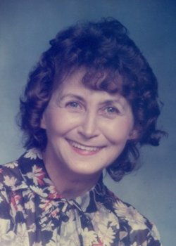


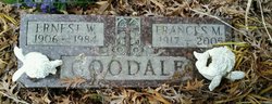
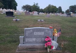
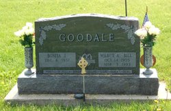
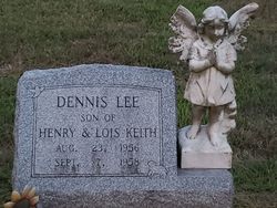
Lois Jean Goodale Keith
| Birth | : | 17 Jun 1934 Rochester, Cedar County, Iowa, USA |
| Death | : | 14 Oct 2010 Iowa City, Johnson County, Iowa, USA |
| Burial | : | Sugar Grove Baptist Church Cemetery, Dry Hill, Johnson County, USA |
| Coordinate | : | 36.3174200, -81.9590100 |
| Description | : | Lois Jean Keith, 76, died Thursday, Oct. 14, 2010, at the Hospice Unit of Mercy Hospital in Iowa City. Funeral services were 10:30 a.m. on Wednesday, Oct. 20, 2010, at the Zion Lutheran Church in Atalissa officiated by Pastor Lynn Thiede. Visitation was Tuesday, Oct. 19, 2010, at the Zion Lutheran Church in Atalissa. Burial will be at the Oak Ridge Cemetery in West Liberty. A memorial fund has been established. Lois was born June 17, 1934, in Rochester, Iowa, the daughter of Wilbur and Frances Shetler Goodale. She graduated from Atalissa High School. She was united in marriage to Henry "Hank"... Read More |
frequently asked questions (FAQ):
-
Where is Lois Jean Goodale Keith's memorial?
Lois Jean Goodale Keith's memorial is located at: Sugar Grove Baptist Church Cemetery, Dry Hill, Johnson County, USA.
-
When did Lois Jean Goodale Keith death?
Lois Jean Goodale Keith death on 14 Oct 2010 in Iowa City, Johnson County, Iowa, USA
-
Where are the coordinates of the Lois Jean Goodale Keith's memorial?
Latitude: 36.3174200
Longitude: -81.9590100
Family Members:
Parent

Spouse
Siblings
Children
Flowers:


Nearby Cemetories:
1. Julius Dugger Cemetery
Dry Hill, Johnson County, USA
Coordinate: 36.3130989, -81.9580994
2. John Cable Cemetery
Dry Hill, Johnson County, USA
Coordinate: 36.3130989, -81.9606018
3. William Powell Burial Site
Butler, Johnson County, USA
Coordinate: 36.3195600, -81.9514900
4. Trivett Family Cemetery
Dry Hill, Johnson County, USA
Coordinate: 36.3275600, -81.9546500
5. Dry Hill Cemetery
Johnson County, USA
Coordinate: 36.3280983, -81.9539032
6. Glenn Cable Cemetery
Butler, Johnson County, USA
Coordinate: 36.3318100, -81.9593800
7. Dugger Cemetery
Buntontown, Johnson County, USA
Coordinate: 36.3106003, -81.9421997
8. Michael Dugger Cemetery
Johnson County, USA
Coordinate: 36.3018990, -81.9464035
9. Cowan Cemetery
Butler, Johnson County, USA
Coordinate: 36.3074300, -81.9387100
10. Greenwell Cemetery
Johnson County, USA
Coordinate: 36.3306007, -81.9785995
11. Wagner Cemetery
Dry Hill, Johnson County, USA
Coordinate: 36.3292007, -81.9822006
12. Crosswhite Cemetery
Johnson County, USA
Coordinate: 36.2947006, -81.9649963
13. Payne Cemetery
Butler, Johnson County, USA
Coordinate: 36.2961000, -81.9439000
14. Andrews-Tester Cemetery
Buntontown, Johnson County, USA
Coordinate: 36.2937430, -81.9735220
15. Carriger Cemetery
Johnson County, USA
Coordinate: 36.3373500, -81.9829100
16. Bradley Cemetery
Johnson County, USA
Coordinate: 36.3452988, -81.9630966
17. Bunton Cemetery
Johnson County, USA
Coordinate: 36.2921982, -81.9744034
18. Silas Blackburn Cemetery
Butler, Johnson County, USA
Coordinate: 36.3475500, -81.9545300
19. Lakeview Cemetery
Elk Mills, Carter County, USA
Coordinate: 36.3143997, -81.9978027
20. J. L. Price Cemetery
Buntontown, Johnson County, USA
Coordinate: 36.2891300, -81.9819000
21. Campbell Cemetery
Carter County, USA
Coordinate: 36.3171997, -82.0018997
22. Evans Potter Cemetery
Buntontown, Johnson County, USA
Coordinate: 36.2808800, -81.9650200
23. Hatley Cemetery
Carter County, USA
Coordinate: 36.3087850, -82.0063170
24. Wagner Cemetery
Johnson County, USA
Coordinate: 36.3572006, -81.9617004