| Birth | : | 14 Oct 1910 Rutherford County, North Carolina, USA |
| Death | : | 5 Nov 2000 Hilldale, Summers County, West Virginia, USA |
| Burial | : | Golden Valley United Methodist Church Cemetery, Bostic, Rutherford County, USA |
| Coordinate | : | 35.5203018, -81.7900009 |
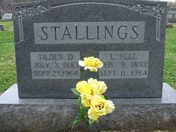
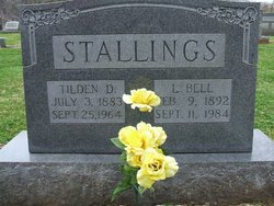
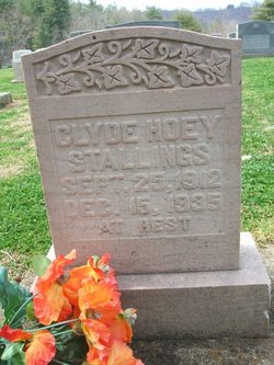
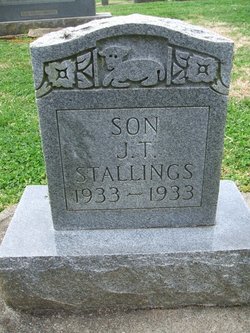
| Description | : | Born Oct. 14, 1910, in Rutherford County, she was the daughter of the late Tilden D. and Lucindy Bell McCurry Stallings. In addition to her parents, she was preceded in death by her husband, Robert Perley Johnson; three brothers, J.T. Stallings, Jamee Stallings and Clyde Stallings; and a sister, Birdie Lee Smith. |
frequently asked questions (FAQ):
-
Where is Lola Louetta “Oda” Stallings Johnson's memorial?
Lola Louetta “Oda” Stallings Johnson's memorial is located at: Golden Valley United Methodist Church Cemetery, Bostic, Rutherford County, USA.
-
When did Lola Louetta “Oda” Stallings Johnson death?
Lola Louetta “Oda” Stallings Johnson death on 5 Nov 2000 in Hilldale, Summers County, West Virginia, USA
-
Where are the coordinates of the Lola Louetta “Oda” Stallings Johnson's memorial?
Latitude: 35.5203018
Longitude: -81.7900009
Family Members:
Parent
Spouse
Siblings
Flowers:
Nearby Cemetories:
1. Golden Valley United Methodist Church Cemetery
Bostic, Rutherford County, USA
Coordinate: 35.5203018, -81.7900009
2. Mooney-Van Zandt Cemetery
Rutherford County, USA
Coordinate: 35.5335800, -81.7932500
3. Golden Valley Church of the Brethren Cemetery
Sunshine, Rutherford County, USA
Coordinate: 35.5368800, -81.7974200
4. Fairview Church Cemetery
Forest City, Rutherford County, USA
Coordinate: 35.5409640, -81.8010940
5. Fortune Cemetery
Rutherford County, USA
Coordinate: 35.5092010, -81.7647018
6. Weast Cemetery
Sunshine, Rutherford County, USA
Coordinate: 35.5341320, -81.8145960
7. First Broad Baptist Church Cemetery
Bostic, Rutherford County, USA
Coordinate: 35.5176770, -81.7543960
8. Golden Valley Missionary Methodist Church Cemetery
Bostic, Rutherford County, USA
Coordinate: 35.4961700, -81.7678800
9. Cooper Springs Congregational Holiness Church Ceme
Rutherford County, USA
Coordinate: 35.4755700, -81.7844540
10. Cane Creek Baptist Church Cemetery
Union Mills, Rutherford County, USA
Coordinate: 35.5222250, -81.8530630
11. Mount Harmony Baptist Church Cemetery
Bostic, Rutherford County, USA
Coordinate: 35.4588380, -81.7996940
12. Ross Hill Baptist Church Cemetery
Bostic, Rutherford County, USA
Coordinate: 35.4575280, -81.7922220
13. Silver Creek Knob
Burke County, USA
Coordinate: 35.5835000, -81.7970000
14. Duncans Creek Presbyterian Church Cemetery
Hollis, Rutherford County, USA
Coordinate: 35.4742680, -81.7276620
15. Diviney Cemetery
Duncans Creek, Rutherford County, USA
Coordinate: 35.5143920, -81.7042200
16. Fellowship Baptist Church Cemetery
Bostic, Rutherford County, USA
Coordinate: 35.5650630, -81.7235360
17. Cedar Grove United Methodist Church Cemetery
Rutherford County, USA
Coordinate: 35.4506110, -81.8097540
18. Fork Creek Baptist Church Cemetery
Rutherford County, USA
Coordinate: 35.5249710, -81.8802872
19. Kirksey Family Cemetery
McDowell County, USA
Coordinate: 35.5810600, -81.8431900
20. Sweezy-Murray Family Cemetery
Rutherford County, USA
Coordinate: 35.4432090, -81.7671363
21. Sandy Level Baptist Cemetery
Bostic, Rutherford County, USA
Coordinate: 35.4591400, -81.8520440
22. Mount Pleasant Baptist Church Cemetery
Rutherford County, USA
Coordinate: 35.5509280, -81.6976340
23. Freedom Baptist Church Cemetery
McDowell County, USA
Coordinate: 35.5883900, -81.8445700
24. Pisgah United Methodist Church Cemetery
Rutherfordton, Rutherford County, USA
Coordinate: 35.4770130, -81.8799750

