Loretta L. Morrison Larsen
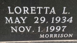
| Birth | : | 29 May 1934 Central City, Merrick County, Nebraska, USA |
| Death | : | 1 Nov 1997 Grand Island, Hall County, Nebraska, USA |
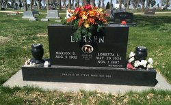
| Burial | : | Augusta Christian Church Cemetery, Augusta, Carroll County, USA |
| Coordinate | : | 40.6880989, -81.0211029 |
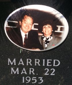
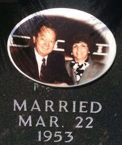
| Description | : | Loretta was born on May 29, 1934 in Central City to Clifford and Ruth (Tuttle) Morrison. She grew up on a farm west of Central City, attended country school and graduated from Central City High School in 1952. Loretta married Marion Larsen on March 22, 1953 at Central City. They farmed west of Marquette until 1961, then moved to Grand Island. In 1978 they moved to Scottsdale, Arizona and later returned to Nebraska to build a home on their farm north of Marquette. Here they resided in the summer and fall months. Loretta was a member of St.... Read More |
frequently asked questions (FAQ):
-
Where is Loretta L. Morrison Larsen's memorial?
Loretta L. Morrison Larsen's memorial is located at: Augusta Christian Church Cemetery, Augusta, Carroll County, USA.
-
When did Loretta L. Morrison Larsen death?
Loretta L. Morrison Larsen death on 1 Nov 1997 in Grand Island, Hall County, Nebraska, USA
-
Where are the coordinates of the Loretta L. Morrison Larsen's memorial?
Latitude: 40.6880989
Longitude: -81.0211029
Family Members:
Parent
Spouse
Siblings
Children
Flowers:
Nearby Cemetories:
1. Augusta Christian Church Cemetery
Augusta, Carroll County, USA
Coordinate: 40.6880989, -81.0211029
2. Pattersonville Presbyterian Cemetery
Augusta, Carroll County, USA
Coordinate: 40.6845047, -81.0367607
3. Bird Cemetery
Carroll County, USA
Coordinate: 40.6761017, -81.0406036
4. Mount Zion Cemetery
Augusta, Carroll County, USA
Coordinate: 40.6982994, -81.0492020
5. Crawford Cemetery
Augusta, Carroll County, USA
Coordinate: 40.6664009, -81.0036011
6. Stillfork Cemetery
Augusta, Carroll County, USA
Coordinate: 40.6720050, -81.0503730
7. Still Fork Church Cemetery
Carroll County, USA
Coordinate: 40.6719017, -81.0505981
8. Moore Cemetery
Augusta, Carroll County, USA
Coordinate: 40.7064018, -81.0539017
9. Herrington Bethel Cemetery
Carroll County, USA
Coordinate: 40.6493988, -81.0128021
10. Quaker Ridge Cemetery
Carroll County, USA
Coordinate: 40.7268982, -81.0119019
11. Glade Run Mennonite Church Cemetery
East Township, Carroll County, USA
Coordinate: 40.6760920, -80.9639470
12. Upper Glade Run Cemetery
Carroll County, USA
Coordinate: 40.6691400, -80.9653910
13. Glade Run Cemetery
East Township, Carroll County, USA
Coordinate: 40.6680984, -80.9642029
14. Chestnut Knob Cemetery
Carroll County, USA
Coordinate: 40.6772003, -81.0886002
15. Roudebush Cemetery
Carroll County, USA
Coordinate: 40.7097015, -80.9563980
16. Stuller Cemetery
Carroll County, USA
Coordinate: 40.6302986, -81.0513992
17. Plaines Cemetery
West Township, Columbiana County, USA
Coordinate: 40.7419270, -81.0762320
18. Harsh-Swamp Cemetery
Carroll County, USA
Coordinate: 40.6413994, -81.0892029
19. East Lawn Cemetery
Minerva, Stark County, USA
Coordinate: 40.7289009, -81.0960999
20. Pleasant Grove Cemetery
Carroll County, USA
Coordinate: 40.6589012, -81.1089020
21. Valley Street Cemetery
Carroll County, USA
Coordinate: 40.7248001, -81.1065979
22. Christian Fellowship Amish Mennonite Cemetery
West Township, Columbiana County, USA
Coordinate: 40.7638016, -81.0315018
23. Sandy Springs Cemetery
Hanoverton, Columbiana County, USA
Coordinate: 40.7491989, -80.9561005
24. Snyder Cemetery
Carroll County, USA
Coordinate: 40.6169014, -80.9766998


