| Birth | : | 24 Sep 1832 Ashtabula County, Ohio, USA |
| Death | : | 11 Jul 1909 |
| Burial | : | Bebington Cemetery, Bebington, Metropolitan Borough of Wirral, England |
| Coordinate | : | 53.3588030, -3.0165370 |
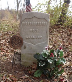
| Description | : | Source: Deaths from book 4 1907-1916 Wapello County Iowa page 79. First marriage was to Richard Groger who was killed in 1866 at Horse Creek Dakota Territory. Marriages book 1 1861-1869 Wilson Abraham & Lucretia Groger Reel 2 page 42 Jan. 1, 1867. Thanks Charlott for this obit. Source Info: Ottumwa Courier July 14, 1909. LUCRETIA ABRAHAM, died July 11, 1909 Ottumwa, Iowa She was born in Astabula County, Ohio on September 24, 1832. On February 09, 1852, she was married RICHARD GROGER. They moved to Dahlonega, Iowa shortly after their marriage. Her husband enlisted in the Iowa Calavery and was killed on Battle Field Horse Creek Dakota... Read More |
frequently asked questions (FAQ):
-
Where is Lucretia Sales Groger Abraham's memorial?
Lucretia Sales Groger Abraham's memorial is located at: Bebington Cemetery, Bebington, Metropolitan Borough of Wirral, England.
-
When did Lucretia Sales Groger Abraham death?
Lucretia Sales Groger Abraham death on 11 Jul 1909 in
-
Where are the coordinates of the Lucretia Sales Groger Abraham's memorial?
Latitude: 53.3588030
Longitude: -3.0165370
Family Members:
Spouse
Children
Flowers:
Nearby Cemetories:
1. Bebington Cemetery
Bebington, Metropolitan Borough of Wirral, England
Coordinate: 53.3588030, -3.0165370
2. Christ Church
Bebington, Metropolitan Borough of Wirral, England
Coordinate: 53.3584460, -3.0254810
3. St Andrews Parish Churchyard
Bebington, Metropolitan Borough of Wirral, England
Coordinate: 53.3479800, -3.0035400
4. St. Peter's Churchyard
Bebington, Metropolitan Borough of Wirral, England
Coordinate: 53.3692500, -3.0021020
5. Christ Church Churchyard
Port Sunlight, Metropolitan Borough of Wirral, England
Coordinate: 53.3534920, -2.9953750
6. St Paul's
Tranmere, Metropolitan Borough of Wirral, England
Coordinate: 53.3740000, -3.0154600
7. St. Werburgh & St. Laurence Catholic Churchyard
Birkenhead, Metropolitan Borough of Wirral, England
Coordinate: 53.3894910, -3.0217530
8. St. Mary's Churchyard
Birkenhead, Metropolitan Borough of Wirral, England
Coordinate: 53.3895930, -3.0112520
9. St Barnabas Bromborough
Bromborough, Metropolitan Borough of Wirral, England
Coordinate: 53.3324700, -2.9784000
10. Ancient Chapel Of Toxteth Park
Liverpool, Metropolitan Borough of Liverpool, England
Coordinate: 53.3811568, -2.9575849
11. All Saints Churchyard
Thornton Hough, Metropolitan Borough of Wirral, England
Coordinate: 53.3203500, -3.0444780
12. Barnston Cemetery
Barnston, Metropolitan Borough of Wirral, England
Coordinate: 53.3408590, -3.0820730
13. St. James Churchyard
Toxteth, Metropolitan Borough of Liverpool, England
Coordinate: 53.3943720, -2.9750688
14. St Michael's in the Hamlet
Aigburth, Metropolitan Borough of Liverpool, England
Coordinate: 53.3765870, -2.9499850
15. Landican Cemetery and Crematorium
Woodchurch, Metropolitan Borough of Wirral, England
Coordinate: 53.3654000, -3.0887510
16. Wesleyan Methodist Chapel Graveyard
Liverpool, Metropolitan Borough of Liverpool, England
Coordinate: 53.3940590, -2.9719160
17. St. Michaels Churchyard
Liverpool, Metropolitan Borough of Liverpool, England
Coordinate: 53.3976599, -2.9789353
18. St James Garden Cemetery
Liverpool, Metropolitan Borough of Liverpool, England
Coordinate: 53.3960744, -2.9715005
19. St. Thomas Churchyard
Liverpool, Metropolitan Borough of Liverpool, England
Coordinate: 53.4010330, -2.9861190
20. Holy Cross Churchyard
Woodchurch, Metropolitan Borough of Wirral, England
Coordinate: 53.3731900, -3.0899400
21. Plymyard Cemetery
Bromborough, Metropolitan Borough of Wirral, England
Coordinate: 53.3207700, -2.9725400
22. Liverpool Cathedral
Liverpool, Metropolitan Borough of Liverpool, England
Coordinate: 53.3974310, -2.9731610
23. Flaybrick Memorial Gardens
Birkenhead, Metropolitan Borough of Wirral, England
Coordinate: 53.3968130, -3.0633240
24. Liverpool Naval Memorial
Liverpool, Metropolitan Borough of Liverpool, England
Coordinate: 53.4061220, -2.9981050


