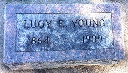
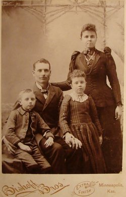
Lucy Ellen Wilson Young
| Birth | : | 5 Apr 1864 Indiana, USA |
| Death | : | 3 Sep 1939 Clyde, Cloud County, Kansas, USA |
| Burial | : | Cherokee Memorial Park, Lodi, San Joaquin County, USA |
| Coordinate | : | 38.1017303, -121.2585983 |
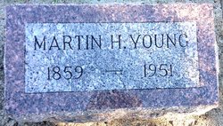
| Description | : | Glasco Sun, Sept. 7, 1939, page 1: Mrs. Ella Young, former Glasco resident died Sunday at her home in Clyde, Kansas. Funeral services were held Tuesday and burial was made in the Glasco cemetery. Mrs. Young was an aunt of Mrs. Ella Martin, Mrs. Ida Struble, Oliver Clark, and a half sister of Chris Wilson and a relative of J.H. Lindley and many other Glasco persons. Mrs. Fred Downing, a newcomer to Glasco, is a granddaughter of Mrs. Young. Clyde Republican, Sept. 7, 1939, page 1: Well Known Woman Dies Unexpectedly The death of Mrs. M.H. Young at her home in... Read More |
frequently asked questions (FAQ):
-
Where is Lucy Ellen Wilson Young's memorial?
Lucy Ellen Wilson Young's memorial is located at: Cherokee Memorial Park, Lodi, San Joaquin County, USA.
-
When did Lucy Ellen Wilson Young death?
Lucy Ellen Wilson Young death on 3 Sep 1939 in Clyde, Cloud County, Kansas, USA
-
Where are the coordinates of the Lucy Ellen Wilson Young's memorial?
Latitude: 38.1017303
Longitude: -121.2585983
Family Members:
Parent
Spouse
Siblings
Children
Flowers:
Nearby Cemetories:
1. Cherokee Memorial Park
Lodi, San Joaquin County, USA
Coordinate: 38.1017303, -121.2585983
2. Islamic Cemetery of California
Lodi, San Joaquin County, USA
Coordinate: 38.1091730, -121.2563590
3. Live Oak Cemetery
Lodi, San Joaquin County, USA
Coordinate: 38.0868760, -121.2874780
4. Lodi Memorial Park and Cemetery
Lodi, San Joaquin County, USA
Coordinate: 38.1319008, -121.2455978
5. Saint John The Baptist Episcopal Columbarium
Lodi, San Joaquin County, USA
Coordinate: 38.1213500, -121.3074400
6. Woodbridge Masonic Cemetery
Woodbridge, San Joaquin County, USA
Coordinate: 38.1496506, -121.3016663
7. Harmony Grove Cemetery
Lockeford, San Joaquin County, USA
Coordinate: 38.1478004, -121.1755981
8. Saint Joachim Catholic Cemetery
Lockeford, San Joaquin County, USA
Coordinate: 38.1478400, -121.1752500
9. Locke Cemetery
Lockeford, San Joaquin County, USA
Coordinate: 38.1758003, -121.1616974
10. Stockton Rural Cemetery
Stockton, San Joaquin County, USA
Coordinate: 37.9794006, -121.2869034
11. De Vries Ranch Family Cemetery
Lodi, San Joaquin County, USA
Coordinate: 38.2005530, -121.3556060
12. Central United Methodist Church Columbarium
Stockton, San Joaquin County, USA
Coordinate: 37.9825710, -121.3078170
13. Stockton Woodland Mausoleum
Stockton, San Joaquin County, USA
Coordinate: 37.9762400, -121.2878000
14. Casa Bonita Mausoleum
Stockton, San Joaquin County, USA
Coordinate: 37.9752340, -121.2877800
15. San Joaquin Catholic Cemetery
Stockton, San Joaquin County, USA
Coordinate: 37.9707830, -121.2850190
16. Liberty Cemetery
Acampo, San Joaquin County, USA
Coordinate: 38.2350006, -121.2782974
17. Stockton State Hospital Cemetery
Stockton, San Joaquin County, USA
Coordinate: 37.9663110, -121.2846850
18. Temple Israel Cemetery
Stockton, San Joaquin County, USA
Coordinate: 37.9640541, -121.2784348
19. Galt Cemetery
Galt, Sacramento County, USA
Coordinate: 38.2414017, -121.3013992
20. Fairbanks Ranch Cemetery
San Joaquin County, USA
Coordinate: 38.2310250, -121.1725170
21. Citizens Cemetery
Stockton, San Joaquin County, USA
Coordinate: 37.9559410, -121.2769120
22. Thomas Lindsay Gravesite
San Joaquin County, USA
Coordinate: 37.9573110, -121.2918430
23. David Kelsey Gravesite
Stockton, San Joaquin County, USA
Coordinate: 37.9573110, -121.2918430
24. Elliott Cemetery
San Joaquin County, USA
Coordinate: 38.2341995, -121.1761017

