Luvina G. Sayers Hyde
| Birth | : | 23 Mar 1834 Ohio, USA |
| Death | : | 1 Mar 1875 Brock, Scotland County, Missouri, USA |
| Burial | : | St. Peter and St. Paul's Churchyard, Salle, Broadland District, England |
| Coordinate | : | 52.7802370, 1.1276420 |
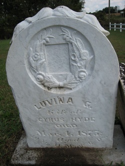
| Inscription | : | Luvina G. wife of Cyrus Hyde, died Mar. 1, 1875, aged 40 yrs. 11 mos. 6 dys. |
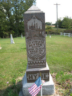
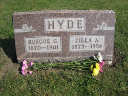
| Description | : | Luvina was the daughter of James and Eleanor Ellen (Goodin) Sayers. She married (1) Samuel Coleman on 8 Dec 1850 in Lee County, Iowa. Samuel and Luvina divorced between 1853-1855. Luvina married (2) Cyrus Lyens Hyde on November 22, 1855, in Memphis, Jefferson Township, Scotland County, Missouri. They settled on a farm in Green Township, Scotland County, Missouri, later moving to the Brock area in Union Township. They were the parents of six children: Elnora "Nora", Celestia, Donna Lovina, Emma V., Roscoe Cyrus, and Ella V. Obituary HYDE On the 1st day of March,... Read More |
frequently asked questions (FAQ):
-
Where is Luvina G. Sayers Hyde's memorial?
Luvina G. Sayers Hyde's memorial is located at: St. Peter and St. Paul's Churchyard, Salle, Broadland District, England.
-
When did Luvina G. Sayers Hyde death?
Luvina G. Sayers Hyde death on 1 Mar 1875 in Brock, Scotland County, Missouri, USA
-
Where are the coordinates of the Luvina G. Sayers Hyde's memorial?
Latitude: 52.7802370
Longitude: 1.1276420
Family Members:
Parent
Spouse
Siblings
Children
Flowers:
Nearby Cemetories:
1. St. Peter and St. Paul's Churchyard
Salle, Broadland District, England
Coordinate: 52.7802370, 1.1276420
2. St. Mary's Churchyard
Reepham, Broadland District, England
Coordinate: 52.7623070, 1.1128810
3. All Saints Churchyard, Hackford
Reepham, Broadland District, England
Coordinate: 52.7622480, 1.1122220
4. St. Peter and St. Paul's Churchyard
Heydon, Broadland District, England
Coordinate: 52.8027280, 1.1345020
5. St. Agnes Churchyard
Cawston, Broadland District, England
Coordinate: 52.7702040, 1.1617360
6. Reepham Cemetery
Reepham, Broadland District, England
Coordinate: 52.7595078, 1.1082559
7. St. Michael the Archangel Churchyard
Booton, Broadland District, England
Coordinate: 52.7575040, 1.1446340
8. Cawston Cemetery
Cawston, Broadland District, England
Coordinate: 52.7695320, 1.1666930
9. St. Andrew's Churchyard
Wood Dalling, Broadland District, England
Coordinate: 52.8001170, 1.0985350
10. St. Peter & St. Paul's Churchyard
Oulton, Broadland District, England
Coordinate: 52.8114317, 1.1685485
11. St. Peter's Churchyard
Corpusty, North Norfolk District, England
Coordinate: 52.8207280, 1.1371910
12. St. Nicholas' Churchyard
Brandiston, Broadland District, England
Coordinate: 52.7479240, 1.1712620
13. St. Faith Churchyard
Little Witchingham, Broadland District, England
Coordinate: 52.7382900, 1.1322470
14. St. Mary's Churchyard
Great Witchingham, Broadland District, England
Coordinate: 52.7370860, 1.1142140
15. St Peter
Guestwick, Broadland District, England
Coordinate: 52.8014270, 1.0565010
16. St. Andrew's Churchyard
Saxthorpe, North Norfolk District, England
Coordinate: 52.8299250, 1.1398600
17. St. Peter's Churchyard
Haveringland, Broadland District, England
Coordinate: 52.7427900, 1.1857300
18. St. Margaret of Swannington Churchyard
Swannington, Broadland District, England
Coordinate: 52.7289500, 1.1591660
19. St. John the Baptist Churchyard
Alderford, Broadland District, England
Coordinate: 52.7248870, 1.1435180
20. Matthews Family Mausoleum
Great Witchingham, Broadland District, England
Coordinate: 52.7238450, 1.1259340
21. St. Mary's Churchyard
Sparham, Breckland Borough, England
Coordinate: 52.7349340, 1.0661850
22. St Mary Churchyard
Itteringham, North Norfolk District, England
Coordinate: 52.8334650, 1.1826370
23. All Saints Churchyard
Bawdeswell, Breckland Borough, England
Coordinate: 52.7469490, 1.0307670
24. Bawdeswell Cemetery
Bawdeswell, Breckland Borough, England
Coordinate: 52.7446450, 1.0328570


