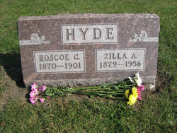
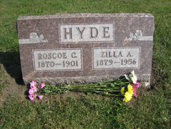
Roscoe Cyrus Hyde
| Birth | : | 8 Jun 1870 Brock, Scotland County, Missouri, USA |
| Death | : | 29 Mar 1901 Brock, Scotland County, Missouri, USA |
| Burial | : | St. Peter and St. Paul's Churchyard, Salle, Broadland District, England |
| Coordinate | : | 52.7802370, 1.1276420 |
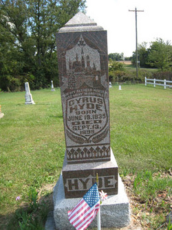
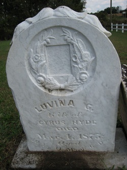
| Description | : | Roscoe Cyrus Hyde is the son of Cyrus Lyens Hyde and Luvina G. (Sayers) Hyde. On December 12, 1897, he married Zilla Anna Honiter in Memphis, Scotland County, Missouri. They started their life together on a rented farm in Union Township and Zilla gave birth to their only child, Mary Luvina, in 1900. A year later, Roscoe died of pneumonia, leaving his widow and young daughter. Note: His published obituary gives his date of death as March 30, 1901, but the family Bible with entries by his wife and daughter and his wife's obituary give the date... Read More |
frequently asked questions (FAQ):
-
Where is Roscoe Cyrus Hyde's memorial?
Roscoe Cyrus Hyde's memorial is located at: St. Peter and St. Paul's Churchyard, Salle, Broadland District, England.
-
When did Roscoe Cyrus Hyde death?
Roscoe Cyrus Hyde death on 29 Mar 1901 in Brock, Scotland County, Missouri, USA
-
Where are the coordinates of the Roscoe Cyrus Hyde's memorial?
Latitude: 52.7802370
Longitude: 1.1276420
Family Members:
Parent
Spouse
Siblings
Children
Flowers:
Nearby Cemetories:
1. St. Peter and St. Paul's Churchyard
Salle, Broadland District, England
Coordinate: 52.7802370, 1.1276420
2. St. Mary's Churchyard
Reepham, Broadland District, England
Coordinate: 52.7623070, 1.1128810
3. All Saints Churchyard, Hackford
Reepham, Broadland District, England
Coordinate: 52.7622480, 1.1122220
4. St. Peter and St. Paul's Churchyard
Heydon, Broadland District, England
Coordinate: 52.8027280, 1.1345020
5. St. Agnes Churchyard
Cawston, Broadland District, England
Coordinate: 52.7702040, 1.1617360
6. Reepham Cemetery
Reepham, Broadland District, England
Coordinate: 52.7595078, 1.1082559
7. St. Michael the Archangel Churchyard
Booton, Broadland District, England
Coordinate: 52.7575040, 1.1446340
8. Cawston Cemetery
Cawston, Broadland District, England
Coordinate: 52.7695320, 1.1666930
9. St. Andrew's Churchyard
Wood Dalling, Broadland District, England
Coordinate: 52.8001170, 1.0985350
10. St. Peter & St. Paul's Churchyard
Oulton, Broadland District, England
Coordinate: 52.8114317, 1.1685485
11. St. Peter's Churchyard
Corpusty, North Norfolk District, England
Coordinate: 52.8207280, 1.1371910
12. St. Nicholas' Churchyard
Brandiston, Broadland District, England
Coordinate: 52.7479240, 1.1712620
13. St. Faith Churchyard
Little Witchingham, Broadland District, England
Coordinate: 52.7382900, 1.1322470
14. St. Mary's Churchyard
Great Witchingham, Broadland District, England
Coordinate: 52.7370860, 1.1142140
15. St Peter
Guestwick, Broadland District, England
Coordinate: 52.8014270, 1.0565010
16. St. Andrew's Churchyard
Saxthorpe, North Norfolk District, England
Coordinate: 52.8299250, 1.1398600
17. St. Peter's Churchyard
Haveringland, Broadland District, England
Coordinate: 52.7427900, 1.1857300
18. St. Margaret of Swannington Churchyard
Swannington, Broadland District, England
Coordinate: 52.7289500, 1.1591660
19. St. John the Baptist Churchyard
Alderford, Broadland District, England
Coordinate: 52.7248870, 1.1435180
20. Matthews Family Mausoleum
Great Witchingham, Broadland District, England
Coordinate: 52.7238450, 1.1259340
21. St. Mary's Churchyard
Sparham, Breckland Borough, England
Coordinate: 52.7349340, 1.0661850
22. St Mary Churchyard
Itteringham, North Norfolk District, England
Coordinate: 52.8334650, 1.1826370
23. All Saints Churchyard
Bawdeswell, Breckland Borough, England
Coordinate: 52.7469490, 1.0307670
24. Bawdeswell Cemetery
Bawdeswell, Breckland Borough, England
Coordinate: 52.7446450, 1.0328570

