
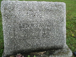
Madeline “Lena” Weber Savage
| Birth | : | 1883 |
| Death | : | 23 Feb 1950 Uniontown, Fayette County, Pennsylvania, USA |
| Burial | : | Oak Grove Church of the Brethren Cemetery, McHenry, Garrett County, USA |
| Coordinate | : | 39.5694400, -79.3834300 |
| Description | : | The Evening Standard, Uniontown, Ps., Friday, February 24, 1950 After prayer services in the Minerd funeral home at 12:30 o'clock tomorrow afternoon, a cortege bearing the body of Mrs. Lena Weber Savage, 67, who died yesterday afternoon, will go to McHenry, Md. where Rev. Roy M. Shade of the Hopwood Free Methodist church will conduct funeral services, burial will be in the Oak Grove Church of the Brethren cemetery. Mrs. Savage, who was a native of Baltimore, died after a brief illness at the home of her brother-in-law, Edward H. Savage, Hopwood-Coolspring road. Surviving also are a nephew, Herbert Reilly, Baltimore; a sister-in-law,... Read More |
frequently asked questions (FAQ):
-
Where is Madeline “Lena” Weber Savage's memorial?
Madeline “Lena” Weber Savage's memorial is located at: Oak Grove Church of the Brethren Cemetery, McHenry, Garrett County, USA.
-
When did Madeline “Lena” Weber Savage death?
Madeline “Lena” Weber Savage death on 23 Feb 1950 in Uniontown, Fayette County, Pennsylvania, USA
-
Where are the coordinates of the Madeline “Lena” Weber Savage's memorial?
Latitude: 39.5694400
Longitude: -79.3834300
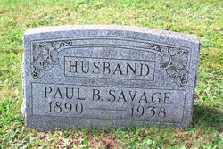
Family Members:
Spouse
Flowers:


Nearby Cemetories:
1. Oak Grove Church of the Brethren Cemetery
McHenry, Garrett County, USA
Coordinate: 39.5694400, -79.3834300
2. Hoye Family Cemetery - Crab Tree Bottom
McHenry, Garrett County, USA
Coordinate: 39.5642220, -79.3855000
3. Saint Dominic Catholic Cemetery
Hoyes, Garrett County, USA
Coordinate: 39.5868300, -79.3698600
4. Hoyes Cemetery
Garrett County, USA
Coordinate: 39.5905991, -79.3683014
5. Upper Sang Run Cemetery
McHenry, Garrett County, USA
Coordinate: 39.5717810, -79.4242430
6. Flatwood Cemetery
Accident, Garrett County, USA
Coordinate: 39.5923500, -79.3515400
7. Skiles Cemetery
Accident, Garrett County, USA
Coordinate: 39.5971570, -79.3439160
8. Bumblebee Ridge Cemetery
McHenry, Garrett County, USA
Coordinate: 39.5774400, -79.3296800
9. Hoyes Run Cemetery
Garrett County, USA
Coordinate: 39.5313100, -79.4110900
10. Bray Cemetery
Oakland, Garrett County, USA
Coordinate: 39.5006900, -79.3858100
11. Glotfelty Farm Cemetery
McHenry, Garrett County, USA
Coordinate: 39.5708800, -79.2905500
12. Bear Creek Church of the Brethren Cemetery
Accident, Garrett County, USA
Coordinate: 39.6213000, -79.3099800
13. Saint Paul's Old Cemetery
Accident, Garrett County, USA
Coordinate: 39.6287100, -79.3182100
14. Friend Cemetery
Oakland, Garrett County, USA
Coordinate: 39.4913500, -79.3778000
15. Ruckle Family Cemetery
Bittinger, Garrett County, USA
Coordinate: 39.5802600, -79.2821900
16. Cherry Glade Cemetery
Accident, Garrett County, USA
Coordinate: 39.5827200, -79.2799500
17. Glade Mennonite Cemetery
Bittinger, Garrett County, USA
Coordinate: 39.5826300, -79.2796700
18. Zion Lutheran Cemetery
Accident, Garrett County, USA
Coordinate: 39.6300510, -79.3129020
19. Taylor-Sines Cemetery
Oakland, Garrett County, USA
Coordinate: 39.4894470, -79.4165480
20. Lake Ford Cemetery
Garrett County, USA
Coordinate: 39.5278015, -79.4792023
21. Cranesville Cemetery
Cranesville, Preston County, USA
Coordinate: 39.5543920, -79.4929870
22. Glendale Cemetery
Oakland, Garrett County, USA
Coordinate: 39.5085983, -79.2953033
23. Rodeheaver Cemetery
Oakland, Garrett County, USA
Coordinate: 39.4804680, -79.3521300
24. Sisler Cemetery
Mountain Dale, Preston County, USA
Coordinate: 39.6081009, -79.4938965