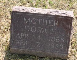
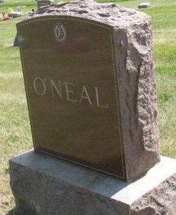
Madora Ellen “Dora” Harrison O'Neal
| Birth | : | 4 Apr 1856 |
| Death | : | 7 Apr 1933 |
| Burial | : | Pleasington Priory, Pleasington, Blackburn with Darwen Unitary Authority, England |
| Coordinate | : | 53.7348590, -2.5433060 |
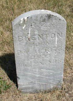
| Description | : | Her mother passed away just before her 9th birthday while her father was still at war; soon after his return that summer, he remarried. When she was 16, the entire family moved to Kirwin, Phillips Co., Kansas along with a great many settlers from Dallas County Iowa, seeking better conditions in the new territory. Within a few short months she married 20-year old Henry Glenn Brenton (23Jan1873), using the name Mary M.E. Harrison - Brenton. They stayed (I'm told) in the first sod house, and there in December 1873 they had their first son, Thomas R.Z. The next year, however,... Read More |
frequently asked questions (FAQ):
-
Where is Madora Ellen “Dora” Harrison O'Neal's memorial?
Madora Ellen “Dora” Harrison O'Neal's memorial is located at: Pleasington Priory, Pleasington, Blackburn with Darwen Unitary Authority, England.
-
When did Madora Ellen “Dora” Harrison O'Neal death?
Madora Ellen “Dora” Harrison O'Neal death on 7 Apr 1933 in
-
Where are the coordinates of the Madora Ellen “Dora” Harrison O'Neal's memorial?
Latitude: 53.7348590
Longitude: -2.5433060
Family Members:
Parent
Spouse
Siblings
Children
Flowers:
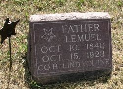
Dora O'Neal was born Madera E. Harrison, but called herself Mary. At age 16 she moved with her family to an ill-fated settlement in Kirwin Kansas for two years, where in 1873 she met and married Henry Glen Brenton (son of Thomas and Mary Ann), before returning after locusts and drought. She had eight children and buried four of them young. After being abandoned by her first husband she was lucky enough to find Lemuel O'Neal to help her care for her four teenagers. She lived in Dallas County for all but those two years, and in the same house the last 45 years. What a woman! Read less
Left by Anonymous on 08 Aug 2007
My great grand aunt Madora 'Dora' Ellen Harrison, dau. of Robert Allen Harrison and Mary Jane Davidson.
Left by Anonymous on 05 Oct 2013
Nearby Cemetories:
1. Pleasington Priory
Pleasington, Blackburn with Darwen Unitary Authority, England
Coordinate: 53.7348590, -2.5433060
2. Pleasington Cemetery and Crematorium
Blackburn, Blackburn with Darwen Unitary Authority, England
Coordinate: 53.7388880, -2.5368710
3. Holy Trinity Churchyard
Hoghton, Chorley Borough, England
Coordinate: 53.7279300, -2.5848550
4. St. Josephs Roman Catholic Churchyard
Brindle, Chorley Borough, England
Coordinate: 53.7350780, -2.5880640
5. New Row Methodist Church
Blackburn with Darwen Unitary Authority, England
Coordinate: 53.7208950, -2.5023720
6. St Stephen Churchyard
Tockholes, Blackburn with Darwen Unitary Authority, England
Coordinate: 53.7058350, -2.5169320
7. St. Peter's Churchyard
Blackburn, Blackburn with Darwen Unitary Authority, England
Coordinate: 53.7448110, -2.4865070
8. St Paul's
Blackburn, Blackburn with Darwen Unitary Authority, England
Coordinate: 53.7491222, -2.4891266
9. Independent Chapel Churchyard
Blackburn, Blackburn with Darwen Unitary Authority, England
Coordinate: 53.7454960, -2.4864460
10. Wesleyan Methodist Chapel Chapelyard
Blackburn, Blackburn with Darwen Unitary Authority, England
Coordinate: 53.7464910, -2.4848380
11. Blackburn Cathedral
Blackburn, Blackburn with Darwen Unitary Authority, England
Coordinate: 53.7472960, -2.4820020
12. St. Mary's Churchyard
Mellor, Ribble Valley Borough, England
Coordinate: 53.7728600, -2.5312400
13. St Paul's Churchyard
Withnell, Chorley Borough, England
Coordinate: 53.6970740, -2.5592150
14. Mellor Methodist Churchyard
Blackburn, Blackburn with Darwen Unitary Authority, England
Coordinate: 53.7742950, -2.5255060
15. Mount St Presbyterian Chapelyard
Blackburn, Blackburn with Darwen Unitary Authority, England
Coordinate: 53.7478000, -2.4775000
16. Holy Trinity Church
Blackburn with Darwen Unitary Authority, England
Coordinate: 53.7511727, -2.4747178
17. St James's Churchyard
Brindle, Chorley Borough, England
Coordinate: 53.7133333, -2.6086111
18. St Alban's Churchyard
Blackburn, Blackburn with Darwen Unitary Authority, England
Coordinate: 53.7530090, -2.4748540
19. St Mary's R.C. Church Cemetery
Osbaldeston, Ribble Valley Borough, England
Coordinate: 53.7816970, -2.5350240
20. St James Churchyard
Lower Darwen, Blackburn with Darwen Unitary Authority, England
Coordinate: 53.7245510, -2.4634700
21. St Leonard Churchyard
Balderstone, Ribble Valley Borough, England
Coordinate: 53.7860070, -2.5609380
22. Blackburn Cemetery
Blackburn, Blackburn with Darwen Unitary Authority, England
Coordinate: 53.7662430, -2.4726050
23. St. Mary's and St. John RC Churchyard, Southworth
Samlesbury, South Ribble Borough, England
Coordinate: 53.7676690, -2.6183400
24. St. Leonard the Less Churchyard
Samlesbury, South Ribble Borough, England
Coordinate: 53.7680000, -2.6237000

