

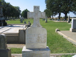
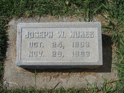
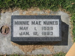
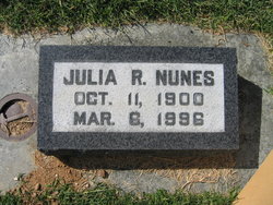
Manuel Frederick Nunes
| Birth | : | 6 May 1895 Red Bluff, Tehama County, California, USA |
| Death | : | 17 Apr 1954 Tehama County, California, USA |
| Burial | : | Saint Mary's Cemetery, Red Bluff, Tehama County, USA |
| Coordinate | : | 40.1716995, -122.2521973 |
| Plot | : | Block A; Grave 49 |
frequently asked questions (FAQ):
-
Where is Manuel Frederick Nunes's memorial?
Manuel Frederick Nunes's memorial is located at: Saint Mary's Cemetery, Red Bluff, Tehama County, USA.
-
When did Manuel Frederick Nunes death?
Manuel Frederick Nunes death on 17 Apr 1954 in Tehama County, California, USA
-
Where are the coordinates of the Manuel Frederick Nunes's memorial?
Latitude: 40.1716995
Longitude: -122.2521973
Family Members:
Parent
Spouse

Siblings

Flowers:


Nearby Cemetories:
1. Saint Mary's Cemetery
Red Bluff, Tehama County, USA
Coordinate: 40.1716995, -122.2521973
2. Red Bluff Memorial Chapel Mausoleum & Columbarium
Red Bluff, Tehama County, USA
Coordinate: 40.1717130, -122.2466860
3. Oak Hill Cemetery
Red Bluff, Tehama County, USA
Coordinate: 40.1699982, -122.2433014
4. Growney Ranch Family Cemetery
Red Bluff, Tehama County, USA
Coordinate: 40.1167300, -122.1952500
5. Red Bank Cemetery
Red Bank, Tehama County, USA
Coordinate: 40.1036970, -122.4458540
6. Los Molinos Cemetery
Los Molinos, Tehama County, USA
Coordinate: 40.0475650, -122.1011820
7. Tehama Cemetery
Tehama, Tehama County, USA
Coordinate: 40.0233002, -122.1433029
8. Inks Creek Cemetery
Tehama County, USA
Coordinate: 40.3419800, -122.1297100
9. Cottonwood Creek Ranch Cemetery
Cottonwood, Shasta County, USA
Coordinate: 40.3663100, -122.2598800
10. Cottonwood Cemetery
Cottonwood, Shasta County, USA
Coordinate: 40.3856100, -122.2936500
11. Major Pierson B Reading Family Cemetery
Cottonwood, Shasta County, USA
Coordinate: 40.3924300, -122.2126900
12. Sleepy Hollow Pet Cemetery
Anderson, Shasta County, USA
Coordinate: 40.4199430, -122.2858410
13. Rosewood Cemetery
Rosewood, Tehama County, USA
Coordinate: 40.2685360, -122.5575190
14. Sunset Hill Cemetery
Corning, Tehama County, USA
Coordinate: 39.9271600, -122.1586100
15. Anderson District Cemetery
Anderson, Shasta County, USA
Coordinate: 40.4419518, -122.2967300
16. Oddfellows Cemetery
Anderson, Shasta County, USA
Coordinate: 40.4431590, -122.2907070
17. Anderson Pioneer Cemetery
Anderson, Shasta County, USA
Coordinate: 40.4439011, -122.2904968
18. New Clairvaux Abbey Cemetery
Vina, Tehama County, USA
Coordinate: 39.9381450, -122.0641890
19. Vina Cemetery
Vina, Tehama County, USA
Coordinate: 39.9636440, -121.9957070
20. Lowrey Cemetery
Tehama County, USA
Coordinate: 40.0066986, -122.5635986
21. Parkville Cemetery
Anderson, Shasta County, USA
Coordinate: 40.4640200, -122.1897500
22. Cameron-Davis Cemetery
Tehama County, USA
Coordinate: 40.2709800, -121.8778500
23. Pinckney Cemetery
Cottonwood, Shasta County, USA
Coordinate: 40.3997002, -122.5180969
24. Lanes Valley Cemetery
Paynes Creek, Tehama County, USA
Coordinate: 40.3998400, -121.9762400