
| Birth | : | 1562 Bourne, South Kesteven District, Lincolnshire, England |
| Death | : | 1616 Leicestershire, England |
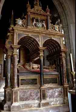
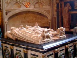
| Burial | : | Withcote Chapel, Harborough District, England |
| Coordinate | : | 52.6440500, -0.8253346 |
| Description | : | Margaret died in Withcote Hall near Oakham Leicestershire. |
frequently asked questions (FAQ):
-
Where is Margaret Cecil Smith's memorial?
Margaret Cecil Smith's memorial is located at: Withcote Chapel, Harborough District, England.
-
When did Margaret Cecil Smith death?
Margaret Cecil Smith death on 1616 in Leicestershire, England
-
Where are the coordinates of the Margaret Cecil Smith's memorial?
Latitude: 52.6440500
Longitude: -0.8253346
Family Members:
Parent
Spouse

Siblings
Children
Flowers:


Nearby Cemetories:
1. Withcote Chapel
Harborough District, England
Coordinate: 52.6440500, -0.8253346
2. Launde Abbey
Launde, Harborough District, England
Coordinate: 52.6313950, -0.8233060
3. St Peter Churchyard
Knossington, Melton Borough, England
Coordinate: 52.6699000, -0.8168600
4. Saint Andrew's Churchyard
Owston, Harborough District, England
Coordinate: 52.6642540, -0.8561200
5. St John the Baptist Churchyard
Cold Overton, Melton Borough, England
Coordinate: 52.6829560, -0.8027660
6. Pickwell Road Cemetery
Somerby, Melton Borough, England
Coordinate: 52.6865550, -0.8444540
7. St Peter Churchyard
Belton, Rutland Unitary Authority, England
Coordinate: 52.6038200, -0.7957000
8. All Saints Churchyard
Somerby, Melton Borough, England
Coordinate: 52.6864700, -0.8482390
9. St Peter Churchyard
Tilton-on-the-Hill, Harborough District, England
Coordinate: 52.6435650, -0.9026860
10. All Saints Churchyard, Pickwell
Melton Mowbray, Melton Borough, England
Coordinate: 52.6943280, -0.8388740
11. St. Thomas A. Becket Churchyard
Tugby, Harborough District, England
Coordinate: 52.6015640, -0.8766340
12. St Thomas a Becket Churchyard
Skeffington, Harborough District, England
Coordinate: 52.6163920, -0.9063090
13. St Mary the Virgin Churchyard
Somerby, Melton Borough, England
Coordinate: 52.6894150, -0.8806740
14. SS Peter and Paul Church
Langham, Rutland Unitary Authority, England
Coordinate: 52.6918700, -0.7529300
15. All Saints Churchyard
Lowesby, Harborough District, England
Coordinate: 52.6601500, -0.9314700
16. Oakham Cemetery
Oakham, Rutland Unitary Authority, England
Coordinate: 52.6768700, -0.7297400
17. Leicester Road Cemetery
Uppingham, Rutland Unitary Authority, England
Coordinate: 52.5975766, -0.7413414
18. Billesdon Cemetery
Billesdon, Harborough District, England
Coordinate: 52.6185500, -0.9317400
19. St Andrew Churchyard
Twyford, Melton Borough, England
Coordinate: 52.6835600, -0.9217660
20. St. Mary the Virgin Churchyard
Uppingham, Rutland Unitary Authority, England
Coordinate: 52.5996800, -0.7324400
21. St James the Greater Churchyard
Little Dalby, Melton Borough, England
Coordinate: 52.7149700, -0.8543800
22. St Peter & Paul Churchyard
Preston, Rutland Unitary Authority, England
Coordinate: 52.6122600, -0.7162560
23. St John the Baptist Churchyard
Billesdon, Harborough District, England
Coordinate: 52.6159495, -0.9379699
24. St. Peter's Churchyard
Stockerston, Harborough District, England
Coordinate: 52.5687800, -0.7706600