
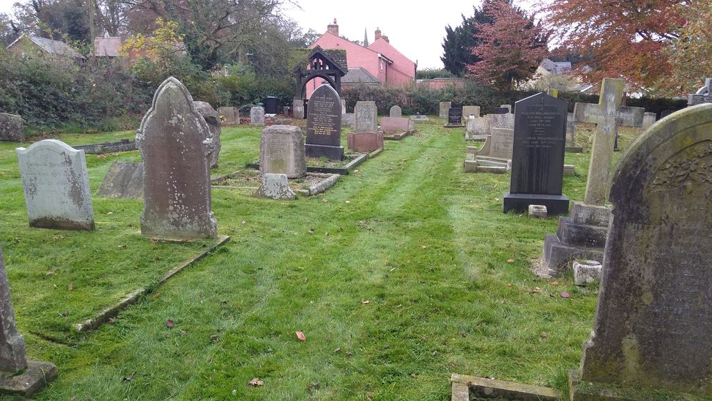
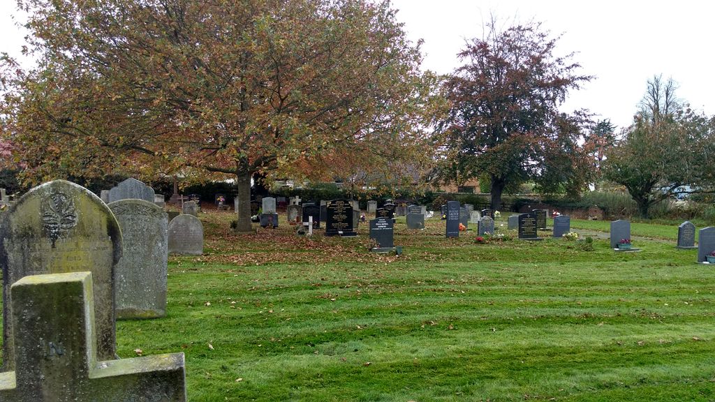
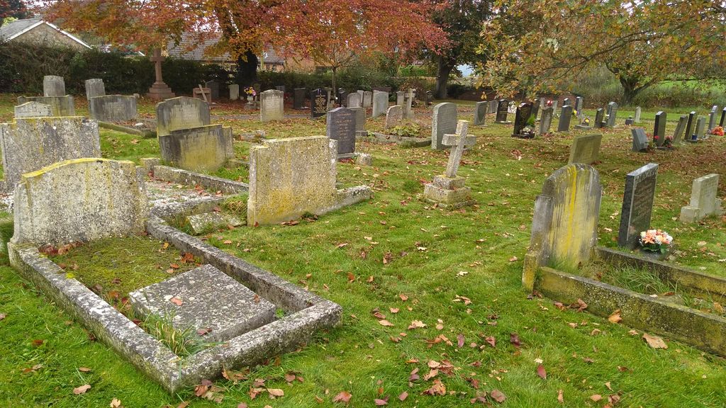
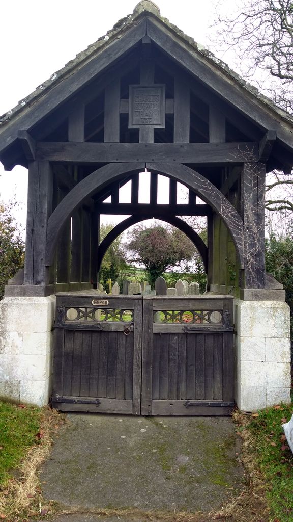
| Memorials | : | 1 |
| Location | : | Somerby, Melton Borough, England |
| Website | : | www.somerbyparish.org.uk/parish-council-responsibilities.html |
| Coordinate | : | 52.6865550, -0.8444540 |
frequently asked questions (FAQ):
-
Where is Pickwell Road Cemetery?
Pickwell Road Cemetery is located at Somerby, Melton Borough ,Leicestershire ,England.
-
Pickwell Road Cemetery cemetery's updated grave count on graveviews.com?
1 memorials
-
Where are the coordinates of the Pickwell Road Cemetery?
Latitude: 52.6865550
Longitude: -0.8444540
Nearby Cemetories:
1. All Saints Churchyard
Somerby, Melton Borough, England
Coordinate: 52.6864700, -0.8482390
2. All Saints Churchyard, Pickwell
Melton Mowbray, Melton Borough, England
Coordinate: 52.6943280, -0.8388740
3. St Mary the Virgin Churchyard
Somerby, Melton Borough, England
Coordinate: 52.6894150, -0.8806740
4. Saint Andrew's Churchyard
Owston, Harborough District, England
Coordinate: 52.6642540, -0.8561200
5. St Peter Churchyard
Knossington, Melton Borough, England
Coordinate: 52.6699000, -0.8168600
6. St John the Baptist Churchyard
Cold Overton, Melton Borough, England
Coordinate: 52.6829560, -0.8027660
7. St James the Greater Churchyard
Little Dalby, Melton Borough, England
Coordinate: 52.7149700, -0.8543800
8. Withcote Chapel
Harborough District, England
Coordinate: 52.6440500, -0.8253346
9. St Andrew Churchyard
Twyford, Melton Borough, England
Coordinate: 52.6835600, -0.9217660
10. St Swithun Churchyard
Great Dalby, Melton Borough, England
Coordinate: 52.7224510, -0.9027190
11. St Peter Churchyard
Tilton-on-the-Hill, Harborough District, England
Coordinate: 52.6435650, -0.9026860
12. SS Peter and Paul Church
Langham, Rutland Unitary Authority, England
Coordinate: 52.6918700, -0.7529300
13. Launde Abbey
Launde, Harborough District, England
Coordinate: 52.6313950, -0.8233060
14. St Andrew Churchyard
Whissendine, Rutland Unitary Authority, England
Coordinate: 52.7200520, -0.7682370
15. All Saints Churchyard
Lowesby, Harborough District, England
Coordinate: 52.6601500, -0.9314700
16. St James Churchyard
Burton Lazars, Melton Borough, England
Coordinate: 52.7446910, -0.8643730
17. Ashby Folville Church of St Mary
Melton Mowbray, Melton Borough, England
Coordinate: 52.7009720, -0.9555180
18. Oakham Cemetery
Oakham, Rutland Unitary Authority, England
Coordinate: 52.6768700, -0.7297400
19. St. Mary Magdalen Churchyard
Stapleford, Melton Borough, England
Coordinate: 52.7553000, -0.7987000
20. St. Mary Churchyard
Wyfordby, Melton Borough, England
Coordinate: 52.7621940, -0.8257020
21. St Thomas a Becket Churchyard
Skeffington, Harborough District, England
Coordinate: 52.6163920, -0.9063090
22. St Mary the Virgin Churchyard
Ashwell, Rutland Unitary Authority, England
Coordinate: 52.7144490, -0.7200580
23. St Mary Churchyard
Melton Mowbray, Melton Borough, England
Coordinate: 52.7635680, -0.8858380
24. St John the Baptist Churchyard
South Croxton, Charnwood Borough, England
Coordinate: 52.6862210, -0.9780790