
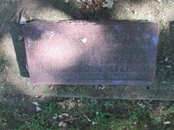
| Birth | : | 4 Apr 1858 Garnavillo, Clayton County, Iowa, USA |
| Death | : | 27 Apr 1859 Iowa, USA |
| Burial | : | Pioneer Rock Cemetery, Ceres, Clayton County, USA |
| Coordinate | : | 42.8230591, -91.1863937 |
| Description | : | Marie is buried next to her cousin Anna Catherina Bierbaum, memorial #7653653. Excerpt: Near Anna is her cousin, Maria Elisabeth Bierbaum--daughter of Gerhard and Caroline (Walke) Bierbaum. Baby Maria was born in 1858 and died in 1859. Maria's parents, Gerhard and Caroline Bierbaum, are buried at Ceres, too. Pioneer Rock Church was originally founded in 1858 as St. Peter's German United Evangelical Lutheran Church. Among its first members was Clayton County, Iowa pioneer Gerhard Bierbaum referred to in the foregoing paragraph. It was from Bierbaum's quarry that rock was obtained to build the... Read More |
frequently asked questions (FAQ):
-
Where is Maria Elisabeth Bierbaum's memorial?
Maria Elisabeth Bierbaum's memorial is located at: Pioneer Rock Cemetery, Ceres, Clayton County, USA.
-
When did Maria Elisabeth Bierbaum death?
Maria Elisabeth Bierbaum death on 27 Apr 1859 in Iowa, USA
-
Where are the coordinates of the Maria Elisabeth Bierbaum's memorial?
Latitude: 42.8230591
Longitude: -91.1863937
Family Members:
Parent

Siblings
Flowers:


Nearby Cemetories:
1. Pioneer Rock Cemetery
Ceres, Clayton County, USA
Coordinate: 42.8230591, -91.1863937
2. McClelland Cemetery
Garnavillo, Clayton County, USA
Coordinate: 42.8249879, -91.2084641
3. Saint Michael Cemetery
Clayton County, USA
Coordinate: 42.8055992, -91.1802979
4. Borcherding Cemetery
Jefferson Township, Clayton County, USA
Coordinate: 42.8182983, -91.1414032
5. Tangeman Family Cemetery
Garnavillo, Clayton County, USA
Coordinate: 42.8580000, -91.1420000
6. Storck Cemetery
Guttenberg, Clayton County, USA
Coordinate: 42.7694335, -91.1834638
7. Garnavillo Cemetery
Garnavillo, Clayton County, USA
Coordinate: 42.8660300, -91.2390100
8. Garnavillo Community Cemetery
Garnavillo, Clayton County, USA
Coordinate: 42.8656000, -91.2422100
9. Saint Paula Cemetery
Osterdock, Clayton County, USA
Coordinate: 42.7635994, -91.1992035
10. Saint Joseph Cemetery
Garnavillo, Clayton County, USA
Coordinate: 42.8628006, -91.2502975
11. Saint Marys Cemetery
Guttenberg, Clayton County, USA
Coordinate: 42.7691994, -91.1352997
12. Mount Olivet Cemetery
Guttenberg, Clayton County, USA
Coordinate: 42.7764840, -91.1083560
13. Guttenberg Cemetery
Guttenberg, Clayton County, USA
Coordinate: 42.7691994, -91.1035995
14. Lewis Cemetery
Osterdock, Clayton County, USA
Coordinate: 42.7416000, -91.1834000
15. Clayton Cemetery
Clayton, Clayton County, USA
Coordinate: 42.9043999, -91.1641998
16. Duncan Cemetery
Glen Haven, Grant County, USA
Coordinate: 42.8325540, -91.0725940
17. Old Garber Cemetery
Garber, Clayton County, USA
Coordinate: 42.7560005, -91.2580032
18. Old Saint Marys Cemetery
Glen Haven, Grant County, USA
Coordinate: 42.8078100, -91.0675330
19. Krumm Cemetery
Garber, Clayton County, USA
Coordinate: 42.7913760, -91.3023559
20. Saint Johns Cemetery
Jefferson Township, Clayton County, USA
Coordinate: 42.7497000, -91.1133000
21. Immanuel Lutheran Cemetery
Elkport, Clayton County, USA
Coordinate: 42.7433014, -91.2733002
22. Saint Michaels Cemetery
Elkport, Clayton County, USA
Coordinate: 42.7433014, -91.2733002
23. Bagley Cemetery
Bagley, Grant County, USA
Coordinate: 42.9019012, -91.0907974
24. Gockel Cemetery
Glen Haven, Grant County, USA
Coordinate: 42.8224983, -91.0385971