Mariah L. Crigler Martin
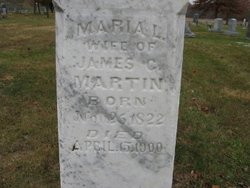
| Birth | : | 26 Nov 1822 Saline County, Missouri, USA |
| Death | : | 15 Apr 1900 Marshall, Saline County, Missouri, USA |
| Burial | : | St Andrew Churchyard, Kingswood, Reigate and Banstead Borough, England |
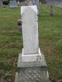
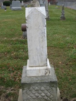
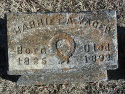
| Inscription | : | Wife of James C. Martin. |
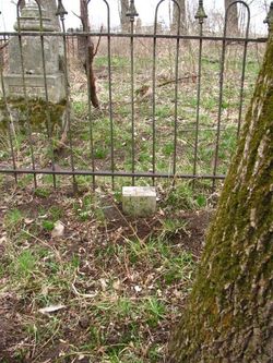
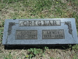
| Description | : | Daughter of Richard Gaines and Margaret Crigler. ********** Mother of Margaret, Richard, Jennie, Lou Ella, Mary, John J, Calhoun C, Francis, Harriett, and Permelia. In 2008 the memorial stone was moved from Marshall Junction Cemetery (unconfirmed location) to Bethlehem Cemetery at the behest of the Bethlehem Cemetery Board of Directors because the Marshall Junction Cemetery was not being maintained. https://bethlehemcemetery.org/ Contributor: Richard Weiss (48726124) |
frequently asked questions (FAQ):
-
Where is Mariah L. Crigler Martin's memorial?
Mariah L. Crigler Martin's memorial is located at: St Andrew Churchyard, Kingswood, Reigate and Banstead Borough, England.
-
When did Mariah L. Crigler Martin death?
Mariah L. Crigler Martin death on 15 Apr 1900 in Marshall, Saline County, Missouri, USA
Family Members:
Parent
Spouse
Siblings
Children
Flowers:
Nearby Cemetories:
1. St Andrew Churchyard
Kingswood, Reigate and Banstead Borough, England
Coordinate: 51.2923980, -0.1602950
2. Quakers Burial Ground
Reigate, Reigate and Banstead Borough, England
3. Reigate Cemetery
Reigate, Reigate and Banstead Borough, England
Coordinate: 51.3246900, -0.1693300
4. Reigate Garden of Remembrance
Reigate, Reigate and Banstead Borough, England
Coordinate: 51.3220583, -0.2008833
5. Gatton Hall, St Andrew's Church
Reigate, Reigate and Banstead Borough, England
Coordinate: 51.3389400, -0.1849100
6. St Mary Magdalene Churchyard
Reigate, Reigate and Banstead Borough, England
Coordinate: 51.3215180, -0.2120434
7. St Katharine's Churchyard
Merstham, Reigate and Banstead Borough, England
8. Everton Saint George
Walton-on-the-Hill, Reigate and Banstead Borough, England
Coordinate: 51.2310910, -0.1601330
9. Saint Peter's Church
Walton-on-the-Hill, Reigate and Banstead Borough, England
10. Netherne Cemetery
Netherne-on-the-Hill, Reigate and Banstead Borough, England
Coordinate: 51.1711120, -0.1747610
11. Sidlow Bridge Emmanuel Churchyard
Sidlow, Reigate and Banstead Borough, England
Coordinate: 51.1698000, -0.1758000
12. St. Margaret's Churchyard
Hooley, Reigate and Banstead Borough, England
Coordinate: 51.2923980, -0.1602950
13. Box Hill
Tadworth, Reigate and Banstead Borough, England
14. St Peter's Churchyard
Woodmansterne, Reigate and Banstead Borough, England
Coordinate: 51.3246900, -0.1693300
15. All Saints Churchyard
Banstead, Reigate and Banstead Borough, England
Coordinate: 51.3220583, -0.2008833
16. Banstead Hospital Cemetery
Banstead, Reigate and Banstead Borough, England
Coordinate: 51.3389400, -0.1849100
17. St Ann's Memorial Garden
Banstead, Reigate and Banstead Borough, England
Coordinate: 51.3215180, -0.2120434
18. Philanthropic Farm School Graveyard
Redhill, Reigate and Banstead Borough, England
19. Redstone Cemetery
Redhill, Reigate and Banstead Borough, England
Coordinate: 51.2310910, -0.1601330
20. St. John the Evangelist Churchyard
Redhill, Reigate and Banstead Borough, England
21. Parish of Horley's New Churchyard
Horley, Reigate and Banstead Borough, England
Coordinate: 51.1711120, -0.1747610
22. St. Bartholomew's Churchyard
Horley, Reigate and Banstead Borough, England
Coordinate: 51.1698000, -0.1758000

