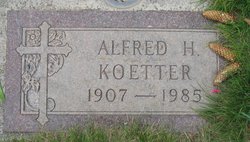
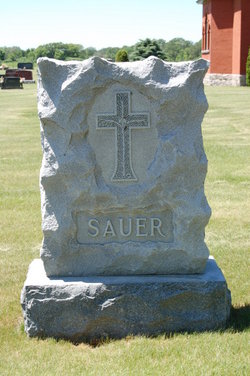
| Birth | : | 6 Jan 1910 |
| Death | : | 25 Jul 2001 |
| Burial | : | Dakota Cemetery, Dakota, Stephenson County, USA |
| Coordinate | : | 42.3899994, -89.5338974 |
frequently asked questions (FAQ):
-
Where is Marie Agatha Koetter Rausch's memorial?
Marie Agatha Koetter Rausch's memorial is located at: Dakota Cemetery, Dakota, Stephenson County, USA.
-
When did Marie Agatha Koetter Rausch death?
Marie Agatha Koetter Rausch death on 25 Jul 2001 in
-
Where are the coordinates of the Marie Agatha Koetter Rausch's memorial?
Latitude: 42.3899994
Longitude: -89.5338974
Family Members:
Parent
Spouse
Siblings
Flowers:
Nearby Cemetories:
1. Lancaster Cemetery
Dakota, Stephenson County, USA
Coordinate: 42.3600006, -89.5342026
2. Pioneers Cemetery
Rock Run Township, Stephenson County, USA
Coordinate: 42.4014015, -89.4953003
3. Freeport Mennonite Church Cemetery
Freeport, Stephenson County, USA
Coordinate: 42.3601600, -89.5450400
4. Rock City Cemetery
Rock City, Stephenson County, USA
Coordinate: 42.4025002, -89.4728012
5. Afolkey Cemetery
Afolkey, Stephenson County, USA
Coordinate: 42.4289017, -89.5759506
6. Brubaker Cemetery
Rock Run Township, Stephenson County, USA
Coordinate: 42.3526306, -89.4791183
7. Silver Spring Cemetery
Stephenson County, USA
Coordinate: 42.3306007, -89.5532990
8. Saint Pauls Epleyanna Cemetery
Davis, Stephenson County, USA
Coordinate: 42.4300000, -89.4420000
9. Rock Grove Cemetery
Rock Grove, Stephenson County, USA
Coordinate: 42.4688988, -89.5294037
10. Cedarville Cemetery
Cedarville, Stephenson County, USA
Coordinate: 42.3838997, -89.6410980
11. Bethlehem Cemetery
Stephenson County, USA
Coordinate: 42.4481010, -89.4574966
12. Zion Cemetery
Buckeye Township, Stephenson County, USA
Coordinate: 42.4210400, -89.6379800
13. Grandview Cemetery
Freeport, Stephenson County, USA
Coordinate: 42.3480988, -89.6318970
14. Bellview Cemetery
Stephenson County, USA
Coordinate: 42.4166985, -89.6524963
15. Irish Grove Catholic Cemetery
Stephenson County, USA
Coordinate: 42.3797226, -89.4069443
16. Davis Cemetery
Davis, Stephenson County, USA
Coordinate: 42.4255790, -89.4091840
17. Ridott Township Cemetery
Ridott, Stephenson County, USA
Coordinate: 42.2946120, -89.4808530
18. Frankeburger Cemetery
Rock Grove, Stephenson County, USA
Coordinate: 42.4892006, -89.4925003
19. Felts Cemetery
Stephenson County, USA
Coordinate: 42.4692001, -89.4308014
20. Summit Street Burial Ground
Freeport, Stephenson County, USA
Coordinate: 42.3032560, -89.6254550
21. Eldorado Cemetery
Orangeville, Stephenson County, USA
Coordinate: 42.4831009, -89.6136017
22. Gund Cemetery
Freeport, Stephenson County, USA
Coordinate: 42.2797012, -89.5194016
23. Sunset Acres Cemetery
Orangeville, Stephenson County, USA
Coordinate: 42.4734200, -89.6347200
24. State Road Cemetery
Stephenson County, USA
Coordinate: 42.2764015, -89.5130997

