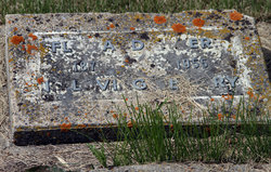
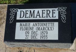
Marie Antoinette Florine “Flora” Marckx Demaere
| Birth | : | 9 Dec 1879 Belgium Row, Vermilion County, Illinois, USA |
| Death | : | 27 Dec 1955 Lethbridge, Lethbridge Census Division, Alberta, Canada |
| Burial | : | St. Mary's Churchyard, Gate Helmsley, Ryedale District, England |
| Coordinate | : | 53.9883720, -0.9481980 |
| Description | : | Add by Bear Hugs ID 47810210 Lethbridge Herald December 28, 1955 HIGHWAY MISHAP CLAIMS LIFE OF MRS FLORA DEMAERE, 76 - Mrs DeMaere died following a 2 car collision five miles west of Lethbridge on Highway 3 - 11 people were injured - born in Belgium and moved to the USA with her parents - homesteaded in Granum district with her husband, Adolph, in 1902 - survived by her children: John of Red Deer Albert of Granum Francis of Granum Clarence of Granum Mrs Janet Summerville of Lachine, Quebec Mrs Mary Ellison of Enchant Mrs Rose Metziar of Stirling Mrs Marguerite of Granum Mrs Fedelia Fitzpatrick of Granum Mrs Alice Hoglund of Granum 30 grandchildren & several... Read More |
frequently asked questions (FAQ):
-
Where is Marie Antoinette Florine “Flora” Marckx Demaere's memorial?
Marie Antoinette Florine “Flora” Marckx Demaere's memorial is located at: St. Mary's Churchyard, Gate Helmsley, Ryedale District, England.
-
When did Marie Antoinette Florine “Flora” Marckx Demaere death?
Marie Antoinette Florine “Flora” Marckx Demaere death on 27 Dec 1955 in Lethbridge, Lethbridge Census Division, Alberta, Canada
-
Where are the coordinates of the Marie Antoinette Florine “Flora” Marckx Demaere's memorial?
Latitude: 53.9883720
Longitude: -0.9481980
Family Members:
Spouse
Children
Flowers:
Nearby Cemetories:
1. St. Mary's Churchyard
Gate Helmsley, Ryedale District, England
Coordinate: 53.9883720, -0.9481980
2. St Mary Churchyard
Warthill, Ryedale District, England
Coordinate: 53.9887610, -0.9714450
3. St Peter Churchyard
Upper Helmsley, Ryedale District, England
Coordinate: 54.0044650, -0.9409770
4. Holy Trinity Churchyard
Holtby, York Unitary Authority, England
Coordinate: 53.9792890, -0.9719310
5. All Saints Churchyard
Low Catton, East Riding of Yorkshire Unitary Authority, England
Coordinate: 53.9769280, -0.9268720
6. Dunnington Cemetery
Dunnington, York Unitary Authority, England
Coordinate: 53.9675110, -0.9823760
7. St Nicholas Churchyard
Dunnington, York Unitary Authority, England
Coordinate: 53.9661680, -0.9829590
8. St. Mary's Churchyard
Sand Hutton, Ryedale District, England
Coordinate: 54.0183800, -0.9410700
9. St Peter Churchyard
Stockton-on-the-Forest, York Unitary Authority, England
Coordinate: 53.9964440, -0.9991290
10. Holy Trinity Churchyard
Stockton-on-the-Forest, York Unitary Authority, England
Coordinate: 53.9960220, -0.9994630
11. St Paul Churchyard
Kexby, York Unitary Authority, England
Coordinate: 53.9505970, -0.9339900
12. Saint James Churchyard
Murton, York Unitary Authority, England
Coordinate: 53.9656390, -1.0125031
13. St John the Evangelist Churchyard
Buttercrambe, Ryedale District, England
Coordinate: 54.0137300, -0.8812900
14. St Mary Churchyard
Full Sutton, East Riding of Yorkshire Unitary Authority, England
Coordinate: 53.9897620, -0.8613700
15. St Botolph Churchyard
Bossall, Ryedale District, England
Coordinate: 54.0375570, -0.9047540
16. St Thomas Churchyard
Osbaldwick, York Unitary Authority, England
Coordinate: 53.9588640, -1.0338800
17. St Peter and St Paul Churchyard
Scrayingham, Ryedale District, England
Coordinate: 54.0342510, -0.8826130
18. St Lawrence Churchyard
Flaxton, Ryedale District, England
Coordinate: 54.0508680, -0.9624500
19. New Lane Cemetery
Huntington, York Unitary Authority, England
Coordinate: 53.9816223, -1.0576156
20. All Saints Churchyard
Huntington, York Unitary Authority, England
Coordinate: 53.9977460, -1.0633490
21. Holy Trinity Churchyard
Heworth, York Unitary Authority, England
Coordinate: 53.9660080, -1.0596980
22. St Paul Churchyard
Heslington, York Unitary Authority, England
Coordinate: 53.9471780, -1.0445150
23. Holy Trinity Churchyard
Elvington, York Unitary Authority, England
Coordinate: 53.9186950, -0.9341610
24. St Martin Churchyard
Fangfoss, East Riding of Yorkshire Unitary Authority, England
Coordinate: 53.9704970, -0.8324690

