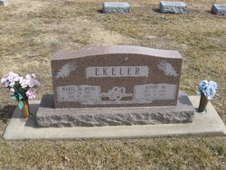
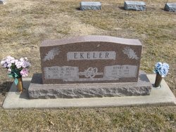
Marie Delivance Ruhl Ekeler
| Birth | : | 14 Sep 1912 |
| Death | : | 10 Jan 2003 |
| Burial | : | Oxdrift Cemetery, Oxdrift, Kenora District, Canada |
| Coordinate | : | 49.8148000, -92.9632200 |
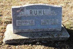
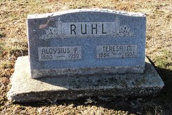
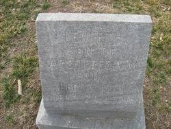
| Description | : | Obituary Marie D. (Ruhl) Ekeler Marie D. Ruhl was born to Aloysius P. Ruhl and Teresa M. (Robbins) Ruhl on September 14, 1912 at Exeter, Nebraska. She was the fourth in the family of eleven children. She was baptized at St. Stephen Church and was a life long member. Her education included Fillmore County District #78, St. Stephen Catholic School, and the Immaculate Conception Academy, Hastings, Nebraska through the ninth grade. On June 21, 1932, Marie was married to Henry M. Ekeler at St. Stephen Church, Exeter, Nebraska. They raised two daughter, Agnes Marie and Kathleen Ann. Marie and Henry lived and farmed... Read More |
frequently asked questions (FAQ):
-
Where is Marie Delivance Ruhl Ekeler's memorial?
Marie Delivance Ruhl Ekeler's memorial is located at: Oxdrift Cemetery, Oxdrift, Kenora District, Canada.
-
When did Marie Delivance Ruhl Ekeler death?
Marie Delivance Ruhl Ekeler death on 10 Jan 2003 in
-
Where are the coordinates of the Marie Delivance Ruhl Ekeler's memorial?
Latitude: 49.8148000
Longitude: -92.9632200
Family Members:
Parent
Spouse
Siblings
Flowers:
Nearby Cemetories:
1. Oxdrift Cemetery
Oxdrift, Kenora District, Canada
Coordinate: 49.8148000, -92.9632200
2. Dryden Cemetery
Dryden, Kenora District, Canada
Coordinate: 49.7993900, -92.8460600
3. Minnitaki Cemetery
Minnitaki, Kenora District, Canada
Coordinate: 49.8157393, -93.0846587
4. Eagle River Cemetery
Eagle River, Kenora District, Canada
Coordinate: 49.7920670, -93.2036170
5. Wabigoon Cemetery
Wabigoon, Kenora District, Canada
Coordinate: 49.7266200, -92.5850100
6. Vermilion Bay Catholic Cemetery
Vermilion Bay, Kenora District, Canada
Coordinate: 49.8782390, -93.4265730
7. St. George's Anglican Cemetery
Dinorwic, Kenora District, Canada
Coordinate: 49.6919800, -92.4943600
8. Quibell Cemetery
Quibell, Kenora District, Canada
Coordinate: 49.9594491, -93.4252027
9. Trinity Lutheran Church Cemetery
Dinorwic, Kenora District, Canada
Coordinate: 49.6628200, -92.4821100
10. McIntosh Cemetery
McIntosh, Kenora District, Canada
Coordinate: 49.9813175, -93.5870514
11. McIntosh First Nation Residential School Cemetery
McIntosh, Kenora District, Canada
Coordinate: 49.9794440, -93.6108330
12. Sacred Heart Cemetery
Sioux Lookout, Kenora District, Canada
Coordinate: 50.1029400, -91.9313600
13. Northway Cemetery
Sioux Lookout, Kenora District, Canada
Coordinate: 50.1028800, -91.9289400
14. Ear Falls Municipal Cemetery
Ear Falls, Kenora District, Canada
Coordinate: 50.6151080, -93.1993280
15. Pineridge Cemetery
Sioux Narrows, Kenora District, Canada
Coordinate: 49.3975171, -94.0623584
16. Gold Pines Burying Ground
Ear Falls, Kenora District, Canada
Coordinate: 50.6408620, -93.3123336
17. Norman Cottam Memorial Gardens
Nestor Falls, Kenora District, Canada
Coordinate: 49.1343810, -93.9210630
18. Ignace Municipal Cemetery
Ignace, Kenora District, Canada
Coordinate: 49.4163300, -91.6590200
19. Lake Of The Woods Cemetery
Kenora, Kenora District, Canada
Coordinate: 49.7764700, -94.4798500
20. Post Narrows Burying Ground
Red Lake, Kenora District, Canada
Coordinate: 50.9500348, -93.6032140
21. Fort Frances Couchiching Reserve Cemetery
Fort Frances, Rainy River District, Canada
Coordinate: 48.6309300, -93.3585300
22. Our Lady of Lourdes Cemetery
Fort Frances, Rainy River District, Canada
Coordinate: 48.6310200, -93.3592400
23. Burriss Municipal Cemetery
Burriss, Rainy River District, Canada
Coordinate: 48.6780400, -93.6887900
24. Fort Frances Cemetery
Fort Frances, Rainy River District, Canada
Coordinate: 48.6114100, -93.4090200

