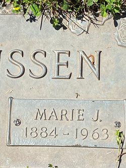
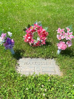
Marie Johanna Nielsen Markussen
| Birth | : | 11 Feb 1884 Denmark |
| Death | : | 7 Dec 1963 Council Bluffs, Pottawattamie County, Iowa, USA |
| Burial | : | St. Michael Churchyard, Ilderton, Northumberland Unitary Authority, England |
| Coordinate | : | 55.4904200, -1.9743800 |
frequently asked questions (FAQ):
-
Where is Marie Johanna Nielsen Markussen's memorial?
Marie Johanna Nielsen Markussen's memorial is located at: St. Michael Churchyard, Ilderton, Northumberland Unitary Authority, England.
-
When did Marie Johanna Nielsen Markussen death?
Marie Johanna Nielsen Markussen death on 7 Dec 1963 in Council Bluffs, Pottawattamie County, Iowa, USA
-
Where are the coordinates of the Marie Johanna Nielsen Markussen's memorial?
Latitude: 55.4904200
Longitude: -1.9743800
Family Members:
Parent
Spouse
Siblings
Children
Flowers:
Nearby Cemetories:
1. St. Michael Churchyard
Ilderton, Northumberland Unitary Authority, England
Coordinate: 55.4904200, -1.9743800
2. St. Michael and All Angels Churchyard
Ingram, Northumberland Unitary Authority, England
Coordinate: 55.4405530, -1.9706240
3. St. Peter's Parish Church
Chillingham, Northumberland Unitary Authority, England
Coordinate: 55.5273100, -1.9030830
4. Holy Cross Churchyard
Chatton, Northumberland Unitary Authority, England
Coordinate: 55.5474907, -1.9105738
5. St Maurice Churchyard
Eglingham, Northumberland Unitary Authority, England
Coordinate: 55.4689000, -1.8336000
6. St Mary & St Michael Churchyard
Doddington, Northumberland Unitary Authority, England
Coordinate: 55.5837211, -2.0083409
7. St. Michael & All Angels Churchyard
Alnham, Northumberland Unitary Authority, England
Coordinate: 55.3926170, -2.0159210
8. Bolton Chapel
Edlingham, Northumberland Unitary Authority, England
Coordinate: 55.4168580, -1.8335818
9. St Gregory Churchyard
Kirknewton, Northumberland Unitary Authority, England
Coordinate: 55.5658590, -2.1387780
10. Saint Mary's Churchyard
Belford, Northumberland Unitary Authority, England
Coordinate: 55.5992600, -1.8292900
11. Hulne Priory
Alnwick, Northumberland Unitary Authority, England
Coordinate: 55.4350530, -1.7430160
12. Saint Hilda’s Churchyard
Lucker, Northumberland Unitary Authority, England
Coordinate: 55.5660400, -1.7597400
13. St John the Baptist Churchyard
Edlingham, Northumberland Unitary Authority, England
Coordinate: 55.3758250, -1.8212200
14. St Maurice's Churchyard
Ellingham, Northumberland Unitary Authority, England
Coordinate: 55.5245000, -1.7245300
15. St Michael and All Angels Churchyard
Ford, Northumberland Unitary Authority, England
Coordinate: 55.6301700, -2.0895430
16. St John the Baptist Churchyard
Lowick, Northumberland Unitary Authority, England
Coordinate: 55.6501470, -1.9826250
17. Alnwick Abbey
Alnwick, Northumberland Unitary Authority, England
Coordinate: 55.4198500, -1.7191400
18. Saint Michael's Churchyard
Alnwick, Northumberland Unitary Authority, England
Coordinate: 55.4169400, -1.7111000
19. Rock Church of St. Philip and St. James
Alnwick, Northumberland Unitary Authority, England
Coordinate: 55.4755200, -1.6817200
20. St Michael and All Angels Churchyard
Alwinton, Northumberland Unitary Authority, England
Coordinate: 55.3460600, -2.1218900
21. Saint Nicholas Churchyard
Kyloe, Northumberland Unitary Authority, England
Coordinate: 55.6569000, -1.9188300
22. Kyloe Cemetery
Kyloe, Northumberland Unitary Authority, England
Coordinate: 55.6570310, -1.9191950
23. Grey Family Cemetery
Fallodon, Northumberland Unitary Authority, England
Coordinate: 55.5058580, -1.6760530
24. St. Mary the Virgin Chapelyard
Etal, Northumberland Unitary Authority, England
Coordinate: 55.6481100, -2.1150200


