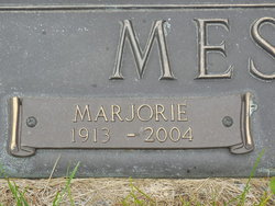
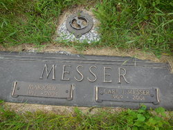
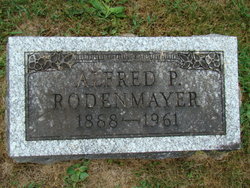
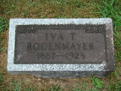
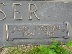
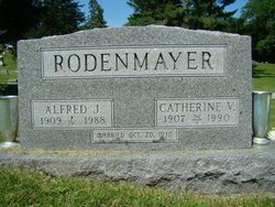
Marjorie Marie Rodenmayer Messer
| Birth | : | 14 Sep 1913 Fairfield, Jefferson County, Iowa, USA |
| Death | : | 28 Mar 2004 Ottumwa, Wapello County, Iowa, USA |
| Burial | : | Memorial Lawn Cemetery, Fairfield, Jefferson County, USA |
| Coordinate | : | 41.0068000, -91.9805000 |
| Plot | : | Devotion A 130 - Space 6 |
| Description | : | Fairfield Daily Ledger March 29, 2004 Marjorie Marie Messer Marjorie Marie Messer, 90, of 1102 W. Carpenter Ave., died at 2:10 a.m. Sunday, March 28, 2004, at Vista Woods Care Center in Ottumwa. The funeral will be held at 10 a.m. Wednesday at First Lutheran Church, with the Rev. Marvin Robeck officiating. Burial will be in Memorial Lawn Cemetery. The family will receive friends at First Lutheran Church after the burial. Open visitation will be Tuesday afternoon at Raymond Funeral Home. Memorials may be made to First Lutheran Church, Vista Woods Care Center's aviary fund or Hospice of Davis and Wapello... Read More |
frequently asked questions (FAQ):
-
Where is Marjorie Marie Rodenmayer Messer's memorial?
Marjorie Marie Rodenmayer Messer's memorial is located at: Memorial Lawn Cemetery, Fairfield, Jefferson County, USA.
-
When did Marjorie Marie Rodenmayer Messer death?
Marjorie Marie Rodenmayer Messer death on 28 Mar 2004 in Ottumwa, Wapello County, Iowa, USA
-
Where are the coordinates of the Marjorie Marie Rodenmayer Messer's memorial?
Latitude: 41.0068000
Longitude: -91.9805000
Family Members:
Parent
Spouse
Siblings
Flowers:
Nearby Cemetories:
1. Memorial Lawn Cemetery
Fairfield, Jefferson County, USA
Coordinate: 41.0068000, -91.9805000
2. Old Fairfield Cemetery
Fairfield, Jefferson County, USA
Coordinate: 41.0148000, -91.9598000
3. Evergreen Cemetery
Fairfield, Jefferson County, USA
Coordinate: 41.0138600, -91.9562100
4. Smith Family Cemetery
Libertyville, Jefferson County, USA
Coordinate: 40.9972416, -92.0362857
5. Roth Cemetery
Fairfield, Jefferson County, USA
Coordinate: 40.9589005, -91.9574966
6. Switzer Cemetery
Fairfield, Jefferson County, USA
Coordinate: 41.0368996, -91.9096985
7. Bradshaw Cemetery
Jefferson County, USA
Coordinate: 40.9766998, -91.9032974
8. Jefferson County Poor Farm Cemetery
Libertyville, Jefferson County, USA
Coordinate: 40.9416900, -91.9996200
9. Moorman Cemetery
Fairfield, Jefferson County, USA
Coordinate: 41.0452995, -92.0622025
10. Gregg Cemetery
Jefferson County, USA
Coordinate: 41.0078011, -92.0811005
11. Bethesda Cemetery
Fairfield, Jefferson County, USA
Coordinate: 41.0019000, -91.8796000
12. McCleary Cemetery
Jefferson County, USA
Coordinate: 40.9892006, -92.0805969
13. Cumberland Cemetery
Jefferson County, USA
Coordinate: 40.9248000, -91.9903000
14. Galliher Cemetery
Glasgow, Jefferson County, USA
Coordinate: 40.9666892, -91.8835038
15. Pattison Cemetery
Fairfield, Jefferson County, USA
Coordinate: 40.9444008, -91.9049988
16. Wheeler Cemetery
Jefferson County, USA
Coordinate: 41.0797000, -91.9185500
17. Brooks Cemetery
Jefferson County, USA
Coordinate: 41.0635986, -92.0693970
18. Koons Cemetery
Locust Grove Township, Jefferson County, USA
Coordinate: 41.0286410, -92.0948960
19. Morgan Burial Plot
Des Moines Township, Jefferson County, USA
Coordinate: 40.9837160, -92.0964340
20. Thompson Cemetery
Jefferson County, USA
Coordinate: 40.9155998, -91.9772034
21. Upper Richwoods Cemetery
Salina, Jefferson County, USA
Coordinate: 41.0602989, -91.8807983
22. Perlee Cemetery
Perlee, Jefferson County, USA
Coordinate: 41.0805750, -91.8993380
23. Wright Cemetery
Fairfield, Jefferson County, USA
Coordinate: 40.9524000, -91.8728000
24. Gantz Cemetery
Abingdon, Jefferson County, USA
Coordinate: 41.0464000, -92.1017000

