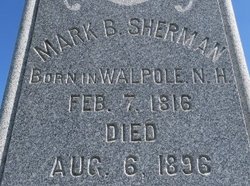
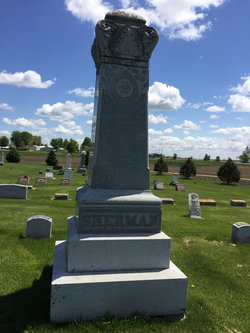
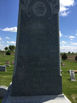
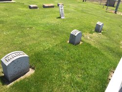
Mark Bachelor Sherman
| Birth | : | 7 Feb 1816 Walpole, Cheshire County, New Hampshire, USA |
| Death | : | 6 Aug 1896 Farmersburg, Clayton County, Iowa, USA |
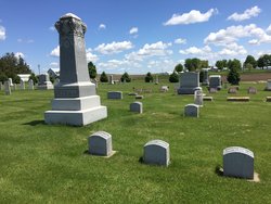
| Burial | : | National Cemetery, National, Clayton County, USA |
| Coordinate | : | 42.9536018, -91.2902985 |
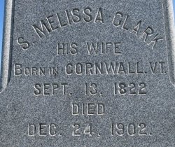
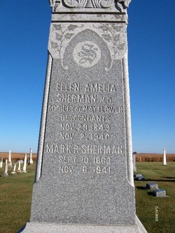
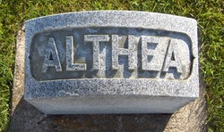
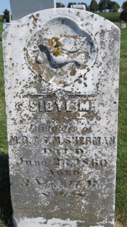
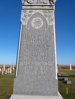
| Description | : | Mark married Sibyl Melisa Clark of Cornwall,VT.on 26 May 1842 in Westport,Essex Co.,NY.They are parents of six children,Emma born in WI. and the rest in IA. Emma Maria Sherman-22 Mar 1844-9 Aug 1881 Julia Adelaide Sherman-6 May 1847 Ellen Amelia Sherman-29 Nov 1849 Althea Rosina Sherman-10 Oct 1853 Sibyl Melissa Sherman-28 Jul 1856 Mark Roger Sherman-10 Sep 1863 Mark is the son of Elijah Sherman and Sally Bachelor.He was a shoemaker and farmer.He came to Iowa in 1845 and settled in Clayton Co in the town of National(Later called Farmersburg). |
frequently asked questions (FAQ):
-
Where is Mark Bachelor Sherman's memorial?
Mark Bachelor Sherman's memorial is located at: National Cemetery, National, Clayton County, USA.
-
When did Mark Bachelor Sherman death?
Mark Bachelor Sherman death on 6 Aug 1896 in Farmersburg, Clayton County, Iowa, USA
-
Where are the coordinates of the Mark Bachelor Sherman's memorial?
Latitude: 42.9536018
Longitude: -91.2902985
Family Members:
Parent
Spouse
Siblings
Children
Flowers:
Nearby Cemetories:
1. National Cemetery
National, Clayton County, USA
Coordinate: 42.9536018, -91.2902985
2. Giard Cemetery
Farmersburg, Clayton County, USA
Coordinate: 42.9933014, -91.3080978
3. Bismark Cemetery
Farmersburg, Clayton County, USA
Coordinate: 42.9790000, -91.3500000
4. Farmersburg-Wagner Cemetery
Farmersburg, Clayton County, USA
Coordinate: 42.9481010, -91.3700027
5. Eastman Cemetery
McGregor, Clayton County, USA
Coordinate: 43.0010000, -91.2190000
6. Clayton Center Cemetery
Clayton Center, Clayton County, USA
Coordinate: 42.8841705, -91.3225021
7. Zion Lutheran Cemetery
Clayton Center, Clayton County, USA
Coordinate: 42.8841705, -91.3249969
8. County Home Cemetery
Clayton Center, Clayton County, USA
Coordinate: 42.8916702, -91.3499985
9. Railroad Employee Cemetery
Giard, Clayton County, USA
Coordinate: 43.0305395, -91.3140229
10. Norwegian Church Cemetery
McGregor, Clayton County, USA
Coordinate: 42.9644400, -91.1764100
11. First Evangelical Lutheran Church Cemetery
McGregor, Clayton County, USA
Coordinate: 42.9718000, -91.1760000
12. Colony Catholic Cemetery (Defunct)
Read Township, Clayton County, USA
Coordinate: 42.8830000, -91.3580000
13. Moody Cemetery
McGregor, Clayton County, USA
Coordinate: 43.0030594, -91.1886063
14. Buell Park Cemetery
Mendon Township, Clayton County, USA
Coordinate: 43.0168226, -91.1999590
15. Garnavillo Community Cemetery
Garnavillo, Clayton County, USA
Coordinate: 42.8656000, -91.2422100
16. Garnavillo Cemetery
Garnavillo, Clayton County, USA
Coordinate: 42.8660300, -91.2390100
17. Saint Joseph Cemetery
Garnavillo, Clayton County, USA
Coordinate: 42.8628006, -91.2502975
18. Walton Cemetery
McGregor, Clayton County, USA
Coordinate: 43.0216270, -91.1909350
19. Gooding Cemetery
Wagner Township, Clayton County, USA
Coordinate: 42.9869490, -91.4191570
20. Pleasant Grove Cemetery
McGregor, Clayton County, USA
Coordinate: 43.0266991, -91.1949997
21. Saint Marys Catholic Church Cemetery
McGregor, Clayton County, USA
Coordinate: 43.0213735, -91.1834632
22. Norway Lutheran Church Cemetery
Saint Olaf, Clayton County, USA
Coordinate: 42.9352798, -91.4302826
23. Clayton Cemetery
Clayton, Clayton County, USA
Coordinate: 42.9043999, -91.1641998
24. Saint Wenceslaus Cemetery
McGregor, Clayton County, USA
Coordinate: 43.0593987, -91.3142014

