
| Birth | : | Jun 1861 Cooper County, Missouri, USA |
| Death | : | 1900 Sedalia, Pettis County, Missouri, USA |
| Burial | : | Laurel Oak Cemetery, Windsor, Henry County, USA |
| Coordinate | : | 38.5224991, -93.5203018 |
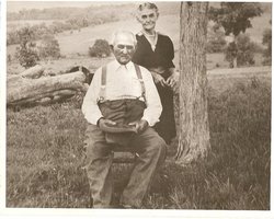
| Description | : | d/o Benjamin Trout & Martha Ann Neale married, William Allen Dillard 1862 MO-1948 CA 1880 in Missouri children: Chester T, June 1883 MO Allie H, March 1886 MO-1910 MO Mary L, October 1889 MO William A, September 1893 MO Bertha Mable, March 1895 MO She died after the 1900 Pettis Co MO census after her death, her widower married Arabella Raybourn/Rabourn, in 1900/01 lived in Pettis Co MO until after 1920, then moved to Santa Cruz CA |
frequently asked questions (FAQ):
-
Where is Martha E Trout Dillard's memorial?
Martha E Trout Dillard's memorial is located at: Laurel Oak Cemetery, Windsor, Henry County, USA.
-
When did Martha E Trout Dillard death?
Martha E Trout Dillard death on 1900 in Sedalia, Pettis County, Missouri, USA
-
Where are the coordinates of the Martha E Trout Dillard's memorial?
Latitude: 38.5224991
Longitude: -93.5203018
Family Members:
Parent

Siblings
Children
Flowers:


Nearby Cemetories:
1. Laurel Oak Cemetery
Windsor, Henry County, USA
Coordinate: 38.5224991, -93.5203018
2. Bell Cemetery
Pettis County, USA
Coordinate: 38.5130997, -93.5038986
3. Woodard Cemetery
Johnson County, USA
Coordinate: 38.5581017, -93.5302963
4. Chipman Cemetery
Henry County, USA
Coordinate: 38.5247002, -93.6010971
5. McMillian Cemetery
Santiago, Benton County, USA
Coordinate: 38.4504800, -93.5072780
6. Askins Cemetery
Calhoun, Henry County, USA
Coordinate: 38.5074997, -93.6177979
7. Goodwin Cemetery
Johnson County, USA
Coordinate: 38.6063995, -93.5310974
8. Harmony Baptist Church Cemetery
Benton County, USA
Coordinate: 38.4460600, -93.4643000
9. Cooper Cemetery
Johnson County, USA
Coordinate: 38.6006012, -93.5725021
10. Robinson Cemetery
Leesville, Henry County, USA
Coordinate: 38.4566130, -93.5982370
11. Salem Cemetery
Henry County, USA
Coordinate: 38.5257988, -93.6371994
12. McIntire Chapel Cemetery
Windsor Junction, Benton County, USA
Coordinate: 38.4303017, -93.4760971
13. High Point Baptist Church Cemetery
Leeton, Johnson County, USA
Coordinate: 38.6028450, -93.6017700
14. Goff Cemetery
Deer Creek Township, Henry County, USA
Coordinate: 38.4537230, -93.6237720
15. Prairie Chapel Methodist Cemetery
Pettis County, USA
Coordinate: 38.5228004, -93.3818970
16. Mount Olivet Cemetery
Roseland, Henry County, USA
Coordinate: 38.4122400, -93.5474300
17. Sardis North Cemetery
Windsor, Henry County, USA
Coordinate: 38.5387670, -93.6650130
18. Sardis Cemetery
Henry County, USA
Coordinate: 38.5374985, -93.6652985
19. Clover Dale-Yancy Cemetery
Benton County, USA
Coordinate: 38.4392014, -93.4191971
20. Avery Cemetery
Henry County, USA
Coordinate: 38.5205994, -93.6678009
21. Lewis Cemetery
Tebo Township, Henry County, USA
Coordinate: 38.5210991, -93.6757965
22. Flat Creek Methodist Cemetery
Pettis County, USA
Coordinate: 38.5236015, -93.3638992
23. George Grave Yard
Calhoun, Henry County, USA
Coordinate: 38.4070160, -93.5829940
24. Green Ridge Cemetery
Green Ridge, Pettis County, USA
Coordinate: 38.6207100, -93.4151500