
| Birth | : | 1 Sep 1868 Indiana, USA |
| Death | : | 1 Jan 1916 Missouri, USA |
| Burial | : | Woodlawn Cemetery, Independence, Jackson County, USA |
| Coordinate | : | 39.0856018, -94.4107971 |
| Plot | : | Sec. #2; North of Pettis St. to first access lane |
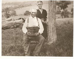
| Description | : | Wife of Benjamin Castro WOLKEY (1860-1942) |
frequently asked questions (FAQ):
-
Where is Celise A. “Lissie” Trout Wolkey's memorial?
Celise A. “Lissie” Trout Wolkey's memorial is located at: Woodlawn Cemetery, Independence, Jackson County, USA.
-
When did Celise A. “Lissie” Trout Wolkey death?
Celise A. “Lissie” Trout Wolkey death on 1 Jan 1916 in Missouri, USA
-
Where are the coordinates of the Celise A. “Lissie” Trout Wolkey's memorial?
Latitude: 39.0856018
Longitude: -94.4107971
Family Members:
Parent

Spouse
Siblings
Children
Flowers:


Nearby Cemetories:
1. Woodlawn Cemetery
Independence, Jackson County, USA
Coordinate: 39.0856018, -94.4107971
2. Trinity Episcopal Church Columbarium
Independence, Jackson County, USA
Coordinate: 39.0952300, -94.4166400
3. Harry S. Truman Library and Museum
Independence, Jackson County, USA
Coordinate: 39.1035200, -94.4213900
4. Hedrick Cemetery
Independence, Jackson County, USA
Coordinate: 39.1072006, -94.3914032
5. Mound Grove Cemetery
Independence, Jackson County, USA
Coordinate: 39.1128006, -94.4281006
6. Hill Park Cemetery
Independence, Jackson County, USA
Coordinate: 39.0835991, -94.4539032
7. Tucker Cemetery
Independence, Jackson County, USA
Coordinate: 39.1224300, -94.4021600
8. Luttrell Cemetery
Independence, Jackson County, USA
Coordinate: 39.0504700, -94.3839300
9. Oak Ridge Memory Gardens
Independence, Jackson County, USA
Coordinate: 39.1046982, -94.3638992
10. Staples Family Cemetery
East Independence, Jackson County, USA
Coordinate: 39.1201400, -94.3797800
11. Saint Michael's Memorial Garden
Independence, Jackson County, USA
Coordinate: 39.0468200, -94.3877300
12. Long Cemetery
Independence, Jackson County, USA
Coordinate: 39.1284700, -94.4097700
13. Reed Cemetery
Independence, Jackson County, USA
Coordinate: 39.1097400, -94.4593900
14. Blue Ridge Lawn Memorial Gardens
Kansas City, Jackson County, USA
Coordinate: 39.0760002, -94.4717026
15. Campground Cemetery
Raytown, Jackson County, USA
Coordinate: 39.0380000, -94.4295700
16. Highland Cemetery
Kansas City, Jackson County, USA
Coordinate: 39.0853004, -94.4760971
17. Pitcher Cemetery
Independence, Jackson County, USA
Coordinate: 39.0635986, -94.4702988
18. Kehilath Israel Blue Ridge Cemetery
Independence, Jackson County, USA
Coordinate: 39.0875015, -94.4766998
19. Mount Washington Cemetery
Independence, Jackson County, USA
Coordinate: 39.0957985, -94.4757996
20. Lincoln Cemetery
Kansas City, Jackson County, USA
Coordinate: 39.0946999, -94.4805984
21. Smiley Cemetery
Sugar Creek, Jackson County, USA
Coordinate: 39.1411000, -94.3941900
22. Noland Cemetery
Kansas City, Jackson County, USA
Coordinate: 39.0265700, -94.4005700
23. House & McMonigle Cemetery
Independence, Jackson County, USA
Coordinate: 39.0250300, -94.4152710
24. Webb Cemetery
Independence, Jackson County, USA
Coordinate: 39.1138600, -94.3403200