
| Birth | : | 20 Jan 1844 Mexico, Audrain County, Missouri, USA |
| Death | : | 27 May 1936 Fort Benton, Chouteau County, Montana, USA |
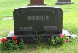
| Burial | : | Riverside Cemetery, Fort Benton, Chouteau County, USA |
| Coordinate | : | 47.8402330, -110.6408830 |
| Plot | : | E0097 |
| Description | : | Marker shows dates as Jan 20, 1843 to May 28, 1936 Cemetery records show Jan 20, 1844 to May 27, 1936 MT death certificate says Jan 20, 1844 to May 27, 1936 1900 Federal Census shows birth as Jan 1845 .......... The following provided by Find A Grave contributor "Cara": The River Press, Fort Benton, Mont., 3 June 1936 Pioneer Resident Answers Final Call. Mrs. Jesse Bright Passed Away Last Wednesday Morning Residents of Fort Benton and Chouteau County were grieved to learn of the passing away of Mrs. Jesse Bright, pioneer Chouteau county resident, at the St.... Read More |
frequently asked questions (FAQ):
-
Where is Mary A Eller Bright's memorial?
Mary A Eller Bright's memorial is located at: Riverside Cemetery, Fort Benton, Chouteau County, USA.
-
When did Mary A Eller Bright death?
Mary A Eller Bright death on 27 May 1936 in Fort Benton, Chouteau County, Montana, USA
-
Where are the coordinates of the Mary A Eller Bright's memorial?
Latitude: 47.8402330
Longitude: -110.6408830
Family Members:
Spouse

Children
Flowers:


Nearby Cemetories:
1. Riverside Cemetery
Fort Benton, Chouteau County, USA
Coordinate: 47.8402330, -110.6408830
2. Old Shep Gravesite
Fort Benton, Chouteau County, USA
Coordinate: 47.8369000, -110.6557000
3. Museum of the Upper Missouri
Fort Benton, Chouteau County, USA
Coordinate: 47.8207000, -110.6642000
4. Montague Cemetery
Chouteau County, USA
Coordinate: 47.6783000, -110.4670000
5. Carter Cemetery
Carter, Chouteau County, USA
Coordinate: 47.7852000, -110.9616000
6. Clear Lake Cemetery
Chouteau County, USA
Coordinate: 47.7731018, -110.2514038
7. Upper Shonkin Cemetery
Chouteau County, USA
Coordinate: 47.5220000, -110.5770000
8. Upper Highwood Cemetery
Chouteau County, USA
Coordinate: 47.5092010, -110.6881027
9. Twin Hills Colony Cemetery
Chouteau County, USA
Coordinate: 48.0142000, -111.0720000
10. Keaster Cemetery
Chouteau County, USA
Coordinate: 47.5093500, -110.7410000
11. Geraldine Cemetery
Geraldine, Chouteau County, USA
Coordinate: 47.5965500, -110.2578000
12. Sample Flat Cemetery
Chouteau County, USA
Coordinate: 48.0175018, -111.1224976
13. Graceville Cemetery
Chouteau County, USA
Coordinate: 47.7505989, -110.0875015
14. Wolf Cemetery
Liberty County, USA
Coordinate: 48.1617620, -110.9984420
15. Kenilworth Cemetery
Chouteau County, USA
Coordinate: 48.2192001, -110.4188995
16. Riverview Colony Cemetery
Riverview Colony, Liberty County, USA
Coordinate: 48.1762000, -111.0315000
17. Big Willow Cemetery
Belt, Cascade County, USA
Coordinate: 47.4164009, -110.7444000
18. McLeish Cemetery
Judith Basin County, USA
Coordinate: 47.3596992, -110.5772018
19. Big Sandy Cemetery
Big Sandy, Chouteau County, USA
Coordinate: 48.1801170, -110.1207500
20. Square Butte Bench Cemetery
Chouteau County, USA
Coordinate: 47.5539017, -110.0447006
21. Memory Gardens Pet Cemetery
Great Falls, Cascade County, USA
Coordinate: 47.4642000, -111.1287000
22. Pleasant View Cemetery
Belt, Cascade County, USA
Coordinate: 47.3722000, -110.9088974
23. Knees Church Cemetery
Fort Benton, Chouteau County, USA
Coordinate: 47.9875000, -111.3621000
24. Erickson Cemetery
Liberty County, USA
Coordinate: 48.3143997, -110.9503021