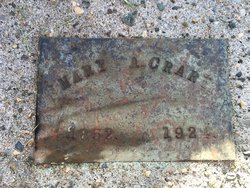
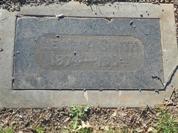
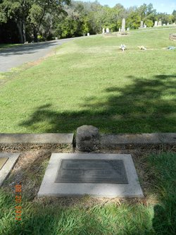
Mary Adeline Young Crary
| Birth | : | 7 Sep 1852 Placerville, El Dorado County, California, USA |
| Death | : | 27 Dec 1924 Stockton, San Joaquin County, California, USA |
| Burial | : | Adams Cemetery, Bronson, Branch County, USA |
| Coordinate | : | 41.8405991, -85.2767029 |
| Plot | : | Around 156 |
| Description | : | Born in Hang Town, Ca. This was a mining town. Not in the data banks on Find A Grave. Note from Robin: Hangtown is the former name of Placerville. |
frequently asked questions (FAQ):
-
Where is Mary Adeline Young Crary's memorial?
Mary Adeline Young Crary's memorial is located at: Adams Cemetery, Bronson, Branch County, USA.
-
When did Mary Adeline Young Crary death?
Mary Adeline Young Crary death on 27 Dec 1924 in Stockton, San Joaquin County, California, USA
-
Where are the coordinates of the Mary Adeline Young Crary's memorial?
Latitude: 41.8405991
Longitude: -85.2767029
Family Members:
Parent
Spouse
Children
Nearby Cemetories:
1. Adams Cemetery
Bronson, Branch County, USA
Coordinate: 41.8405991, -85.2767029
2. Dutch Settlement Cemetery
Bronson, Branch County, USA
Coordinate: 41.8106003, -85.2632980
3. Burr Oak Township Cemetery
Burr Oak, St. Joseph County, USA
Coordinate: 41.8472214, -85.3319473
4. Sanborn Cemetery
Burr Oak, St. Joseph County, USA
Coordinate: 41.8708000, -85.3305969
5. Eroh Cemetery
Fawn River Township, St. Joseph County, USA
Coordinate: 41.8081017, -85.3375015
6. Freedom Cemetery
Fawn River, St. Joseph County, USA
Coordinate: 41.8064003, -85.3371964
7. Bartholomew Cemetery
Fawn River Township, St. Joseph County, USA
Coordinate: 41.8059600, -85.3476300
8. Saint Marys Cemetery
Bronson, Branch County, USA
Coordinate: 41.8582993, -85.1939011
9. Pleasant Hill Cemetery
Noble Township, Branch County, USA
Coordinate: 41.7961110, -85.2111110
10. Trayer Cemetery
Bronson, Branch County, USA
Coordinate: 41.7705550, -85.2677770
11. Curtis Cemetery
Bronson, Branch County, USA
Coordinate: 41.8039017, -85.1956024
12. Bronson Cemetery
Bronson, Branch County, USA
Coordinate: 41.8699340, -85.1858320
13. Fawn River Township Cemetery
Fawn River, St. Joseph County, USA
Coordinate: 41.7819440, -85.3475040
14. South Colon Cemetery
Colon, St. Joseph County, USA
Coordinate: 41.9199982, -85.3114014
15. Tobey Cemetery
Sturgis, St. Joseph County, USA
Coordinate: 41.8375015, -85.3893967
16. Locust Grove Cemetery
Findley, St. Joseph County, USA
Coordinate: 41.8972206, -85.3799973
17. North Gilead Cemetery
Gilead Township, Branch County, USA
Coordinate: 41.8039017, -85.1557999
18. United Methodist Church Cemetery
Howe, LaGrange County, USA
Coordinate: 41.7509918, -85.3379364
19. Snow Prairie Cemetery
Bethel, Branch County, USA
Coordinate: 41.8699989, -85.1408005
20. Bontrager Family Cemetery
Howe, LaGrange County, USA
Coordinate: 41.7503204, -85.3552322
21. First Presbyterian Church Columbarium
Sturgis, St. Joseph County, USA
Coordinate: 41.7875150, -85.4078600
22. Calvary Chapel Cemetery
Sturgis, St. Joseph County, USA
Coordinate: 41.8257350, -85.4253000
23. South Gilead Cemetery
Bronson, Branch County, USA
Coordinate: 41.7733330, -85.1566670
24. Eagle Cemetery
LaGrange County, USA
Coordinate: 41.7313200, -85.3162200

