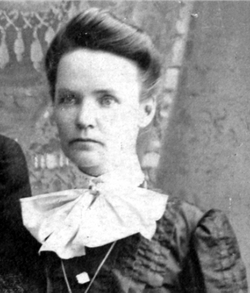
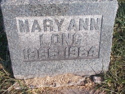
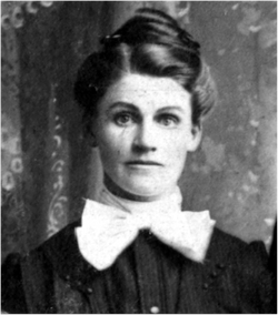
Mary Ann Schwada Long
| Birth | : | 15 Sep 1866 Clarence, Shelby County, Missouri, USA |
| Death | : | 3 Aug 1964 Clarence, Shelby County, Missouri, USA |
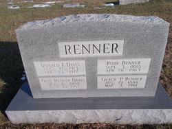
| Burial | : | Maplewood Cemetery, Clarence, Shelby County, USA |
| Coordinate | : | 39.7508011, -92.2572021 |
| Plot | : | AOUW Block 3 Row 5 Lot 38n |
frequently asked questions (FAQ):
-
Where is Mary Ann Schwada Long's memorial?
Mary Ann Schwada Long's memorial is located at: Maplewood Cemetery, Clarence, Shelby County, USA.
-
When did Mary Ann Schwada Long death?
Mary Ann Schwada Long death on 3 Aug 1964 in Clarence, Shelby County, Missouri, USA
-
Where are the coordinates of the Mary Ann Schwada Long's memorial?
Latitude: 39.7508011
Longitude: -92.2572021
Family Members:
Parent
Spouse
Siblings
Children
Flowers:
Nearby Cemetories:
1. Maplewood Cemetery
Clarence, Shelby County, USA
Coordinate: 39.7508011, -92.2572021
2. Clarence City Cemetery
Clarence, Shelby County, USA
Coordinate: 39.7493750, -92.2624800
3. Saint Patricks Cemetery
Clarence, Shelby County, USA
Coordinate: 39.7352982, -92.2714005
4. Hopper Cemetery
Shelby County, USA
Coordinate: 39.8083000, -92.2683029
5. Amish Cemetery
Macon County, USA
Coordinate: 39.7858009, -92.3208008
6. Hawkins Cemetery
Shelby County, USA
Coordinate: 39.8111000, -92.2874985
7. Bethel Christian Church Cemetery
Anabel, Macon County, USA
Coordinate: 39.8018200, -92.3252200
8. Patton Cemetery
Hagers Grove, Shelby County, USA
Coordinate: 39.8155700, -92.2022800
9. Ebenezer Cemetery
Hagers Grove, Shelby County, USA
Coordinate: 39.8302994, -92.2652969
10. Walker Cemetery
Macon County, USA
Coordinate: 39.6823640, -92.3117360
11. Winn Family Cemetery
Macon County, USA
Coordinate: 39.7589684, -92.3646774
12. Hagers Grove Cemetery
Hagers Grove, Shelby County, USA
Coordinate: 39.8305000, -92.2236000
13. Ewing Cemetery
Macon County, USA
Coordinate: 39.7616997, -92.3688965
14. Union Grove Cemetery
Clarence, Shelby County, USA
Coordinate: 39.6630360, -92.2602920
15. Ten Mile Baptist Church Cemetery
Ten Mile, Macon County, USA
Coordinate: 39.8082120, -92.3440980
16. Bethlehem Cemetery
Macon, Macon County, USA
Coordinate: 39.7070007, -92.3570023
17. Brown Cemetery
Macon County, USA
Coordinate: 39.7499140, -92.3723280
18. Sage Cemetery
Macon County, USA
Coordinate: 39.6738570, -92.3175640
19. Graves Chapel Cemetery
Anabel, Macon County, USA
Coordinate: 39.6815900, -92.3337200
20. Bacon Chapel Cemetery
Shelbyville, Shelby County, USA
Coordinate: 39.7511487, -92.1368436
21. Morris Cemetery
Shelby County, USA
Coordinate: 39.8227997, -92.1808014
22. Mount Hope Cemetery
Shelby County, USA
Coordinate: 39.7930984, -92.1442032
23. Harris Graveyard
Woodville, Macon County, USA
Coordinate: 39.6863850, -92.3543810
24. Mitts Cemetery
Macon County, USA
Coordinate: 39.8466988, -92.2913971

