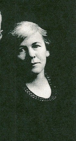
| Birth | : | 18 Aug 1868 Steuben County, Indiana, USA |
| Death | : | 8 Nov 1957 Steuben County, Indiana, USA |
| Burial | : | Clinton Memorial Cemetery, Lancaster, Lancaster County, USA |
| Coordinate | : | 34.7268982, -80.7671967 |
| Description | : | 1st husband -David Freed 2nd -? Scoville |
frequently asked questions (FAQ):
-
Where is Mary C Clink Scoville's memorial?
Mary C Clink Scoville's memorial is located at: Clinton Memorial Cemetery, Lancaster, Lancaster County, USA.
-
When did Mary C Clink Scoville death?
Mary C Clink Scoville death on 8 Nov 1957 in Steuben County, Indiana, USA
-
Where are the coordinates of the Mary C Clink Scoville's memorial?
Latitude: 34.7268982
Longitude: -80.7671967
Family Members:
Parent
Spouse
Siblings
Children
Flowers:
Nearby Cemetories:
1. Clinton Memorial Cemetery
Lancaster, Lancaster County, USA
Coordinate: 34.7268982, -80.7671967
2. Saint Paul Methodist Cemetery
Lancaster, Lancaster County, USA
Coordinate: 34.7231800, -80.7654770
3. First Presbyterian Church of Lancaster Columbarium
Lancaster, Lancaster County, USA
Coordinate: 34.7278800, -80.7756800
4. Witherspoon Cemetery
Lancaster, Lancaster County, USA
Coordinate: 34.7229170, -80.7768560
5. West Side Cemetery
Lancaster, Lancaster County, USA
Coordinate: 34.7216988, -80.7774963
6. Olde Presbyterian Church Cemetery
Lancaster, Lancaster County, USA
Coordinate: 34.7168999, -80.7735977
7. Christ Episcopal Church Cemetery
Lancaster, Lancaster County, USA
Coordinate: 34.7245950, -80.7988530
8. Lancaster Memorial Park
Lancaster, Lancaster County, USA
Coordinate: 34.7016983, -80.7944031
9. County Home Cemetery
Lancaster, Lancaster County, USA
Coordinate: 34.7232400, -80.7258500
10. Mahaffey Hill Baptist Church
Lancaster County, USA
Coordinate: 34.7108510, -80.8066430
11. Centenniel A.M.E. Zion Church Cemetery
Lancaster, Lancaster County, USA
Coordinate: 34.7082970, -80.7257430
12. Fellowship Bible Church
Lancaster, Lancaster County, USA
Coordinate: 34.6914920, -80.7422720
13. Saint John Baptist Church Cemetery
Lancaster, Lancaster County, USA
Coordinate: 34.7655400, -80.7978600
14. Taylors Grove Baptist Church
Lancaster, Lancaster County, USA
Coordinate: 34.7714340, -80.7880710
15. Deliverance Church of God in Jesus Christ
Lancaster County, USA
Coordinate: 34.7754480, -80.7677200
16. Shiloh ARP Church Cemetery
Lancaster, Lancaster County, USA
Coordinate: 34.7745080, -80.7818700
17. Mount Tabor AME Zion Church Cemetery
Lancaster County, USA
Coordinate: 34.7772250, -80.7721730
18. Gills Creek Cemetery
Lancaster County, USA
Coordinate: 34.7300000, -80.7047000
19. Zion United Methodist Church Cemetery
Lancaster, Lancaster County, USA
Coordinate: 34.7734060, -80.7377770
20. Mount Nebo Baptist Church Cemetery
Grace, Lancaster County, USA
Coordinate: 34.7170460, -80.8385550
21. Pleasant Dale Baptist Church Cemetery
Pleasant Dale, Lancaster County, USA
Coordinate: 34.7319740, -80.6920230
22. Shaver Family Cemetery
Elgin, Lancaster County, USA
Coordinate: 34.6794680, -80.7173810
23. Saint Luke UMC Cemetery
Lancaster, Lancaster County, USA
Coordinate: 34.6728310, -80.7204780
24. Red Hill Baptist Church Cemetery
Lancaster County, USA
Coordinate: 34.6727330, -80.8162540


