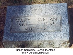
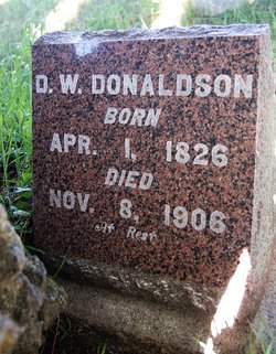
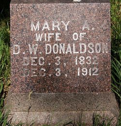
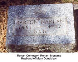
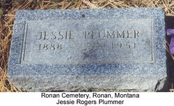
Mary Donaldson Harlan
| Birth | : | 23 Jan 1861 Mower County, Minnesota, USA |
| Death | : | 9 Oct 1939 Ronan, Lake County, Montana, USA |
| Burial | : | Archer Street Cemetery, Masterton, Masterton District, New Zealand |
| Coordinate | : | -40.9538900, 175.6683800 |
| Description | : | Mrs. Mary Harlan passed away Tuesday morning at 2:30 o'clock at her home after an illness that has kept her confined to her bed since the first of the year. She has been cared for by her daughter, Mrs. Jessie Plummer, who has been with her mother since the death of Mr. Harlan, three years ago. Mrs. Harlan was born at Spring Valley, Minnesota, on January 23, 1861. She was married to A.H. Rogers on November 11, 1883. On April 12, 1904 she married Judge B.A. Harlan at Red Lodge, Montana. In 1925 the Harlans came to Ronan and since that time... Read More |
frequently asked questions (FAQ):
-
Where is Mary Donaldson Harlan's memorial?
Mary Donaldson Harlan's memorial is located at: Archer Street Cemetery, Masterton, Masterton District, New Zealand.
-
When did Mary Donaldson Harlan death?
Mary Donaldson Harlan death on 9 Oct 1939 in Ronan, Lake County, Montana, USA
-
Where are the coordinates of the Mary Donaldson Harlan's memorial?
Latitude: -40.9538900
Longitude: 175.6683800
Family Members:
Parent
Spouse
Siblings
Children
Flowers:
Nearby Cemetories:
1. Archer Street Cemetery
Masterton, Masterton District, New Zealand
Coordinate: -40.9538900, 175.6683800
2. Masterton War Memorial
Masterton, Masterton District, New Zealand
Coordinate: -40.9501290, 175.6648800
3. Riverside Cemetery
Masterton, Masterton District, New Zealand
Coordinate: -40.9621550, 175.6722690
4. Ahi pane pane Urupā
Masterton, Masterton District, New Zealand
Coordinate: -40.9524060, 175.6902370
5. Te Ahitainga Urupā
Masterton, Masterton District, New Zealand
Coordinate: -40.9393000, 175.7030750
6. Akura Urupā
Masterton, Masterton District, New Zealand
Coordinate: -40.9314120, 175.6349090
7. Hamuera Urupā
Masterton District, New Zealand
Coordinate: -41.0374980, 175.6611940
8. Clareville Cemetery
Clareville, Carterton District, New Zealand
Coordinate: -40.9981070, 175.5459540
9. Waipoapoa Urupa
Hastings, Hastings District, New Zealand
Coordinate: -41.0696050, 175.6604650
10. Waipopo Urupā
Masterton, Masterton District, New Zealand
Coordinate: -41.0696370, 175.6604430
11. Oates Family Cemetery
Carterton, Carterton District, New Zealand
Coordinate: -41.0453670, 175.5683580
12. Scandinavian Camp Cemetery
Kopuaranga, Masterton District, New Zealand
Coordinate: -40.8345650, 175.6643220
13. Hurunui-o-rangi
Masterton, Masterton District, New Zealand
Coordinate: -41.0709670, 175.6200720
14. Gladstone Church Cemetery
Gladstone, Carterton District, New Zealand
Coordinate: -41.0883600, 175.6432100
15. Te Uru o Tane Urupā
Greytown, South Wairarapa District, New Zealand
Coordinate: -41.0570790, 175.4947740
16. Church of St Francis of Assisi
Bideford, Masterton District, New Zealand
Coordinate: -40.8592400, 175.8714600
17. Mauriceville West Cemetery
Mauriceville West, Masterton District, New Zealand
Coordinate: -40.7670300, 175.6799680
18. Saint Francis Lutheran Churchyard
Mauriceville West, Masterton District, New Zealand
Coordinate: -40.7652900, 175.6834400
19. Papawai Urupā
Greytown, South Wairarapa District, New Zealand
Coordinate: -41.0985090, 175.4892270
20. Greytown Cemetery
Greytown, South Wairarapa District, New Zealand
Coordinate: -41.0920470, 175.4401160
21. Hastwell Cemetery
Eketahuna, Tararua District, New Zealand
Coordinate: -40.7191500, 175.7216100
22. David Leary Memorial
Eketahuna, Tararua District, New Zealand
Coordinate: -40.7079188, 175.5836626
23. Eketahuna Lawn Cemetery
Eketahuna, Tararua District, New Zealand
Coordinate: -40.6538700, 175.6883400
24. Martinborough Cemetery
Martinborough, South Wairarapa District, New Zealand
Coordinate: -41.2158720, 175.4722330

