
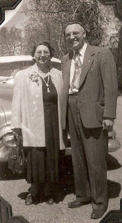
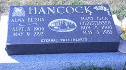
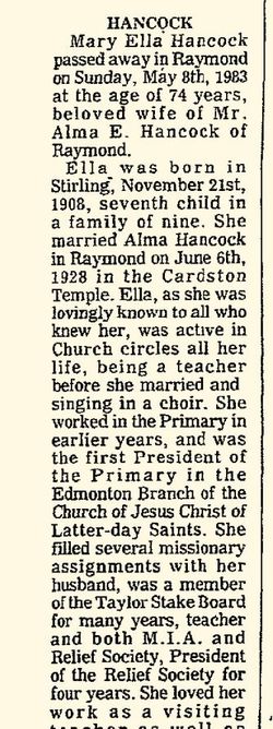
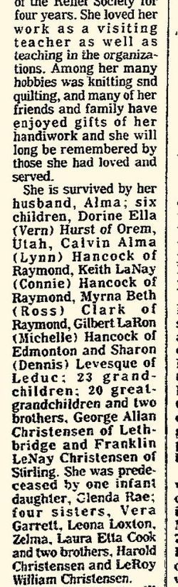
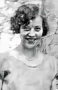
Mary Ella Christensen Hancock
| Birth | : | 21 Nov 1908 Stirling, Lethbridge Census Division, Alberta, Canada |
| Death | : | 8 May 1983 Raymond, Lethbridge Census Division, Alberta, Canada |
| Burial | : | Roxburgh Cemetery, Roxburgh, Central Otago District, New Zealand |
| Coordinate | : | -45.5267800, 169.3107700 |
frequently asked questions (FAQ):
-
Where is Mary Ella Christensen Hancock's memorial?
Mary Ella Christensen Hancock's memorial is located at: Roxburgh Cemetery, Roxburgh, Central Otago District, New Zealand.
-
When did Mary Ella Christensen Hancock death?
Mary Ella Christensen Hancock death on 8 May 1983 in Raymond, Lethbridge Census Division, Alberta, Canada
-
Where are the coordinates of the Mary Ella Christensen Hancock's memorial?
Latitude: -45.5267800
Longitude: 169.3107700
Family Members:
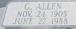
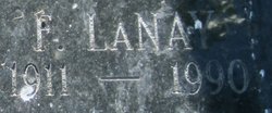
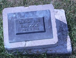
Parent


Spouse

Siblings

Children


Nearby Cemetories:
1. Roxburgh Cemetery
Roxburgh, Central Otago District, New Zealand
Coordinate: -45.5267800, 169.3107700
2. Ettrick Cemetery
Millers Flat, Central Otago District, New Zealand
Coordinate: -45.6318900, 169.3645500
3. Potters
Roxburgh, Central Otago District, New Zealand
Coordinate: -45.4702550, 169.1115970
4. Gorge Creek Miners' Monument
Roxburgh, Central Otago District, New Zealand
Coordinate: -45.3759790, 169.2764350
5. Millers Flat Cemetery
Millers Flat, Central Otago District, New Zealand
Coordinate: -45.6648030, 169.4147400
6. Horseshoe Bend Cemetery
Millers Flat, Central Otago District, New Zealand
Coordinate: -45.7251920, 169.4801120
7. Manuherikia Junction Cemetery
Alexandra, Central Otago District, New Zealand
Coordinate: -45.2614850, 169.3977150
8. Alexandra Cemetery
Alexandra, Central Otago District, New Zealand
Coordinate: -45.2397700, 169.3935560
9. Crookston Cemetery
Heriot, Clutha District, New Zealand
Coordinate: -45.8375170, 169.3251600
10. Clyde Cemetery
Clyde, Central Otago District, New Zealand
Coordinate: -45.1941880, 169.3398930
11. Beaumont Cemetery
Beaumont, Clutha District, New Zealand
Coordinate: -45.8255720, 169.5268560
12. St. Michael & All Angels Church Cemetery
Clyde, Central Otago District, New Zealand
Coordinate: -45.1887000, 169.3172167
13. Waikaia Cemetery
Waikaia, Southland District, New Zealand
Coordinate: -45.7169300, 168.8490600
14. Nevis Cemetery
Central Otago District, New Zealand
Coordinate: -45.2240700, 168.9529050
15. Moa Creek Cemetery
Moa Creek, Central Otago District, New Zealand
Coordinate: -45.2102100, 169.6869300
16. Tapanui Cemetery
Tapanui, Clutha District, New Zealand
Coordinate: -45.9425830, 169.2832320
17. Garston Cemetery
Garston, Southland District, New Zealand
Coordinate: -45.4694520, 168.6840050
18. Kingston Cemetery
Kingston, Queenstown-Lakes District, New Zealand
Coordinate: -45.3376030, 168.7252250
19. Waikaka Cemetery
Waikaka, Gore District, New Zealand
Coordinate: -45.9312400, 169.0188900
20. Nokomai Southern Cemetery
Gore District, New Zealand
Coordinate: -45.5533090, 168.6607170
21. Lawrence Cemetery
Lawrence, Clutha District, New Zealand
Coordinate: -45.9168330, 169.6766480
22. Blacks Cemetery
Omakau, Central Otago District, New Zealand
Coordinate: -45.0895900, 169.6034000
23. Cromwell Cemetery
Cromwell, Central Otago District, New Zealand
Coordinate: -45.0528700, 169.1732500
24. St. Andrew's Anglican Church
Cromwell, Central Otago District, New Zealand
Coordinate: -45.0475370, 169.2098760