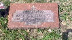
Mary Katherine Dunford Willbourn
| Birth | : | 14 Jun 1872 Hancock Chapel, Harrison County, Indiana, USA |
| Death | : | 21 Aug 1964 Topeka, Shawnee County, Kansas, USA |
| Burial | : | Westwood Cemetery, Woodville, Sandusky County, USA |
| Coordinate | : | 41.4510994, -83.3861008 |
| Plot | : | 472 |
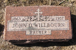
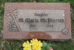
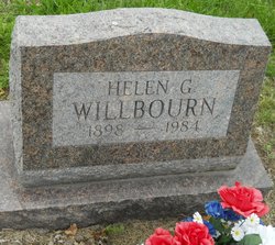
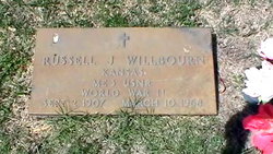
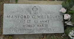
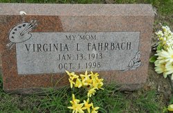
| Description | : | Mother ******************** Topeka Daily Capital, August 22, 1964, page 26: Mary K. Willbourn Mrs. Mary Katherine Willbourne, 92, 2032 Buchanan, died Friday at a local hospital. She was born June 14, 1872, at new Albany, Ind., and had lived in Topeka 78 years. Survivors include two sons, Russell J. Willbourn, Missouri City, Tex. and Manford Willbourn, Oakland, Calif.; four daughters, Mrs. Hazel Stephens, 1339 Clay, Helen Willbourn, at home, Mrs. Virginia Fahrbach, 2440 Harrison, and Mrs. Marie McPherson, St. Joseph, Mo.; five grandchildren and three great-grandchildren. Brennan Funeral Home is in charge of arrangements. |
frequently asked questions (FAQ):
-
Where is Mary Katherine Dunford Willbourn's memorial?
Mary Katherine Dunford Willbourn's memorial is located at: Westwood Cemetery, Woodville, Sandusky County, USA.
-
When did Mary Katherine Dunford Willbourn death?
Mary Katherine Dunford Willbourn death on 21 Aug 1964 in Topeka, Shawnee County, Kansas, USA
-
Where are the coordinates of the Mary Katherine Dunford Willbourn's memorial?
Latitude: 41.4510994
Longitude: -83.3861008
Family Members:
Spouse
Children
Flowers:
Nearby Cemetories:
1. Westwood Cemetery
Woodville, Sandusky County, USA
Coordinate: 41.4510994, -83.3861008
2. Woodville Catholic Cemetery
Woodville, Sandusky County, USA
Coordinate: 41.4621540, -83.3614250
3. Woodville Cemetery
Woodville, Sandusky County, USA
Coordinate: 41.4641991, -83.3625031
4. Salem Church Cemetery
Luckey, Wood County, USA
Coordinate: 41.4438300, -83.4344900
5. Sugar Creek Cemetery
Woodville Township, Sandusky County, USA
Coordinate: 41.4378520, -83.3298720
6. Troy Township Cemetery
Luckey, Wood County, USA
Coordinate: 41.4533300, -83.4772000
7. Eisenhour Cemetery
Pemberville, Wood County, USA
Coordinate: 41.3866997, -83.4347000
8. North Union Cemetery
Gibsonburg, Sandusky County, USA
Coordinate: 41.3981018, -83.3135986
9. West Union Cemetery
Gibsonburg, Sandusky County, USA
Coordinate: 41.3842010, -83.3377991
10. Saint Lawrence Cemetery
Gibsonburg, Sandusky County, USA
Coordinate: 41.3964005, -83.3146973
11. Harrington Cemetery
Elmore, Ottawa County, USA
Coordinate: 41.4781990, -83.2903100
12. Clay Township Cemetery
Genoa, Ottawa County, USA
Coordinate: 41.5092010, -83.3186035
13. Rymers Cemetery
Elmore, Ottawa County, USA
Coordinate: 41.4833900, -83.2871690
14. Harris-Elmore Union Cemetery
Elmore, Ottawa County, USA
Coordinate: 41.4738998, -83.2789001
15. Restlawn Memorial Park
Perrysburg, Wood County, USA
Coordinate: 41.5133018, -83.4661026
16. Pemberville Cemetery
Pemberville, Wood County, USA
Coordinate: 41.3958015, -83.4914017
17. Quinshan Cemetery
Gibsonburg, Sandusky County, USA
Coordinate: 41.3539009, -83.3602982
18. Brandeberry Cemetery
Freedom Township, Wood County, USA
Coordinate: 41.3838997, -83.5017014
19. Webster Township Cemetery
Scotch Ridge, Wood County, USA
Coordinate: 41.4075429, -83.5305762
20. Pember Farm Cemetery
Rollersville, Sandusky County, USA
Coordinate: 41.3341904, -83.3812103
21. Hessville Cemetery
Hessville, Sandusky County, USA
Coordinate: 41.3945000, -83.2465900
22. Fish Cemetery
Pemberville, Wood County, USA
Coordinate: 41.3699989, -83.5038986
23. Myers Cemetery
New Rochester, Wood County, USA
Coordinate: 41.3621708, -83.5034170
24. Chestnut Grove Cemetery
Scott Township, Sandusky County, USA
Coordinate: 41.3268590, -83.4171130

