
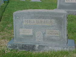
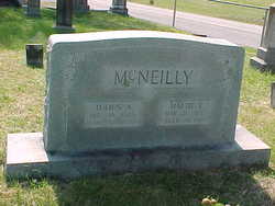
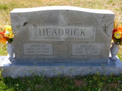
Mary M. Farr Headrick
| Birth | : | 25 Aug 1872 Blount County, Tennessee, USA |
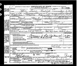
| Death | : | 2 Oct 1943 Walland, Blount County, Tennessee, USA |
| Burial | : | Kuper Memorial Cemetery, Chinook, Blaine County, USA |
| Coordinate | : | 48.6083100, -109.2531200 |
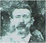
| Description | : | Mary Headrick was the daughter of Granville Farr b. NC and Rebecca Flynn b. Blount; wife of John D. (Devro) Headrick. (see John Devro Headrick for other family information). |
frequently asked questions (FAQ):
-
Where is Mary M. Farr Headrick's memorial?
Mary M. Farr Headrick's memorial is located at: Kuper Memorial Cemetery, Chinook, Blaine County, USA.
-
When did Mary M. Farr Headrick death?
Mary M. Farr Headrick death on 2 Oct 1943 in Walland, Blount County, Tennessee, USA
-
Where are the coordinates of the Mary M. Farr Headrick's memorial?
Latitude: 48.6083100
Longitude: -109.2531200
Family Members:
Parent
Spouse
Siblings
Children
Flowers:


Nearby Cemetories:
1. Kuper Memorial Cemetery
Chinook, Blaine County, USA
Coordinate: 48.6083100, -109.2531200
2. Saint Gabriel Cemetery
Chinook, Blaine County, USA
Coordinate: 48.6065200, -109.2531200
3. Andrew S. Lohman Grave Site
Lohman, Blaine County, USA
Coordinate: 48.5903520, -109.4073350
4. Hollandville Cemetery
Chinook, Blaine County, USA
Coordinate: 48.6960310, -109.1557200
5. Zurich Cemetery
Zurich, Blaine County, USA
Coordinate: 48.5900000, -109.0459000
6. Bethel Bruderthaler Mennonite Church Cemetery
Chinook, Blaine County, USA
Coordinate: 48.7552000, -109.1345000
7. Mennonite Brethren Cemetery
Chinook, Blaine County, USA
Coordinate: 48.8012560, -109.1980620
8. Bear Paw Battlefield
Chinook, Blaine County, USA
Coordinate: 48.3780070, -109.2121290
9. East End Colony Cemetery
East End Colony, Hill County, USA
Coordinate: 48.7485000, -109.5474000
10. Prairie Chapel United Brethren Cemetery
Chinook, Blaine County, USA
Coordinate: 48.8860000, -109.3414000
11. North Havre Lutheran Church Graveyard (Defunct)
Havre, Hill County, USA
Coordinate: 48.6538903, -109.6815870
12. Calvary Cemetery
Havre, Hill County, USA
Coordinate: 48.5457000, -109.6883000
13. Highland Cemetery
Havre, Hill County, USA
Coordinate: 48.5463982, -109.6900024
14. Mount Hope Cemetery
Havre, Hill County, USA
Coordinate: 48.5540000, -109.7050000
15. Harlem Cemetery
Harlem, Blaine County, USA
Coordinate: 48.5444700, -108.7817200
16. North Harlem Colony Cemetery
North Harlem Colony, Blaine County, USA
Coordinate: 48.5855560, -108.7558330
17. Cleveland Cemetery
Cleveland, Blaine County, USA
Coordinate: 48.2714500, -109.1517000
18. Agency Cemetery
Fort Belknap Agency, Blaine County, USA
Coordinate: 48.4767000, -108.7702000
19. Sunset Garden Park
Havre, Hill County, USA
Coordinate: 48.5531006, -109.8019028
20. Hilldale Hutterite Colony Cemetery
Hilldale Colony, Hill County, USA
Coordinate: 48.7997000, -109.7872000
21. Grainbelt Cemetery
Hill County, USA
Coordinate: 48.6828003, -109.8657990
22. Hungry Hollow Cemetery
Blaine County, USA
Coordinate: 48.2103004, -109.4677963
23. Sacred Heart Catholic Cemetery
Fort Belknap Agency, Blaine County, USA
Coordinate: 48.4489000, -108.6582000
24. Silver Bow Cemetery
Hogeland, Blaine County, USA
Coordinate: 48.8870000, -108.7160000