
| Birth | : | 19 Oct 1894 Plymouth, Jefferson County, Nebraska, USA |
| Death | : | 29 Jun 1959 Kansas City, Wyandotte County, Kansas, USA |
| Burial | : | Hubbell Cemetery, Rose Creek Township, Republic County, USA |
| Coordinate | : | 40.0000790, -97.5002770 |
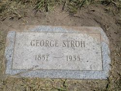
| Description | : | The Belleville Telescope, July 23, 1959 Mrs. Mary Woodside, daughter of George and Katherine Becker Stroh, was born October 19, 1894, and passed away June 29, 1959, at the University of Kansas Medical Center at the age of 64 years, 8 months and 9 days. She was born at Plymouth, Neb., and baptized in the Plymouth Luthern Church. She spent her childhood in Plymouth she went to stay with her sister, Mrs. Charles Butts of Chester in 1912, where she met her husband, Jay Woodside. They were married May 27, 1914 making their home in Hubbell, Neb., where... Read More |
frequently asked questions (FAQ):
-
Where is Mary Pauline Stroh Woodside's memorial?
Mary Pauline Stroh Woodside's memorial is located at: Hubbell Cemetery, Rose Creek Township, Republic County, USA.
-
When did Mary Pauline Stroh Woodside death?
Mary Pauline Stroh Woodside death on 29 Jun 1959 in Kansas City, Wyandotte County, Kansas, USA
-
Where are the coordinates of the Mary Pauline Stroh Woodside's memorial?
Latitude: 40.0000790
Longitude: -97.5002770
Family Members:
Parent
Spouse

Siblings
Children
Flowers:


Nearby Cemetories:
1. Hubbell Cemetery
Rose Creek Township, Republic County, USA
Coordinate: 40.0000790, -97.5002770
2. Maple Grove Cemetery
Narka, Republic County, USA
Coordinate: 39.9728012, -97.4550018
3. Zion Lutheran Cemetery
Hubbell, Thayer County, USA
Coordinate: 40.0437400, -97.4629400
4. Williams Cemetery
Thayer County, USA
Coordinate: 40.0321999, -97.4349976
5. Ida Cemetery
Rose Creek Township, Republic County, USA
Coordinate: 39.9375000, -97.5000000
6. Rose Creek Cemetery
Munden, Republic County, USA
Coordinate: 39.9468994, -97.5663986
7. Saint Johns Lutheran Cemetery
Chester, Thayer County, USA
Coordinate: 40.0167007, -97.5942001
8. Chester Cemetery
Chester, Thayer County, USA
Coordinate: 40.0228004, -97.6121979
9. Shepard Cemetery
Liberty Township, Republic County, USA
Coordinate: 39.9643717, -97.6227674
10. Bethel Cemetery
Munden, Republic County, USA
Coordinate: 39.9002550, -97.5311280
11. Saint Paul's Lutheran Church Cemetery
Gilead, Thayer County, USA
Coordinate: 40.1108000, -97.4449000
12. National Cemetery
Narka, Republic County, USA
Coordinate: 39.8931007, -97.4255981
13. Rose Creek Cemetery
Rose Creek Township, Thayer County, USA
Coordinate: 40.0705986, -97.3694000
14. Dan Schafer Family Farm Cemetery
Hebron, Thayer County, USA
Coordinate: 40.1181500, -97.5437200
15. Stephenson Cemetery
Liberty Township, Republic County, USA
Coordinate: 39.9281006, -97.6438980
16. Saint Georges Cemetery
Munden, Republic County, USA
Coordinate: 39.8711014, -97.5372009
17. New Tabor Cemetery
Cuba, Republic County, USA
Coordinate: 39.8636017, -97.5167007
18. Saint Paul Lutheran Cemetery - Stoddard
Chester, Thayer County, USA
Coordinate: 40.0760300, -97.6515300
19. Spring Hill Cemetery
Belleville, Republic County, USA
Coordinate: 39.8996500, -97.6270900
20. Union Cemetery
Gilead, Thayer County, USA
Coordinate: 40.1319008, -97.4047012
21. King David Fisher Gravesite
Hebron, Thayer County, USA
Coordinate: 40.1509440, -97.5438060
22. Huber Cemetery
Reynolds, Jefferson County, USA
Coordinate: 40.0493000, -97.3085000
23. Thayer County Poor Farm Cemetery
Hebron, Thayer County, USA
Coordinate: 40.1585900, -97.5173370
24. Saint Mark Evangelical Lutheran Cemetery
Thayer County, USA
Coordinate: 40.1331500, -97.6205900