
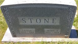
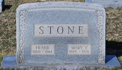
Mary Virginia Frances Blank Stone
| Birth | : | 18 Apr 1889 Frederick County, Maryland, USA |
| Death | : | 21 Jan 1978 Frederick County, Maryland, USA |
| Burial | : | St Andrew Churchyard, South Stoke, South Oxfordshire District, England |
| Coordinate | : | 51.5479065, -1.1377167 |
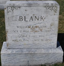
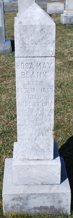
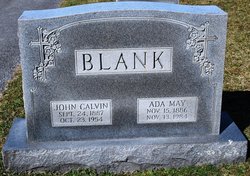
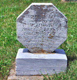
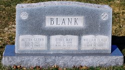
| Description | : | Mrs. Mary Virginia Frances Stone, died at her residence. She was a member of the Church of Jesus Christ of Latter-day Saints. Prior to her retirement, she had been employed at the Moose Tailoring Company and Sagner's, Inc. Services to be held at the Church of Jesus Christ of Latter-day Saints, with services conducted by Bishop Earl J. Wahlquist, pastor of the church, and Elder Norman Lindsay. Parents: William Elmer Blank and Rosie May Whipp Blank Children: Frank Stone, Albert N. Stone, Chester L. Stone, Calvin F. Stone, Mrs. Zola Cadle, Mrs. Rosabell Dutrow, Mrs. Mary M.... Read More |
frequently asked questions (FAQ):
-
Where is Mary Virginia Frances Blank Stone's memorial?
Mary Virginia Frances Blank Stone's memorial is located at: St Andrew Churchyard, South Stoke, South Oxfordshire District, England.
-
When did Mary Virginia Frances Blank Stone death?
Mary Virginia Frances Blank Stone death on 21 Jan 1978 in Frederick County, Maryland, USA
-
Where are the coordinates of the Mary Virginia Frances Blank Stone's memorial?
Latitude: 51.5479065
Longitude: -1.1377167
Family Members:
Parent
Spouse

Siblings

Children
Flowers:


Nearby Cemetories:
1. St Andrew Churchyard
South Stoke, South Oxfordshire District, England
Coordinate: 51.5479065, -1.1377167
2. St John the Baptist
Moulsford, South Oxfordshire District, England
Coordinate: 51.5531050, -1.1482640
3. St. Mary Churchyard
Streatley, West Berkshire Unitary Authority, England
Coordinate: 51.5240170, -1.1449500
4. St. Mary's Churchyard
North Stoke, South Oxfordshire District, England
Coordinate: 51.5714910, -1.1228080
5. St. Thomas of Canterbury Churchyard
Goring, South Oxfordshire District, England
Coordinate: 51.5221440, -1.1399970
6. Whitehill Burial Ground
Goring, South Oxfordshire District, England
Coordinate: 51.5214730, -1.1180180
7. St. Mary's Churchyard
Cholsey, South Oxfordshire District, England
Coordinate: 51.5788078, -1.1589500
8. St. Mary the Virgin Cemetery
Ipsden, South Oxfordshire District, England
Coordinate: 51.5674164, -1.0866686
9. St. John the Baptist Church (Defunct)
Mongwell, South Oxfordshire District, England
Coordinate: 51.5860980, -1.1233580
10. St. Leonard's Churchyard
Woodcote, South Oxfordshire District, England
Coordinate: 51.5348117, -1.0731299
11. St Michael's Cemetery
Aston Tirrold, South Oxfordshire District, England
Coordinate: 51.5730994, -1.1967145
12. All Saints Churchyard
Aston Upthorpe, South Oxfordshire District, England
Coordinate: 51.5715900, -1.2037500
13. St. Leonard's Churchyard
Wallingford, South Oxfordshire District, England
Coordinate: 51.5972711, -1.1230712
14. St. John the Baptist South Moreton
South Moreton, South Oxfordshire District, England
Coordinate: 51.5881630, -1.1895850
15. St. Mary-le-More Churchyard
Wallingford, South Oxfordshire District, England
Coordinate: 51.5993878, -1.1249488
16. St Mary Magdalene Churchyard
Crowmarsh Gifford, South Oxfordshire District, England
Coordinate: 51.5992169, -1.1139564
17. Saint Peter's Churchyard
Wallingford, South Oxfordshire District, England
Coordinate: 51.6005819, -1.1215970
18. South Moreton Strict Baptist Chapel
South Moreton, South Oxfordshire District, England
Coordinate: 51.5900300, -1.1924310
19. All Hallows Graveyard
Wallingford, South Oxfordshire District, England
Coordinate: 51.6020520, -1.1242267
20. St. John the Baptist Churchyard
Whitchurch Hill, South Oxfordshire District, England
Coordinate: 51.5050469, -1.0824315
21. St. Mary the Virgin Churchyard
Aldworth, West Berkshire Unitary Authority, England
Coordinate: 51.5106800, -1.2030150
22. Checkendon Churchyard
Checkendon, South Oxfordshire District, England
Coordinate: 51.5424461, -1.0449720
23. Wallingford Cemetery
Wallingford, South Oxfordshire District, England
Coordinate: 51.6058200, -1.1232000
24. All Saints Churchyard
North Moreton, South Oxfordshire District, England
Coordinate: 51.6021922, -1.1898247