
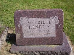
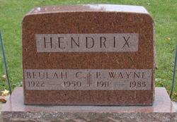
Merril Hart Hendrix
| Birth | : | 11 Jun 1918 White County, Illinois, USA |
| Death | : | 21 Jun 1959 Wabash, Wabash County, Indiana, USA |
| Burial | : | St. Mary & St. Martin Churchyard, Blyth, Bassetlaw District, England |
| Coordinate | : | 53.3785000, -1.0642000 |
| Plot | : | Sec N, lot 16, sp 5 |
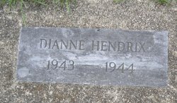
| Description | : | Cause of death: Cancer - lungs. OBITUARY - Plain Dealer, Wabash (IN) Merril H. Hendrix, 41, died at 10 a.m. Sunday in the home of his brother, Wayne Hendrix, 910 Ferry Street, after an illness of nine and one-half months. A native of White County, Ill., he was born June 11, 1918 to Thomas and Bertha (Hart) Hendrix. He had lived in Wabash for 20 years and was employed as a plumber with Utter and Hendrix. The decedent was a member of the Christian Church and Eagles Lodge. Survivors include three daughters, Barbara, Joan and Kay,... Read More |
frequently asked questions (FAQ):
-
Where is Merril Hart Hendrix's memorial?
Merril Hart Hendrix's memorial is located at: St. Mary & St. Martin Churchyard, Blyth, Bassetlaw District, England.
-
When did Merril Hart Hendrix death?
Merril Hart Hendrix death on 21 Jun 1959 in Wabash, Wabash County, Indiana, USA
-
Where are the coordinates of the Merril Hart Hendrix's memorial?
Latitude: 53.3785000
Longitude: -1.0642000
Family Members:
Parent
Spouse
Siblings

Children
Flowers:


Nearby Cemetories:
1. St. Mary & St. Martin Churchyard
Blyth, Bassetlaw District, England
Coordinate: 53.3785000, -1.0642000
2. Blyth City Cemetery
Blyth, Bassetlaw District, England
Coordinate: 53.3729000, -1.0592000
3. St. Barnabas Church Burial Ground
Ranskill, Bassetlaw District, England
Coordinate: 53.3786660, -1.0138210
4. Langold Cemetery
Worksop, Bassetlaw District, England
Coordinate: 53.3777600, -1.1170100
5. St Helen's Roman Catholic Churchyard
Nottingham, Nottingham Unitary Authority, England
Coordinate: 53.3903220, -1.1131860
6. Styrrup Road Cemetery
Harworth, Bassetlaw District, England
Coordinate: 53.4160400, -1.0816770
7. Harworth Cemetery
Harworth, Bassetlaw District, England
Coordinate: 53.4185060, -1.0733460
8. St. Wilfred Churchyard
Scrooby, Bassetlaw District, England
Coordinate: 53.4095670, -1.0204840
9. All Saints Churchyard
Harworth, Bassetlaw District, England
Coordinate: 53.4187800, -1.0781900
10. Saint John the Evangelist Churchyard
Carlton-in-Lindrick, Bassetlaw District, England
Coordinate: 53.3486389, -1.1180278
11. Respect Green Burial Park
Bawtry, Metropolitan Borough of Doncaster, England
Coordinate: 53.4200210, -1.0250520
12. St. Bartholomew's Churchyard
Sutton cum Lound, Bassetlaw District, England
Coordinate: 53.3573000, -0.9784000
13. St. Martin Churchyard
Firbeck, Metropolitan Borough of Rotherham, England
Coordinate: 53.3900080, -1.1561770
14. Sandbeck Park
Maltby, Metropolitan Borough of Rotherham, England
Coordinate: 53.4061450, -1.1460050
15. St. Peter's Churchyard
Letwell, Metropolitan Borough of Rotherham, England
Coordinate: 53.3773774, -1.1606489
16. St. Nicholas' Churchyard
Bawtry, Metropolitan Borough of Doncaster, England
Coordinate: 53.4297900, -1.0183400
17. St. Mary's Churchyard
Tickhill, Metropolitan Borough of Doncaster, England
Coordinate: 53.4309200, -1.1112200
18. Austin Friars Churchyard
Tickhill, Metropolitan Borough of Doncaster, England
Coordinate: 53.4283270, -1.1194740
19. Tickhill Friary
Tickhill, Metropolitan Borough of Doncaster, England
Coordinate: 53.4283330, -1.1195830
20. Saint Mary's Cemetery
Tickhill, Metropolitan Borough of Doncaster, England
Coordinate: 53.4315867, -1.1108661
21. Mattersey Cemetery
Mattersey, Bassetlaw District, England
Coordinate: 53.3986220, -0.9691880
22. St Nicholas Chapel of All Souls Ancillary Cemetery
Bawtry, Metropolitan Borough of Doncaster, England
Coordinate: 53.4344798, -1.0211632
23. Bawtry Cemetery
Bawtry, Metropolitan Borough of Doncaster, England
Coordinate: 53.4341255, -1.0192066
24. St. John the Evangelist Churchyard
Worksop, Bassetlaw District, England
Coordinate: 53.3161600, -1.0584800