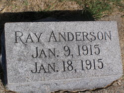
| Birth | : | 13 Mar 1916 Beaver Crossing, Seward County, Nebraska, USA |
| Death | : | 26 Feb 2003 Friend, Saline County, Nebraska, USA |
| Burial | : | Spring Hill Cemetery, Easton, Talbot County, USA |
| Coordinate | : | 38.7775002, -76.0727997 |
| Inscription | : | THE LORD IS MY SHEPHERD, I SHALL NOT WANT |
| Description | : | Meyer Andrew Anderson of Beaver Crossing, died on Wednesday, February 26, 2003, at the Friend Manor at the age of 86 years, 11 months, and 13 days. He was born March 13, 1916 to John and Ella (Meyer) Anderson. He graduated from Beaver Crossing High School in 1933. As a young man he was a member of the Civilian Conservation Corps at Denton, Nebraska. Meyer Anderson and Norma Koch married January 1, 1940, and lived on a farm southeast of Beaver Crossing for most of their married life. The couple became parents to four children:... Read More |
frequently asked questions (FAQ):
-
Where is Meyer Andrew Anderson's memorial?
Meyer Andrew Anderson's memorial is located at: Spring Hill Cemetery, Easton, Talbot County, USA.
-
When did Meyer Andrew Anderson death?
Meyer Andrew Anderson death on 26 Feb 2003 in Friend, Saline County, Nebraska, USA
-
Where are the coordinates of the Meyer Andrew Anderson's memorial?
Latitude: 38.7775002
Longitude: -76.0727997
Family Members:
Parent
Spouse
Siblings
Flowers:
Nearby Cemetories:
1. Spring Hill Cemetery
Easton, Talbot County, USA
Coordinate: 38.7775002, -76.0727997
2. Maryland State Police Canine Cemetery Barrack I
Easton, Talbot County, USA
Coordinate: 38.7843938, -76.0753632
3. Richards Memorial Park
Easton, Talbot County, USA
Coordinate: 38.7761002, -76.0821991
4. Doverbrook Cemetery
Easton, Talbot County, USA
Coordinate: 38.7733002, -76.0643997
5. Third Haven Meeting Burial Ground
Easton, Talbot County, USA
Coordinate: 38.7672005, -76.0764008
6. Peachblossom Meeting House Cemetery
Easton, Talbot County, USA
Coordinate: 38.7332900, -76.0681500
7. Lombardy Farm Cemetery
Unionville, Talbot County, USA
Coordinate: 38.8158530, -76.1259852
8. Chapel Cemetery
Easton, Talbot County, USA
Coordinate: 38.8171997, -76.0211029
9. Saint Stephens Church Cemetery
Easton, Talbot County, USA
Coordinate: 38.8091020, -76.1397660
10. Roberts Cemetery
Talbot County, USA
Coordinate: 38.7192001, -76.0488968
11. Ashby-Goldsborough Family Cemetery
Easton, Talbot County, USA
Coordinate: 38.8251600, -76.1239840
12. Queen Esther Cemetery
Talbot County, USA
Coordinate: 38.7132988, -76.0456009
13. All Saints Cemetery
Easton, Talbot County, USA
Coordinate: 38.8464012, -76.0817032
14. Saint Pauls Cemetery
Talbot County, USA
Coordinate: 38.7439003, -76.1624985
15. White Marsh Cemetery
Trappe, Talbot County, USA
Coordinate: 38.6970329, -76.0600662
16. Landing Neck Cemetery
Trappe Landing, Talbot County, USA
Coordinate: 38.7000008, -76.0402985
17. Woodlawn Memorial Park
Easton, Talbot County, USA
Coordinate: 38.8610992, -76.0597000
18. Royal Oak Cemetery
Bellevue, Talbot County, USA
Coordinate: 38.7421989, -76.1774979
19. DeShields Cemetery
Talbot County, USA
Coordinate: 38.8278008, -76.1678009
20. Banning Graveyard
Easton, Talbot County, USA
Coordinate: 38.7205353, -76.1647339
21. Kings Creek Cemetery
Talbot County, USA
Coordinate: 38.8167000, -75.9527969
22. Hammond Family Plot
Saint Michaels, Talbot County, USA
Coordinate: 38.7495600, -76.1988400
23. Mount Zion Cemetery
Bethlehem, Caroline County, USA
Coordinate: 38.7500000, -75.9430900
24. Tuckahoe Friends Meeting House Burying Ground
Talbot County, USA
Coordinate: 38.8253460, -75.9531270


