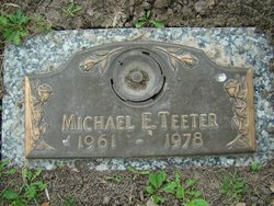
Michael Ernest “Mike” Teeter
| Birth | : | 10 Mar 1961 Fairfield, Jefferson County, Iowa, USA |
| Death | : | 10 Nov 1978 Fairfield, Jefferson County, Iowa, USA |
| Burial | : | Memorial Lawn Cemetery, Fairfield, Jefferson County, USA |
| Coordinate | : | 41.0068000, -91.9805000 |
| Plot | : | Memorial 23 - Space 3 |
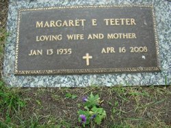
| Description | : | Son of Ernest/Elmer Teeter and Margaret Clubb Teeter. He was a student at Fairfield High School. His death from complications of muscular distrophy had quite an impact on his fellow students and faculty. In a special tribute to his love of life, friends, and family, Michael was inducted into the Torch Club in his junior year, being wheeled onto the stage by Mr. Brookhart. In a story by Tom Green published in the Fairfield Ledger, "This June our senior class will graduate. Mike will not be seen there, but he will be felt there. All of the love felt between Mike... Read More |
frequently asked questions (FAQ):
-
Where is Michael Ernest “Mike” Teeter's memorial?
Michael Ernest “Mike” Teeter's memorial is located at: Memorial Lawn Cemetery, Fairfield, Jefferson County, USA.
-
When did Michael Ernest “Mike” Teeter death?
Michael Ernest “Mike” Teeter death on 10 Nov 1978 in Fairfield, Jefferson County, Iowa, USA
-
Where are the coordinates of the Michael Ernest “Mike” Teeter's memorial?
Latitude: 41.0068000
Longitude: -91.9805000
Family Members:
Parent
Flowers:
Nearby Cemetories:
1. Memorial Lawn Cemetery
Fairfield, Jefferson County, USA
Coordinate: 41.0068000, -91.9805000
2. Old Fairfield Cemetery
Fairfield, Jefferson County, USA
Coordinate: 41.0148000, -91.9598000
3. Evergreen Cemetery
Fairfield, Jefferson County, USA
Coordinate: 41.0138600, -91.9562100
4. Smith Family Cemetery
Libertyville, Jefferson County, USA
Coordinate: 40.9972416, -92.0362857
5. Roth Cemetery
Fairfield, Jefferson County, USA
Coordinate: 40.9589005, -91.9574966
6. Switzer Cemetery
Fairfield, Jefferson County, USA
Coordinate: 41.0368996, -91.9096985
7. Bradshaw Cemetery
Jefferson County, USA
Coordinate: 40.9766998, -91.9032974
8. Jefferson County Poor Farm Cemetery
Libertyville, Jefferson County, USA
Coordinate: 40.9416900, -91.9996200
9. Moorman Cemetery
Fairfield, Jefferson County, USA
Coordinate: 41.0452995, -92.0622025
10. Gregg Cemetery
Jefferson County, USA
Coordinate: 41.0078011, -92.0811005
11. Bethesda Cemetery
Fairfield, Jefferson County, USA
Coordinate: 41.0019000, -91.8796000
12. McCleary Cemetery
Jefferson County, USA
Coordinate: 40.9892006, -92.0805969
13. Cumberland Cemetery
Jefferson County, USA
Coordinate: 40.9248000, -91.9903000
14. Galliher Cemetery
Glasgow, Jefferson County, USA
Coordinate: 40.9666892, -91.8835038
15. Pattison Cemetery
Fairfield, Jefferson County, USA
Coordinate: 40.9444008, -91.9049988
16. Wheeler Cemetery
Jefferson County, USA
Coordinate: 41.0797000, -91.9185500
17. Brooks Cemetery
Jefferson County, USA
Coordinate: 41.0635986, -92.0693970
18. Koons Cemetery
Locust Grove Township, Jefferson County, USA
Coordinate: 41.0286410, -92.0948960
19. Morgan Burial Plot
Des Moines Township, Jefferson County, USA
Coordinate: 40.9837160, -92.0964340
20. Thompson Cemetery
Jefferson County, USA
Coordinate: 40.9155998, -91.9772034
21. Upper Richwoods Cemetery
Salina, Jefferson County, USA
Coordinate: 41.0602989, -91.8807983
22. Perlee Cemetery
Perlee, Jefferson County, USA
Coordinate: 41.0805750, -91.8993380
23. Wright Cemetery
Fairfield, Jefferson County, USA
Coordinate: 40.9524000, -91.8728000
24. Gantz Cemetery
Abingdon, Jefferson County, USA
Coordinate: 41.0464000, -92.1017000


