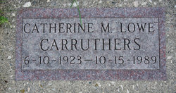
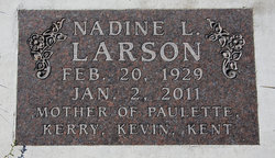
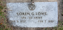
Mildred Lowe Elbert
| Birth | : | 21 Apr 1911 Mallard, Palo Alto County, Iowa, USA |
| Death | : | 14 Apr 1987 Fort Dodge, Webster County, Iowa, USA |
| Burial | : | Saint John the Divine Churchyard, Horninglow, East Staffordshire Borough, England |
| Coordinate | : | 52.8237520, -1.6426170 |
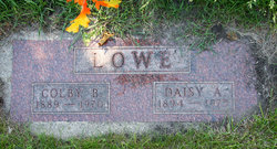
| Description | : | Mallard native Mildred Elbert of Fort Dodge died Tuesday, April 14, 1987, at Trinity Regional Hospital in Fort Dodge. She was 75. Graveside services for Mrs. Elbert were held Sunday, April 19, at 2 p.m. at Evergreen Cemetery. The Rev. Byron Ayers officiated. The Martin Funeral Home in Emmetsburg was in charge of arrangements. Mildred (Lowe) Elbert was born April 21, 1911, in Mallard, the daughter of Colby and Daisy (Vance) Lowe. She graduated from Mallard High School. • In 1929, Mildred and Leonard Eklund were married. The couple made their home in Curlew. After Mr. Eklund's death in 1940, Mildred moved to Des Moines where she worked in a number of Des Moines businesses. In 1952, Mildred and Leroy Elbert were... Read More |
frequently asked questions (FAQ):
-
Where is Mildred Lowe Elbert's memorial?
Mildred Lowe Elbert's memorial is located at: Saint John the Divine Churchyard, Horninglow, East Staffordshire Borough, England.
-
When did Mildred Lowe Elbert death?
Mildred Lowe Elbert death on 14 Apr 1987 in Fort Dodge, Webster County, Iowa, USA
-
Where are the coordinates of the Mildred Lowe Elbert's memorial?
Latitude: 52.8237520
Longitude: -1.6426170
Family Members:
Parent
Spouse
Siblings
Children
Flowers:
Nearby Cemetories:
1. Saint John the Divine Churchyard
Horninglow, East Staffordshire Borough, England
Coordinate: 52.8237520, -1.6426170
2. St Mary's Churchyard
Stretton, South Staffordshire Borough, England
Coordinate: 52.8336500, -1.6253400
3. St Mary's Church
Stretton, East Staffordshire Borough, England
Coordinate: 52.8341478, -1.6247215
4. Garden of Remembrance
Burton upon Trent, East Staffordshire Borough, England
Coordinate: 52.8023045, -1.6283625
5. St. Mary's Churchyard
Rolleston-on-Dove, East Staffordshire Borough, England
Coordinate: 52.8465144, -1.6519844
6. St Modwen Churchyard
Burton upon Trent, East Staffordshire Borough, England
Coordinate: 52.8013990, -1.6291340
7. Stapenhill Cemetery
Burton upon Trent, East Staffordshire Borough, England
Coordinate: 52.8026310, -1.6208900
8. St Mark Churchyard
Winshill, East Staffordshire Borough, England
Coordinate: 52.8082040, -1.6048350
9. Rolleston Cemetery
Rolleston-on-Dove, East Staffordshire Borough, England
Coordinate: 52.8483757, -1.6643849
10. St. Peter's Parish Churchyard
Stapenhill, East Staffordshire Borough, England
Coordinate: 52.7960899, -1.6230323
11. St. Wilfrid Churchyard
Egginton, South Derbyshire District, England
Coordinate: 52.8474570, -1.6041750
12. Saint Saviour's Cemetery
Burton upon Trent, East Staffordshire Borough, England
Coordinate: 52.7892907, -1.6668628
13. Holy Trinity Churchyard
Anslow, East Staffordshire Borough, England
Coordinate: 52.8216926, -1.7079807
14. St Mary's
Marston-on-Dove, South Derbyshire District, England
Coordinate: 52.8633910, -1.6547730
15. Marston-on-Dove Cemetery
Marston-on-Dove, South Derbyshire District, England
Coordinate: 52.8640550, -1.6552780
16. St. Michael and All Angels Churchyard
Tatenhill, East Staffordshire Borough, England
Coordinate: 52.7958170, -1.6968150
17. Priory Church of St. Mary the Virgin
Tutbury, East Staffordshire Borough, England
Coordinate: 52.8590900, -1.6877900
18. Bretby Crematorium
Burton upon Trent, East Staffordshire Borough, England
Coordinate: 52.8008590, -1.5724250
19. St Michael Churchyard
Willington, South Derbyshire District, England
Coordinate: 52.8501540, -1.5636540
20. St. Wystan's Churchyard
Repton, South Derbyshire District, England
Coordinate: 52.8411570, -1.5516380
21. RAF Fauld
Hanbury, East Staffordshire Borough, England
Coordinate: 52.8474200, -1.7303500
22. All Saints Churchyard
Rangemore, East Staffordshire Borough, England
Coordinate: 52.8040800, -1.7337000
23. St. John's Churchyard
Newhall, South Derbyshire District, England
Coordinate: 52.7825310, -1.5685700
24. Swadlincote Newhall and Stanton Burial Ground
Swadlincote, South Derbyshire District, England
Coordinate: 52.7818200, -1.5683500


