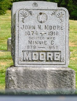
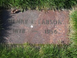
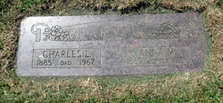
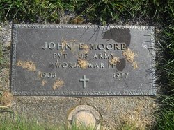
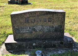
Minnie Catherine Larson Moore
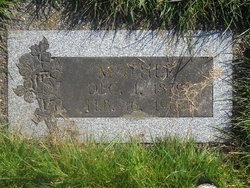
| Birth | : | 1 Dec 1879 Portland, Multnomah County, Oregon, USA |
| Death | : | 16 Feb 1966 Longview, Cowlitz County, Washington, USA |
| Burial | : | White Chapel Memorial Park Cemetery, Troy, Oakland County, USA |
| Coordinate | : | 42.5856018, -83.1635971 |
| Description | : | OBITUARY Longview Daily News, Thursday, February 17, 1966 MOORE- Mrs. Minnie Catherine, 86, 309 south 1st West Kelso. died Feb 16 at a local hospital. She was born Dec 1, 1879 at Portland and had lived here since she was seven years old. She was a member of the Vasa Lodge No. 469. Survivors include two sons, Carl Moore of Kelso and John Moore of Longview; two daughters , Mrs. Lela Olson of Kelso and Mrs. Minnie Walstead of Longview; one brother, Carl Larson of Kelso; one sister, Mrs. Anna Lewis of Kelso; four grandchildren and five great grandchildren. Funeral services... Read More |
frequently asked questions (FAQ):
-
Where is Minnie Catherine Larson Moore's memorial?
Minnie Catherine Larson Moore's memorial is located at: White Chapel Memorial Park Cemetery, Troy, Oakland County, USA.
-
When did Minnie Catherine Larson Moore death?
Minnie Catherine Larson Moore death on 16 Feb 1966 in Longview, Cowlitz County, Washington, USA
-
Where are the coordinates of the Minnie Catherine Larson Moore's memorial?
Latitude: 42.5856018
Longitude: -83.1635971
Family Members:
Parent
Spouse
Siblings
Children
Flowers:
Nearby Cemetories:
1. White Chapel Memorial Park Cemetery
Troy, Oakland County, USA
Coordinate: 42.5856018, -83.1635971
2. Crooks Road Cemetery
Troy, Oakland County, USA
Coordinate: 42.5727997, -83.1680984
3. Beach Cemetery
Troy, Oakland County, USA
Coordinate: 42.5936012, -83.1980972
4. Union Corners Cemetery
Troy, Oakland County, USA
Coordinate: 42.6074982, -83.1256027
5. Beautiful Savior Lutheran Church Columbarium
Bloomfield Hills, Oakland County, USA
Coordinate: 42.5984290, -83.2092050
6. Big Beaver United Methodist Church Columbarium
Troy, Oakland County, USA
Coordinate: 42.5747223, -83.1094131
7. Perrin Cemetery
Troy, Oakland County, USA
Coordinate: 42.5398254, -83.1857605
8. Saint Andrews Memorial Garden
Clawson, Oakland County, USA
Coordinate: 42.5359612, -83.1460571
9. Clover Hill Park Cemetery
Birmingham, Oakland County, USA
Coordinate: 42.5349998, -83.1885986
10. Greenwood Cemetery
Birmingham, Oakland County, USA
Coordinate: 42.5539017, -83.2238998
11. Saint James Episcopal Church Columbarium
Birmingham, Oakland County, USA
Coordinate: 42.5465088, -83.2179642
12. Payne-Waugh Cemetery
Bloomfield Township, Oakland County, USA
Coordinate: 42.6044640, -83.2385790
13. Christ Church Cranbrook Columbarium
Bloomfield Hills, Oakland County, USA
Coordinate: 42.5672188, -83.2440186
14. Saint Hugo of the Hills Columbarium
Bloomfield Hills, Oakland County, USA
Coordinate: 42.5927391, -83.2477036
15. Aaron Webster Cemetery
Auburn Hills, Oakland County, USA
Coordinate: 42.6316605, -83.2230606
16. First United Methodist Church Memorial Garden
Birmingham, Oakland County, USA
Coordinate: 42.5454370, -83.2330870
17. First Presbyterian Church Columbarium
Birmingham, Oakland County, USA
Coordinate: 42.5463380, -83.2351040
18. Lutheran Church of the Redeemer Columbarium
Birmingham, Oakland County, USA
Coordinate: 42.5463540, -83.2373950
19. Bloomfield Hills Cemetery (Defunct)
Bloomfield Hills, Oakland County, USA
Coordinate: 42.5811111, -83.2563889
20. Holy Trinity Cemetery
Sterling Heights, Macomb County, USA
Coordinate: 42.5461006, -83.0830994
21. Christian Memorial Gardens West
Rochester Hills, Oakland County, USA
Coordinate: 42.6543999, -83.1235962
22. Acacia Park Cemetery
Beverly Hills, Oakland County, USA
Coordinate: 42.5217018, -83.2197037
23. Roseland Park Cemetery
Berkley, Oakland County, USA
Coordinate: 42.5060997, -83.1797028
24. Royal Oak Cemetery
Royal Oak, Oakland County, USA
Coordinate: 42.5036011, -83.1442032


