
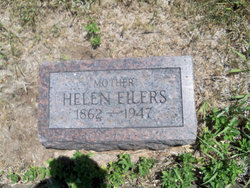
Mrs Helen Elizabeth O'Harro Eilers
| Birth | : | 28 May 1862 Watertown, Jefferson County, New York, USA |
| Death | : | 26 Nov 1947 Clay County, Kansas, USA |
| Burial | : | Bloom Cemetery, Morganville, Clay County, USA |
| Coordinate | : | 39.4519005, -97.2778015 |
| Inscription | : | Mother |
frequently asked questions (FAQ):
-
Where is Mrs Helen Elizabeth O'Harro Eilers's memorial?
Mrs Helen Elizabeth O'Harro Eilers's memorial is located at: Bloom Cemetery, Morganville, Clay County, USA.
-
When did Mrs Helen Elizabeth O'Harro Eilers death?
Mrs Helen Elizabeth O'Harro Eilers death on 26 Nov 1947 in Clay County, Kansas, USA
-
Where are the coordinates of the Mrs Helen Elizabeth O'Harro Eilers's memorial?
Latitude: 39.4519005
Longitude: -97.2778015
Family Members:
Parent

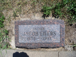
Spouse
Siblings
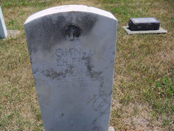
Children
Flowers:


Nearby Cemetories:
1. Bloom Cemetery
Morganville, Clay County, USA
Coordinate: 39.4519005, -97.2778015
2. Lincoln Cemetery
Clay Center, Clay County, USA
Coordinate: 39.4230995, -97.2930984
3. Iwacura Cemetery
Morganville, Clay County, USA
Coordinate: 39.4550000, -97.3510000
4. Riverdale Cemetery
Clay County, USA
Coordinate: 39.5106010, -97.2930984
5. Morganville City Cemetery
Morganville, Clay County, USA
Coordinate: 39.4733009, -97.1819000
6. Norwegian Lutheran Cemetery
Clay Center, Clay County, USA
Coordinate: 39.5027900, -97.1828200
7. Sherman Cemetery
Morganville, Clay County, USA
Coordinate: 39.5316300, -97.2243700
8. Idana Cemetery
Idana, Clay County, USA
Coordinate: 39.3574500, -97.2693300
9. Wilson Cemetery
Clay County, USA
Coordinate: 39.3800011, -97.1896973
10. French Presbyterian Church Cemetery
Cloud County, USA
Coordinate: 39.4395200, -97.4148290
11. Swedish Evangelical Lutheran Cemetery
Clay County, USA
Coordinate: 39.4911700, -97.1455100
12. Saint Joseph Cemetery
Saint Joseph, Cloud County, USA
Coordinate: 39.5074941, -97.4022328
13. Swedish Pleasant Hill Cemetery
Clay Center, Clay County, USA
Coordinate: 39.4735985, -97.1268997
14. Greenwood Cemetery
Clay Center, Clay County, USA
Coordinate: 39.4011002, -97.1275024
15. Saint Peter and Saint Pauls Catholic Cemetery
Clay Center, Clay County, USA
Coordinate: 39.4005450, -97.1236680
16. Hebron Cemetery
Clay County, USA
Coordinate: 39.3213800, -97.2601400
17. Garfield Center Mission Cemetery
Clay Center, Clay County, USA
Coordinate: 39.5243100, -97.1277500
18. Table Mound Cemetery
Idana, Clay County, USA
Coordinate: 39.3141300, -97.2792300
19. Cedar Grove Cemetery
Clyde, Cloud County, USA
Coordinate: 39.5494003, -97.4056015
20. Republican City Cemetery
Clay Center, Clay County, USA
Coordinate: 39.3431015, -97.1628036
21. Shields Cemetery
Clay County, USA
Coordinate: 39.3208008, -97.3507996
22. Smith Grave
Miltonvale, Cloud County, USA
Coordinate: 39.3645300, -97.4308700
23. Hayes Cemetery
Clay County, USA
Coordinate: 39.4516983, -97.0811005
24. Pleasant View Cemetery
Ames, Cloud County, USA
Coordinate: 39.5346985, -97.4431000