
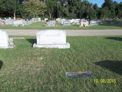
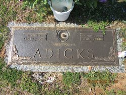
Myrtle Alvena Adicks Parrish
| Birth | : | 21 Dec 1913 Orangeburg County, South Carolina, USA |
| Death | : | 28 Sep 2010 Spartanburg, Spartanburg County, South Carolina, USA |
| Burial | : | St. John the Baptist Churchyard, Bishop's Castle, Shropshire Unitary Authority, England |
| Coordinate | : | 52.4898300, -2.9984000 |
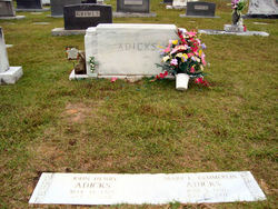
| Description | : | Orangeburg - Myrtle Alvena Adicks Kemmerlin Parrish, 96, a former resident of Adden Street in Orangeburg for 40 years before moving to Spartanburg, died early Tuesday, Sept. 28, 2010, at the Regional Hospice Home in Spartanburg. The funeral will be held at 2 p.m. Thursday, Sept. 30, at Thompson Funeral Home Chapel in Orangeburg, with the Rev. Fred McDaniel officiating. Burial will be in Memorial Park Cemetery in Orangeburg. She was born Dec. 21, 1913, in Orangeburg County, the daughter of the late Grover C. Adicks and the late Cora Kittrell Adicks. She was preceded in death by her first... Read More |
frequently asked questions (FAQ):
-
Where is Myrtle Alvena Adicks Parrish's memorial?
Myrtle Alvena Adicks Parrish's memorial is located at: St. John the Baptist Churchyard, Bishop's Castle, Shropshire Unitary Authority, England.
-
When did Myrtle Alvena Adicks Parrish death?
Myrtle Alvena Adicks Parrish death on 28 Sep 2010 in Spartanburg, Spartanburg County, South Carolina, USA
-
Where are the coordinates of the Myrtle Alvena Adicks Parrish's memorial?
Latitude: 52.4898300
Longitude: -2.9984000
Family Members:
Parent

Spouse
Siblings
Flowers:


Nearby Cemetories:
1. St. John the Baptist Churchyard
Bishop's Castle, Shropshire Unitary Authority, England
Coordinate: 52.4898300, -2.9984000
2. St Michael Churchyard
Edgton, Shropshire Unitary Authority, England
Coordinate: 52.4660500, -2.9044570
3. Clun Cemetery
Clun, Shropshire Unitary Authority, England
Coordinate: 52.4215490, -3.0224990
4. St George Churchyard
Clun, Shropshire Unitary Authority, England
Coordinate: 52.4184914, -3.0303540
5. St Marys Churchyard
Hopesay, Shropshire Unitary Authority, England
Coordinate: 52.4440470, -2.8999020
6. St. Swithin Churchyard
Clunbury, Shropshire Unitary Authority, England
Coordinate: 52.4201670, -2.9261080
7. St. Edward Churchyard
Hopton Castle, Shropshire Unitary Authority, England
Coordinate: 52.3985700, -2.9369700
8. St Mary's Churchyard
Hopton Castle, Shropshire Unitary Authority, England
Coordinate: 52.3985640, -2.9369870
9. Holy Trinity Churchyard
Chirbury with Brompton, Shropshire Unitary Authority, England
Coordinate: 52.5873000, -3.0387300
10. St. Michael the Archangel Churchyard
Chirbury with Brompton, Shropshire Unitary Authority, England
Coordinate: 52.5792757, -3.0914289
11. St Cuthbert Churchyard
Clungunford, Shropshire Unitary Authority, England
Coordinate: 52.4032350, -2.8909360
12. St. Thomas' Churchyard
Craven Arms, Shropshire Unitary Authority, England
Coordinate: 52.4450630, -2.8306870
13. St Margaret's Churchyard
Acton Scott, Shropshire Unitary Authority, England
Coordinate: 52.5001670, -2.8060920
14. Holy Trinity Churchyard
Hope, Shropshire Unitary Authority, England
Coordinate: 52.6070670, -2.9747750
15. Greenhills Cemetery
Church Stretton, Shropshire Unitary Authority, England
Coordinate: 52.5310170, -2.8142480
16. St Mary Churchyard
Bedstone, Shropshire Unitary Authority, England
Coordinate: 52.3759660, -2.9284570
17. St Mary Churchyard
Bettws-y-Crwyn, Shropshire Unitary Authority, England
Coordinate: 52.4244990, -3.1692770
18. Church Stretton Cemetery
Church Stretton, Shropshire Unitary Authority, England
Coordinate: 52.5365590, -2.8097950
19. St Laurence Churchyard
Church Stretton, Shropshire Unitary Authority, England
Coordinate: 52.5381750, -2.8087400
20. Westhope Chapel Burial Ground
Diddlebury, Shropshire Unitary Authority, England
Coordinate: 52.4714690, -2.7818850
21. St Mary Churchyard
Bucknell, Shropshire Unitary Authority, England
Coordinate: 52.3592220, -2.9490030
22. St. Andrew's Churchyard
Hope Bowdler, Shropshire Unitary Authority, England
Coordinate: 52.5271160, -2.7739830
23. St. Barnabas Churchyard
Brampton Bryan, Herefordshire Unitary Authority, England
Coordinate: 52.3470760, -2.9255360
24. Habberley St Mary's Church
Atcham, Shropshire Unitary Authority, England
Coordinate: 52.6266060, -2.8897140