
| Memorials | : | 1 |
| Location | : | Clungunford, Shropshire Unitary Authority, England |
| Coordinate | : | 52.4032350, -2.8909360 |
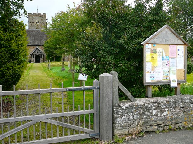
| Description | : | St Cuthbert's Church is more than seven centuries old, and is in a small village in South Shropshire; Craven Arms and Ludlow are the nearest towns. The Church is part of the Middle Marches benefice, with Bedstone, Bucknell, Chapel Lawn, Hopton Castle, Llanfair Waterdine, and Stowe. In 2009 St Cuthbert's was short listed for the national prize for a "Village Church for Village Life", and continues to host both religious and secular events. The organ, by James J. Binns of Leeds was dedicated on 19 October 1895 by the Archbishop of York, when the recently restored church was rededicated.... Read More |
frequently asked questions (FAQ):
-
Where is St Cuthbert Churchyard?
St Cuthbert Churchyard is located at Church Lane Clungunford, Shropshire Unitary Authority ,Shropshire ,England.
-
St Cuthbert Churchyard cemetery's updated grave count on graveviews.com?
1 memorials
-
Where are the coordinates of the St Cuthbert Churchyard?
Latitude: 52.4032350
Longitude: -2.8909360
Nearby Cemetories:
1. St. Swithin Churchyard
Clunbury, Shropshire Unitary Authority, England
Coordinate: 52.4201670, -2.9261080
2. St. Edward Churchyard
Hopton Castle, Shropshire Unitary Authority, England
Coordinate: 52.3985700, -2.9369700
3. St Mary's Churchyard
Hopton Castle, Shropshire Unitary Authority, England
Coordinate: 52.3985640, -2.9369870
4. St Mary Churchyard
Bedstone, Shropshire Unitary Authority, England
Coordinate: 52.3759660, -2.9284570
5. St Marys Churchyard
Hopesay, Shropshire Unitary Authority, England
Coordinate: 52.4440470, -2.8999020
6. St. Thomas' Churchyard
Craven Arms, Shropshire Unitary Authority, England
Coordinate: 52.4450630, -2.8306870
7. St Mary Churchyard
Bucknell, Shropshire Unitary Authority, England
Coordinate: 52.3592220, -2.9490030
8. St. Barnabas Churchyard
Brampton Bryan, Herefordshire Unitary Authority, England
Coordinate: 52.3470760, -2.9255360
9. St Michael Churchyard
Edgton, Shropshire Unitary Authority, England
Coordinate: 52.4660500, -2.9044570
10. St. George's Churchyard
Burrington, Herefordshire Unitary Authority, England
Coordinate: 52.3440700, -2.8200100
11. St. Mary the Virgin Churchyard
Bromfield, Shropshire Unitary Authority, England
Coordinate: 52.3873900, -2.7636700
12. Clun Cemetery
Clun, Shropshire Unitary Authority, England
Coordinate: 52.4215490, -3.0224990
13. St George Churchyard
Clun, Shropshire Unitary Authority, England
Coordinate: 52.4184914, -3.0303540
14. St. Mary the Virgin Churchyard
Elton, Shropshire Unitary Authority, England
Coordinate: 52.3345972, -2.7969324
15. All Saints Churchyard
Culmington, Shropshire Unitary Authority, England
Coordinate: 52.4334800, -2.7463500
16. Westhope Chapel Burial Ground
Diddlebury, Shropshire Unitary Authority, England
Coordinate: 52.4714690, -2.7818850
17. St. Michael and All Angels Churchyard
Lingen, Herefordshire Unitary Authority, England
Coordinate: 52.2992480, -2.9317460
18. St. John the Baptist Churchyard
Bishop's Castle, Shropshire Unitary Authority, England
Coordinate: 52.4898300, -2.9984000
19. St Margaret's Churchyard
Acton Scott, Shropshire Unitary Authority, England
Coordinate: 52.5001670, -2.8060920
20. St. Peter's Churchyard
Diddlebury, Shropshire Unitary Authority, England
Coordinate: 52.4640570, -2.7249740
21. Church of St John the Baptist and St Alkmund
Aymestrey, Herefordshire Unitary Authority, England
Coordinate: 52.2813000, -2.8428000
22. St Michael and All Angels Churchyard
Croft, Herefordshire Unitary Authority, England
Coordinate: 52.2841090, -2.8079510
23. St. Andrew, Ashford Bowdler.
Ashford Bowdler, Shropshire Unitary Authority, England
Coordinate: 52.3308770, -2.7065930
24. Greenhills Cemetery
Church Stretton, Shropshire Unitary Authority, England
Coordinate: 52.5310170, -2.8142480