
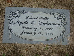
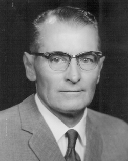
Myrtle Ellen Evans Beerbower Dickerman
| Birth | : | 8 Feb 1920 Miami, Ottawa County, Oklahoma, USA |
| Death | : | 17 Jan 2005 Lawrence, Douglas County, Kansas, USA |
| Burial | : | Oak Hill Cemetery, Lawrence, Douglas County, USA |
| Coordinate | : | 38.9589005, -95.2118988 |
| Plot | : | Section 16, lot 219, grave 6 |
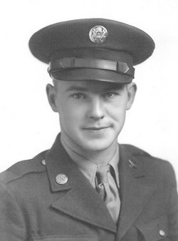
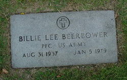
| Description | : | Graveside services for Myrtle Ellen Dickerman, 84, Lawrence, will be at 10:30 a.m. Friday in Oak Hill Cemetery. Mrs. Dickerman died Monday, Jan. 17, 2005, at Lawrence Memorial Hospital. She was born Feb. 8, 1920, in Miami, Okla., the daughter of William Edward & Olive M. Patterson Evans. Mrs. Dickerman moved to Lawrence when she was an infant. Mrs. Dickerman was a homemaker and worked at Duckwalls until in closed. She worked at Kmart for 10 years before she retired. She married Chester J. Beerbower on May, 6, 1936. He was killed in World War II on June 1,... Read More |
frequently asked questions (FAQ):
-
Where is Myrtle Ellen Evans Beerbower Dickerman's memorial?
Myrtle Ellen Evans Beerbower Dickerman's memorial is located at: Oak Hill Cemetery, Lawrence, Douglas County, USA.
-
When did Myrtle Ellen Evans Beerbower Dickerman death?
Myrtle Ellen Evans Beerbower Dickerman death on 17 Jan 2005 in Lawrence, Douglas County, Kansas, USA
-
Where are the coordinates of the Myrtle Ellen Evans Beerbower Dickerman's memorial?
Latitude: 38.9589005
Longitude: -95.2118988
Family Members:
Parent
Spouse
Siblings

Children
Flowers:


Nearby Cemetories:
1. Oak Hill Cemetery
Lawrence, Douglas County, USA
Coordinate: 38.9589005, -95.2118988
2. Mount Calvary Catholic Cemetery
Lawrence, Douglas County, USA
Coordinate: 38.9580002, -95.2139969
3. Memorial Park Cemetery
Lawrence, Douglas County, USA
Coordinate: 38.9552994, -95.2153015
4. Trinity Episcopal Church Columbarium
Lawrence, Douglas County, USA
Coordinate: 38.9653893, -95.2373886
5. Saint Johns Catholic Cemetery
Douglas County, USA
Coordinate: 38.9437900, -95.1919600
6. Dyche Hall Natural History Museum
Lawrence, Douglas County, USA
Coordinate: 38.9584800, -95.2434800
7. Franklin Cemetery
Douglas County, USA
Coordinate: 38.9437523, -95.1869431
8. Haskell Cemetery
Lawrence, Douglas County, USA
Coordinate: 38.9353790, -95.2284241
9. Pioneer Cemetery
Lawrence, Douglas County, USA
Coordinate: 38.9528008, -95.2611008
10. First Presbyterian Church Memorial Garden
Lawrence, Douglas County, USA
Coordinate: 38.9414900, -95.2641600
11. Maple Grove Cemetery
Lawrence, Douglas County, USA
Coordinate: 39.0018997, -95.2316971
12. County Poor Farm Cemetery
Douglas County, USA
Coordinate: 38.9119400, -95.2214600
13. Adams Cemetery
Douglas County, USA
Coordinate: 38.9955400, -95.2509100
14. Kennedy Cemetery
Douglas County, USA
Coordinate: 38.9112900, -95.2269200
15. Davis Cemetery
Lawrence, Douglas County, USA
Coordinate: 38.9722500, -95.2831100
16. Blue Mound Cemetery
Lawrence, Douglas County, USA
Coordinate: 38.9046600, -95.1865400
17. Marshall Cemetery
Douglas County, USA
Coordinate: 38.9040800, -95.2446700
18. Dutton Cemetery
Douglas County, USA
Coordinate: 38.8989800, -95.2790600
19. Luckan Family Cemetery
Fall Leaf, Leavenworth County, USA
Coordinate: 38.9808500, -95.1128000
20. Cemetery Beni Israel
Eudora, Douglas County, USA
Coordinate: 38.9280128, -95.1122208
21. Southwest City Cemetery
Eudora, Douglas County, USA
Coordinate: 38.9334800, -95.1070300
22. Lyon Family Cemetery
Lawrence, Douglas County, USA
Coordinate: 38.9877440, -95.3166530
23. Corpus Christi Catholic Church Columbarium
Lawrence, Douglas County, USA
Coordinate: 38.9572250, -95.3238450
24. Richland Cemetery
Lawrence, Douglas County, USA
Coordinate: 38.8768997, -95.2630997