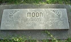
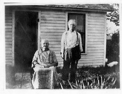
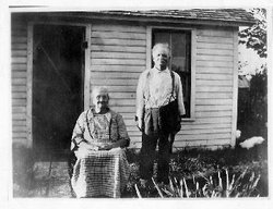
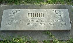
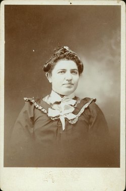
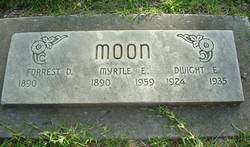
Myrtle Ethel Buttolph Moon
| Birth | : | 5 Mar 1890 Missouri, USA |
| Death | : | 14 Sep 1959 Chico, Butte County, California, USA |
| Burial | : | Rose Hill Cemetery, Hebron, Thayer County, USA |
| Coordinate | : | 40.1889000, -97.5960999 |
| Description | : | In Loving Memory Myrtle Ethel Moon Entered Into Rest September 14, 1959. Services First Christian Church Thursday September 17, 1959 - 10:00 A.M. Interment Oak Hill Cemetery, Red Bluff. Chico Funeral Home Directing. |
frequently asked questions (FAQ):
-
Where is Myrtle Ethel Buttolph Moon's memorial?
Myrtle Ethel Buttolph Moon's memorial is located at: Rose Hill Cemetery, Hebron, Thayer County, USA.
-
When did Myrtle Ethel Buttolph Moon death?
Myrtle Ethel Buttolph Moon death on 14 Sep 1959 in Chico, Butte County, California, USA
-
Where are the coordinates of the Myrtle Ethel Buttolph Moon's memorial?
Latitude: 40.1889000
Longitude: -97.5960999
Family Members:
Parent
Spouse
Siblings
Children
Flowers:
Nearby Cemetories:
1. Sacred Heart Cemetery
Hebron, Thayer County, USA
Coordinate: 40.1767006, -97.5880966
2. Hebron City Cemetery
Hebron, Thayer County, USA
Coordinate: 40.1753006, -97.5877991
3. Old Hebron Cemetery
Hebron, Thayer County, USA
Coordinate: 40.1758003, -97.5852966
4. King David Fisher Gravesite
Hebron, Thayer County, USA
Coordinate: 40.1509440, -97.5438060
5. Saint Mark Evangelical Lutheran Cemetery
Thayer County, USA
Coordinate: 40.1331500, -97.6205900
6. Letterman Cemetery
Deshler, Thayer County, USA
Coordinate: 40.1614500, -97.6708000
7. Thayer County Poor Farm Cemetery
Hebron, Thayer County, USA
Coordinate: 40.1585900, -97.5173370
8. Friedensau Cemetery
Hebron, Thayer County, USA
Coordinate: 40.1841100, -97.6895500
9. Belvidere Rural Cemetery
Belvidere, Thayer County, USA
Coordinate: 40.2559200, -97.5489300
10. Dan Schafer Family Farm Cemetery
Hebron, Thayer County, USA
Coordinate: 40.1181500, -97.5437200
11. Deshler City Cemetery
Deshler, Thayer County, USA
Coordinate: 40.1468506, -97.7135620
12. Saint Peter Lutheran Cemetery
Deshler, Thayer County, USA
Coordinate: 40.1464005, -97.7142029
13. Peace Lutheran Cemetery
Deshler, Thayer County, USA
Coordinate: 40.1464005, -97.7213974
14. Kennedy Lone Grave
Gilead, Thayer County, USA
Coordinate: 40.1715900, -97.4425500
15. Saint Paul Lutheran Cemetery - Stoddard
Chester, Thayer County, USA
Coordinate: 40.0760300, -97.6515300
16. Carleton Cemetery
Carleton, Thayer County, USA
Coordinate: 40.2929000, -97.6764000
17. Mount Gilead Cemetery
Gilead, Thayer County, USA
Coordinate: 40.1906000, -97.4246500
18. Immanuel Evangelical Lutheran Cemetery
Deshler, Thayer County, USA
Coordinate: 40.1473400, -97.7605700
19. Keim Cemetery
Bruning, Thayer County, USA
Coordinate: 40.3222008, -97.6033020
20. Saint Paul's Lutheran Church Cemetery
Gilead, Thayer County, USA
Coordinate: 40.1108000, -97.4449000
21. Bethlehem Cemetery
Kiowa Township, Thayer County, USA
Coordinate: 40.2055800, -97.7838800
22. Trinity Lutheran Cemetery
Bruning, Thayer County, USA
Coordinate: 40.3367800, -97.5566900
23. Bruning Public Cemetery
Bruning, Thayer County, USA
Coordinate: 40.3393100, -97.5579000
24. Union Cemetery
Gilead, Thayer County, USA
Coordinate: 40.1319008, -97.4047012

