
| Memorials | : | 0 |
| Location | : | Gilead, Thayer County, USA |
| Coordinate | : | 40.1906000, -97.4246500 |
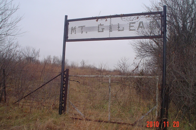
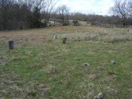
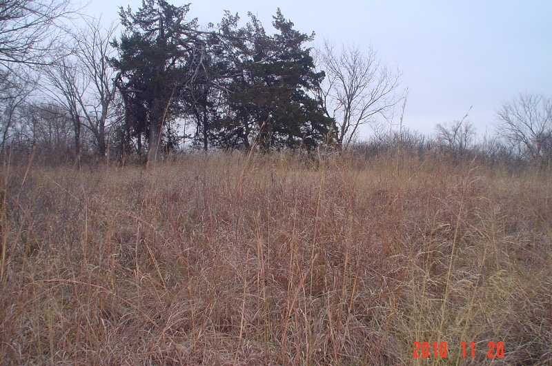
| Description | : | Information taken from www.usgennet.org/usa/ne/county/thayer/mtgilead.htm This cemetery is located north of Gilead, in the North Half of the Northwest Quarter of Section 34 in Township 3 North, Range 1 West of the 6th P. M. Thayer County School District No. 4, Sandy Knob School, also called Mt. Gilead School in earlier days, is located on the sandy knob just west of the cemetery. This pioneer cemetery has not had a burial since SamueI Gaston was buried there in December, 1918. There are many members of the Gaston family buried there and the cemetery has been called the Gaston Family Cemetery. RESTORATION PLANNED FOR... Read More |
frequently asked questions (FAQ):
-
Where is Mount Gilead Cemetery?
Mount Gilead Cemetery is located at Gilead, Thayer County ,Nebraska ,USA.
-
Mount Gilead Cemetery cemetery's updated grave count on graveviews.com?
0 memorials
-
Where are the coordinates of the Mount Gilead Cemetery?
Latitude: 40.1906000
Longitude: -97.4246500
Nearby Cemetories:
1. Kennedy Lone Grave
Gilead, Thayer County, USA
Coordinate: 40.1715900, -97.4425500
2. Catholic Cemetery
Alexandria, Thayer County, USA
Coordinate: 40.2202988, -97.3878021
3. Meridian Presbyterian Cemetery
Meridian Township, Jefferson County, USA
Coordinate: 40.2178001, -97.3625031
4. Alexandria Cemetery
Alexandria, Thayer County, USA
Coordinate: 40.2489014, -97.4060974
5. Union Cemetery
Gilead, Thayer County, USA
Coordinate: 40.1319008, -97.4047012
6. Woltemath Lone Grave
Alexandria, Thayer County, USA
Coordinate: 40.2343600, -97.3691800
7. Grace Lutheran Cemetery
Gladstone, Jefferson County, USA
Coordinate: 40.1620670, -97.3522350
8. Thayer County Poor Farm Cemetery
Hebron, Thayer County, USA
Coordinate: 40.1585900, -97.5173370
9. Saint Paul's Lutheran Church Cemetery
Gilead, Thayer County, USA
Coordinate: 40.1108000, -97.4449000
10. King David Fisher Gravesite
Hebron, Thayer County, USA
Coordinate: 40.1509440, -97.5438060
11. Zion United Church of Christ Cemetery
Gladstone, Jefferson County, USA
Coordinate: 40.1630000, -97.2910000
12. Belvidere Rural Cemetery
Belvidere, Thayer County, USA
Coordinate: 40.2559200, -97.5489300
13. Dan Schafer Family Farm Cemetery
Hebron, Thayer County, USA
Coordinate: 40.1181500, -97.5437200
14. Powell Cemetery
Powell, Jefferson County, USA
Coordinate: 40.2332993, -97.2742004
15. Moles Cemetery
Powell, Jefferson County, USA
Coordinate: 40.2015100, -97.2647950
16. Old Hebron Cemetery
Hebron, Thayer County, USA
Coordinate: 40.1758003, -97.5852966
17. Hebron City Cemetery
Hebron, Thayer County, USA
Coordinate: 40.1753006, -97.5877991
18. Sacred Heart Cemetery
Hebron, Thayer County, USA
Coordinate: 40.1767006, -97.5880966
19. Rose Creek Cemetery
Rose Creek Township, Thayer County, USA
Coordinate: 40.0705986, -97.3694000
20. Rose Hill Cemetery
Hebron, Thayer County, USA
Coordinate: 40.1889000, -97.5960999
21. Pleasant Hill Cemetery
Jefferson County, USA
Coordinate: 40.1595910, -97.2573280
22. Hunt Family Plot
Reynolds, Jefferson County, USA
Coordinate: 40.0868380, -97.3115940
23. Pleasant Plain Cemetery
Bruning, Thayer County, USA
Coordinate: 40.3217010, -97.4738998
24. Helvey Cemetery
Helvey, Jefferson County, USA
Coordinate: 40.2347354, -97.2533342