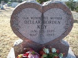
Nancy "Dellar" Borden Starr Key
| Birth | : | 25 Jan 1895 Oklahoma, USA |
| Death | : | 15 May 1985 USA |
| Burial | : | West Side District Cemetery, Taft, Kern County, USA |
| Coordinate | : | 35.1559160, -119.4368360 |
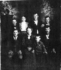
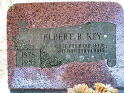
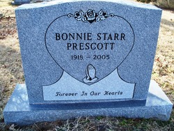
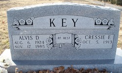
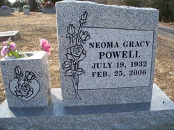
| Description | : | M#1: John Lemuel Starr, 1913, Arkansas. Children: Bonnie(Starr)Prescott (1918-2005), Delsa(Starr)Hatley (1920-2013). M#2: Elbert R.Key, 1921, Arkansas. Children: Alvis & Tommie Key and Neoma(Key)Powell. Born: Choctaw Nation, Indian Territory, OK Arkansas, County Marriages Index, 1837-1957 Name: Elbert Key Gender: Male Age: 43 Birth Year: abt 1878 Residence: Hackett, Sebastian, Arkansas Spouse's Name: Della Borden Spouse's Gender: Female Spouse's Age: 26 Spouse's Residence: Hackett, Sebastian, Arkansas Marriage Date: 3 Aug 1921 Marriage License Date: 3 Aug 1921 Marriage County: Sebastian Event Type: Marriage FHL Film Number: 1034076 |
frequently asked questions (FAQ):
-
Where is Nancy "Dellar" Borden Starr Key's memorial?
Nancy "Dellar" Borden Starr Key's memorial is located at: West Side District Cemetery, Taft, Kern County, USA.
-
When did Nancy "Dellar" Borden Starr Key death?
Nancy "Dellar" Borden Starr Key death on 15 May 1985 in USA
-
Where are the coordinates of the Nancy "Dellar" Borden Starr Key's memorial?
Latitude: 35.1559160
Longitude: -119.4368360
Family Members:
Parent
Spouse
Siblings
Children
Flowers:
Nearby Cemetories:
1. West Side District Cemetery
Taft, Kern County, USA
Coordinate: 35.1559160, -119.4368360
2. Midway Cemetery
Taft, Kern County, USA
Coordinate: 35.1297060, -119.4625090
3. Chinaman Gravesite
McKittrick, Kern County, USA
Coordinate: 35.2822830, -119.5730460
4. Scotsman Grave
McKittrick, Kern County, USA
Coordinate: 35.3070540, -119.6981930
5. Shafter Memorial Park
Shafter, Kern County, USA
Coordinate: 35.4728012, -119.2341995
6. Greenlawn Southwest Mortuary and Cemetery
Bakersfield, Kern County, USA
Coordinate: 35.2948990, -119.0330810
7. Chinese Cemetery
Bakersfield, Kern County, USA
Coordinate: 35.3510550, -119.0273380
8. Saint Pauls Episcopal Church Columbarium
Bakersfield, Kern County, USA
Coordinate: 35.3746120, -119.0277940
9. Home of Peace Jewish Cemetery
Bakersfield, Kern County, USA
Coordinate: 35.3631500, -118.9987400
10. Union Cemetery
Bakersfield, Kern County, USA
Coordinate: 35.3646500, -118.9948700
11. Greenlawn Cemetery and Mortuary
Bakersfield, Kern County, USA
Coordinate: 35.4067001, -118.9856033
12. Arvin Cemetery
Arvin, Kern County, USA
Coordinate: 35.2132300, -118.8952700
13. Wasco Memorial Park
Wasco, Kern County, USA
Coordinate: 35.6034740, -119.3845260
14. Hillcrest Memorial Park
Bakersfield, Kern County, USA
Coordinate: 35.3814316, -118.9012527
15. Kuntz Ranch Cemetery
Bakersfield, Kern County, USA
Coordinate: 35.4373560, -118.9390180
16. Pomfret Memorial Cemetery
Famoso, Kern County, USA
Coordinate: 35.6313580, -119.2064460
17. Fort Tejon Military Cemetery
Lebec, Kern County, USA
Coordinate: 34.8720500, -118.8971500
18. Peter Lebeck Gravesite
Lebec, Kern County, USA
Coordinate: 34.8743040, -118.8926210
19. Mutaw Homestead Cemetery
Sespe, Ventura County, USA
Coordinate: 34.6425910, -119.0419940
20. North Kern Cemetery
Delano, Kern County, USA
Coordinate: 35.7630560, -119.2580560
21. Long Tom Mine Cemetery
Woody, Kern County, USA
Coordinate: 35.5495600, -118.8308700
22. Bakersfield National Cemetery
Arvin, Kern County, USA
Coordinate: 35.2559600, -118.6693480
23. Engle Family Cemetery
Bakersfield, Kern County, USA
Coordinate: 35.6392060, -118.9231180
24. Fickert Family Cemetery
Bear Valley Springs, Kern County, USA
Coordinate: 35.1697260, -118.6443350

