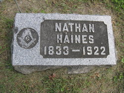
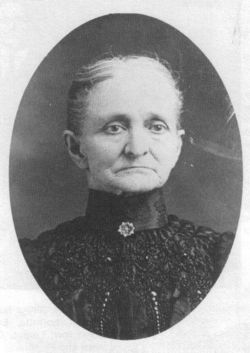
Nathan Haines
| Birth | : | 15 Aug 1833 La Porte County, Indiana, USA |
| Death | : | 8 Jul 1922 Hagerman, Chaves County, New Mexico, USA |
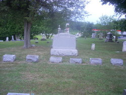
| Burial | : | Pleasant Hill Cemetery, Noble Township, Branch County, USA |
| Coordinate | : | 41.7961110, -85.2111110 |
| Description | : | In 1863, as a young man he moved to Black Hawk Co., IA., moving the same year to Marshall Co. Nathan's brother, William had already settled here. Upon his arrival in Marshall Co., he bought approximately one hundred and ten acres from Conway B. Rhodes. This land was the Maynard Jackson farm east of Rhodes, now owned by Charles Matney. In 1878 this land was valued at fifty dollars per acre. Nathan was a nursery man by trade. It is said he planted trees from Indiana to New Mexico. The Haines family moved to Stafford, Kansas in 1885. They deeded their... Read More |
frequently asked questions (FAQ):
-
Where is Nathan Haines's memorial?
Nathan Haines's memorial is located at: Pleasant Hill Cemetery, Noble Township, Branch County, USA.
-
When did Nathan Haines death?
Nathan Haines death on 8 Jul 1922 in Hagerman, Chaves County, New Mexico, USA
-
Where are the coordinates of the Nathan Haines's memorial?
Latitude: 41.7961110
Longitude: -85.2111110
Family Members:
Parent
Spouse
Siblings
Children
Flowers:
Nearby Cemetories:
1. Pleasant Hill Cemetery
Noble Township, Branch County, USA
Coordinate: 41.7961110, -85.2111110
2. Curtis Cemetery
Bronson, Branch County, USA
Coordinate: 41.8039017, -85.1956024
3. Dutch Settlement Cemetery
Bronson, Branch County, USA
Coordinate: 41.8106003, -85.2632980
4. North Gilead Cemetery
Gilead Township, Branch County, USA
Coordinate: 41.8039017, -85.1557999
5. South Gilead Cemetery
Bronson, Branch County, USA
Coordinate: 41.7733330, -85.1566670
6. Trayer Cemetery
Bronson, Branch County, USA
Coordinate: 41.7705550, -85.2677770
7. Saint Marys Cemetery
Bronson, Branch County, USA
Coordinate: 41.8582993, -85.1939011
8. Adams Cemetery
Bronson, Branch County, USA
Coordinate: 41.8405991, -85.2767029
9. Mill Grove Cemetery
Orland, Steuben County, USA
Coordinate: 41.7327995, -85.1718979
10. Greenlawn Cemetery
Orland, Steuben County, USA
Coordinate: 41.7338982, -85.1594009
11. Bronson Cemetery
Bronson, Branch County, USA
Coordinate: 41.8699340, -85.1858320
12. Fillmore Family Cemetery
Greenfield Mills, LaGrange County, USA
Coordinate: 41.7219260, -85.2347090
13. Carleton Cemetery
Orland, Steuben County, USA
Coordinate: 41.7369890, -85.1403120
14. Snow Prairie Cemetery
Bethel, Branch County, USA
Coordinate: 41.8699989, -85.1408005
15. Freedom Cemetery
Fawn River, St. Joseph County, USA
Coordinate: 41.8064003, -85.3371964
16. Eroh Cemetery
Fawn River Township, St. Joseph County, USA
Coordinate: 41.8081017, -85.3375015
17. East Gilead Cemetery
East Gilead, Branch County, USA
Coordinate: 41.7858330, -85.0825000
18. Eagle Cemetery
LaGrange County, USA
Coordinate: 41.7313200, -85.3162200
19. Bartholomew Cemetery
Fawn River Township, St. Joseph County, USA
Coordinate: 41.8059600, -85.3476300
20. Fawn River Township Cemetery
Fawn River, St. Joseph County, USA
Coordinate: 41.7819440, -85.3475040
21. Burr Oak Township Cemetery
Burr Oak, St. Joseph County, USA
Coordinate: 41.8472214, -85.3319473
22. United Methodist Church Cemetery
Howe, LaGrange County, USA
Coordinate: 41.7509918, -85.3379364
23. Brighton Chapel Cemetery
Brighton, LaGrange County, USA
Coordinate: 41.7163887, -85.3113785
24. Jackson Prairie Cemetery
Orland, Steuben County, USA
Coordinate: 41.6864014, -85.1710968

