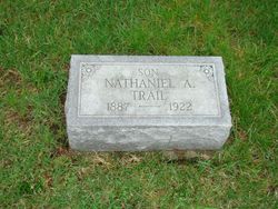
Nathaniel A “Nat” Trail
| Birth | : | 1887 |
| Death | : | 6 Jul 1922 Jefferson County, Iowa, USA |
| Burial | : | McDowell Cemetery, Fairfield, Jefferson County, USA |
| Coordinate | : | 41.1380997, -91.9460983 |
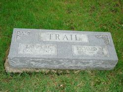
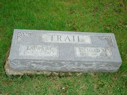
| Description | : | Note: this memorial updated February 25, 2014. ------------ From Brighton Enterprise: "A sad accident occurred on the Trail farm near Veo last Thursday morning, when Nat Trail was instantly killed by being run over by a hay wagon. The two Trail boys, Nat and Jim, were living alone on the farm since the death of their mother last March, and the accident occurred while putting up their hay. Nat's team becoming frightened while at the barn unloading, and ran away. He was thrown under the horses feet and one wheel of the loaded wagon passed over his head, fracturing the skull and... Read More |
frequently asked questions (FAQ):
-
Where is Nathaniel A “Nat” Trail's memorial?
Nathaniel A “Nat” Trail's memorial is located at: McDowell Cemetery, Fairfield, Jefferson County, USA.
-
When did Nathaniel A “Nat” Trail death?
Nathaniel A “Nat” Trail death on 6 Jul 1922 in Jefferson County, Iowa, USA
-
Where are the coordinates of the Nathaniel A “Nat” Trail's memorial?
Latitude: 41.1380997
Longitude: -91.9460983
Family Members:
Parent
Flowers:
Nearby Cemetories:
1. McDowell Cemetery
Fairfield, Jefferson County, USA
Coordinate: 41.1380997, -91.9460983
2. Howard Grove Cemetery
Jefferson County, USA
Coordinate: 41.1488991, -91.9419022
3. Moyer Cemetery
Fairfield, Jefferson County, USA
Coordinate: 41.1046982, -91.9330978
4. Antioch Cemetery
Fairfield, Jefferson County, USA
Coordinate: 41.1002998, -91.9147034
5. Clay Cemetery
Rubio, Washington County, USA
Coordinate: 41.1857986, -91.9218979
6. Walnut Creek Friends Cemetery
Pleasant Plain, Jefferson County, USA
Coordinate: 41.1237500, -91.8747500
7. Laux Park Family Cemetery
Brighton, Washington County, USA
Coordinate: 41.1913920, -91.9098620
8. Blue Point Cemetery
Jefferson County, USA
Coordinate: 41.1618996, -92.0218964
9. Wheeler Cemetery
Jefferson County, USA
Coordinate: 41.0797000, -91.9185500
10. Friends Cemetery
Pleasant Plain, Jefferson County, USA
Coordinate: 41.1478004, -91.8636017
11. Westenhaver Family Cemetery
Perlee, Jefferson County, USA
Coordinate: 41.0968240, -91.8829110
12. Friends Cemetery
Richland, Keokuk County, USA
Coordinate: 41.1917000, -91.9953003
13. Perlee Cemetery
Perlee, Jefferson County, USA
Coordinate: 41.0805750, -91.8993380
14. Rocky Run Cemetery
Richland, Keokuk County, USA
Coordinate: 41.2055707, -91.9473964
15. Highland Cemetery
Richland, Keokuk County, USA
Coordinate: 41.1949997, -91.9985962
16. Old Methodist Cemetery
Richland, Keokuk County, USA
Coordinate: 41.1948000, -92.0002000
17. Ann Gowey Cemetery
Brighton, Washington County, USA
Coordinate: 41.1999642, -91.8974728
18. Saint Josephs Cemetery
Pleasant Plain, Jefferson County, USA
Coordinate: 41.1357994, -91.8463974
19. Evergreen Cemetery
Rubio, Washington County, USA
Coordinate: 41.2139015, -91.9328003
20. Summit Cemetery
Richland, Keokuk County, USA
Coordinate: 41.1897011, -92.0291977
21. Upper Richwoods Cemetery
Salina, Jefferson County, USA
Coordinate: 41.0602989, -91.8807983
22. Halferty Cemetery
Ollie, Keokuk County, USA
Coordinate: 41.1917000, -92.0539017
23. Altman Cemetery
Ollie, Keokuk County, USA
Coordinate: 41.1747017, -92.0733032
24. Polishville Cemetery
East Pleasant Plain, Jefferson County, USA
Coordinate: 41.1116982, -91.8131027


