
| Birth | : | 25 Dec 1830 Sheldon, Wyoming County, New York, USA |
| Death | : | 26 Dec 1921 Siskiyou County, California, USA |
| Burial | : | Cheshunt Cemetery, Cheshunt, Broxbourne Borough, England |
| Coordinate | : | 51.7009840, -0.0563720 |
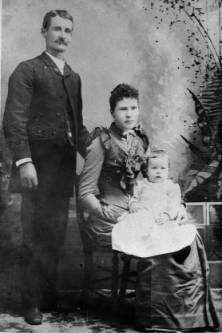
| Description | : | Nelson was a very successful rancher. His farm located in a beautiful cove at the foothills of Mt. Shasta. Their home consisted of 318 acres and was one of the best stock ranches in the valley, supplied with water flowing from the snow-capped mountains. Orchards of apples, pears and peaches abound. Mount Eddy was named for Olive Louisa Paddock Eddy who married Nelson Harvey Eddy in 1854. The couple arrived in Siskiyou County with nothing more than a yoke of oxen and one cow. They settled at the base of the mountain and became prosperous ranchers and farmers. Olive Eddy was... Read More |
frequently asked questions (FAQ):
-
Where is Nelson Harvey Eddy's memorial?
Nelson Harvey Eddy's memorial is located at: Cheshunt Cemetery, Cheshunt, Broxbourne Borough, England.
-
When did Nelson Harvey Eddy death?
Nelson Harvey Eddy death on 26 Dec 1921 in Siskiyou County, California, USA
-
Where are the coordinates of the Nelson Harvey Eddy's memorial?
Latitude: 51.7009840
Longitude: -0.0563720
Family Members:
Parent

Spouse
Siblings
Children
Flowers:


Nearby Cemetories:
1. Cheshunt Cemetery
Cheshunt, Broxbourne Borough, England
Coordinate: 51.7009840, -0.0563720
2. St Mary the Virgin Church
Cheshunt, Broxbourne Borough, England
Coordinate: 51.7042420, -0.0489450
3. Adath Yisroel Cemetery
Cheshunt, Broxbourne Borough, England
Coordinate: 51.7015690, -0.0772910
4. Western Synagogue Cemetery
Cheshunt, Broxbourne Borough, England
Coordinate: 51.6850350, -0.0615410
5. St George Churchyard
Freezywater, London Borough of Enfield, England
Coordinate: 51.6738060, -0.0389670
6. Enfield Crematorium
Enfield, London Borough of Enfield, England
Coordinate: 51.6699829, -0.0544380
7. Waltham Abbey
Waltham Abbey, Epping Forest District, England
Coordinate: 51.6876010, -0.0034070
8. St. Laurence Churchyard
Wormley, Broxbourne Borough, England
Coordinate: 51.7352050, -0.0389350
9. Adath Yisroel Cemetery
Enfield, London Borough of Enfield, England
Coordinate: 51.6634740, -0.0669010
10. Waltham Holy Cross-New Cemetery
Waltham Abbey, Epping Forest District, England
Coordinate: 51.6822880, 0.0024510
11. Waltham Holy Cross Old Cemetery
Waltham Abbey, Epping Forest District, England
Coordinate: 51.6823480, 0.0027610
12. Lavender Hill Cemetery
Enfield, London Borough of Enfield, England
Coordinate: 51.6660423, -0.0944350
13. St. James' Churchyard
Enfield, London Borough of Enfield, England
Coordinate: 51.6558850, -0.0470570
14. Hertford Road Cemetery
Enfield, London Borough of Enfield, England
Coordinate: 51.6554120, -0.0449750
15. St Andrew Churchyard
Enfield, London Borough of Enfield, England
Coordinate: 51.6530210, -0.0821420
16. Saint Augustine's Churchyard
Broxbourne, Broxbourne Borough, England
Coordinate: 51.7445150, -0.0147810
17. Waltham Abbey Jewish Cemetery
Waltham Abbey, Epping Forest District, England
Coordinate: 51.6778780, 0.0389240
18. St. Thomas Churchyard
Upshire, Epping Forest District, England
Coordinate: 51.6898890, 0.0465860
19. Quaker Burial Ground, Hoddesdon, Hertfordshire
Hoddesdon, Broxbourne Borough, England
Coordinate: 51.7610213, -0.0139560
20. St Catherine and St Paul's Churchyard
Hoddesdon, Broxbourne Borough, England
Coordinate: 51.7625830, -0.0120670
21. Saint Mary
Bayford, East Hertfordshire District, England
Coordinate: 51.7629540, -0.1035070
22. Holy Innocents Churchyard
High Beach, Epping Forest District, England
Coordinate: 51.6617140, 0.0343380
23. Woollensbrook Crematorium
Hoddesdon, Broxbourne Borough, England
Coordinate: 51.7681805, -0.0280669
24. St. Andrew's Churchyard
Little Berkhamsted, East Hertfordshire District, England
Coordinate: 51.7547390, -0.1295270